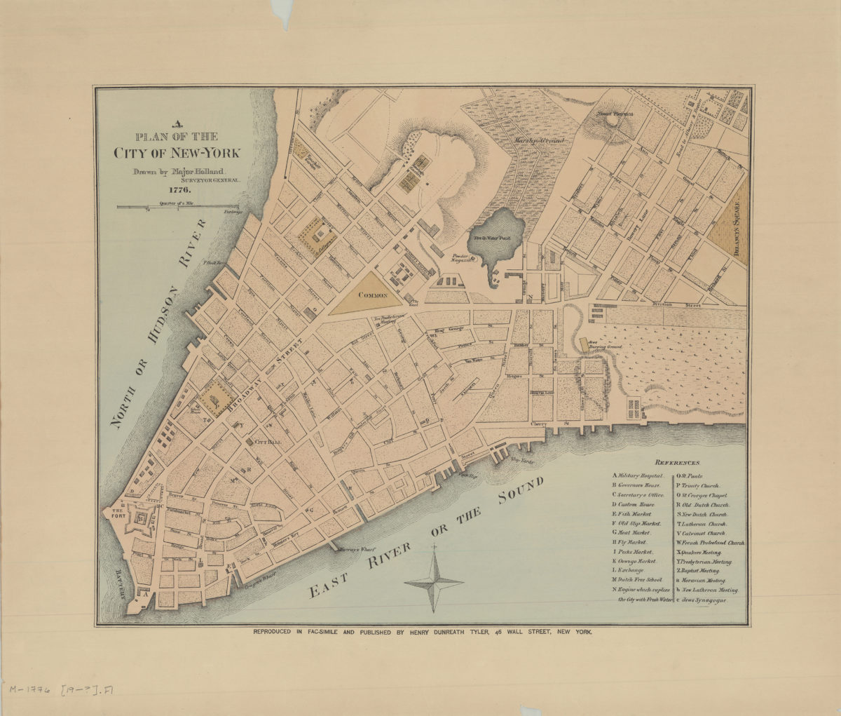
A plan of the city of New York: drawn by Major Holland, surveyor general [189?]
Map No. M-1776 (189-?).Fl
Facsimile covering Lower Manhattan. Shows churches, schools, public buildings, slips, and wharves. Relief shown by hachures. Includes index.
Map area shown
Genre
MapRelation
Full catalog recordSize
36 × 43 cmDownload
Low Resolution Image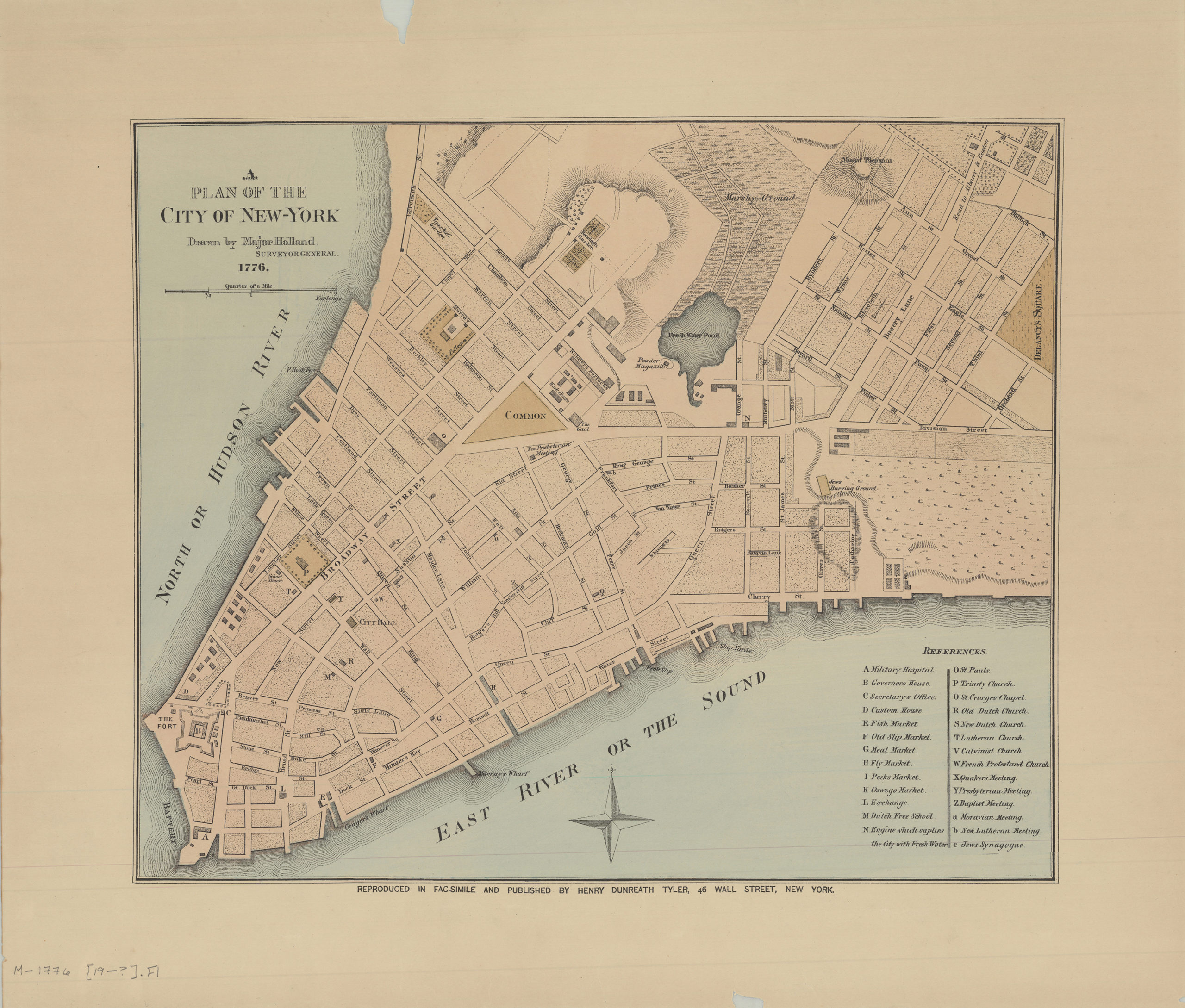
Creator
Holland, Samuel,Publisher
Brooklyn Historical SocietyCitation
A plan of the city of New York: drawn by Major Holland, surveyor general; [189?], Map Collection, M-1776 (189-?).Fl; Brooklyn Historical Society.Scale
Scale [ca. 1:4,000]Loading zoom image...