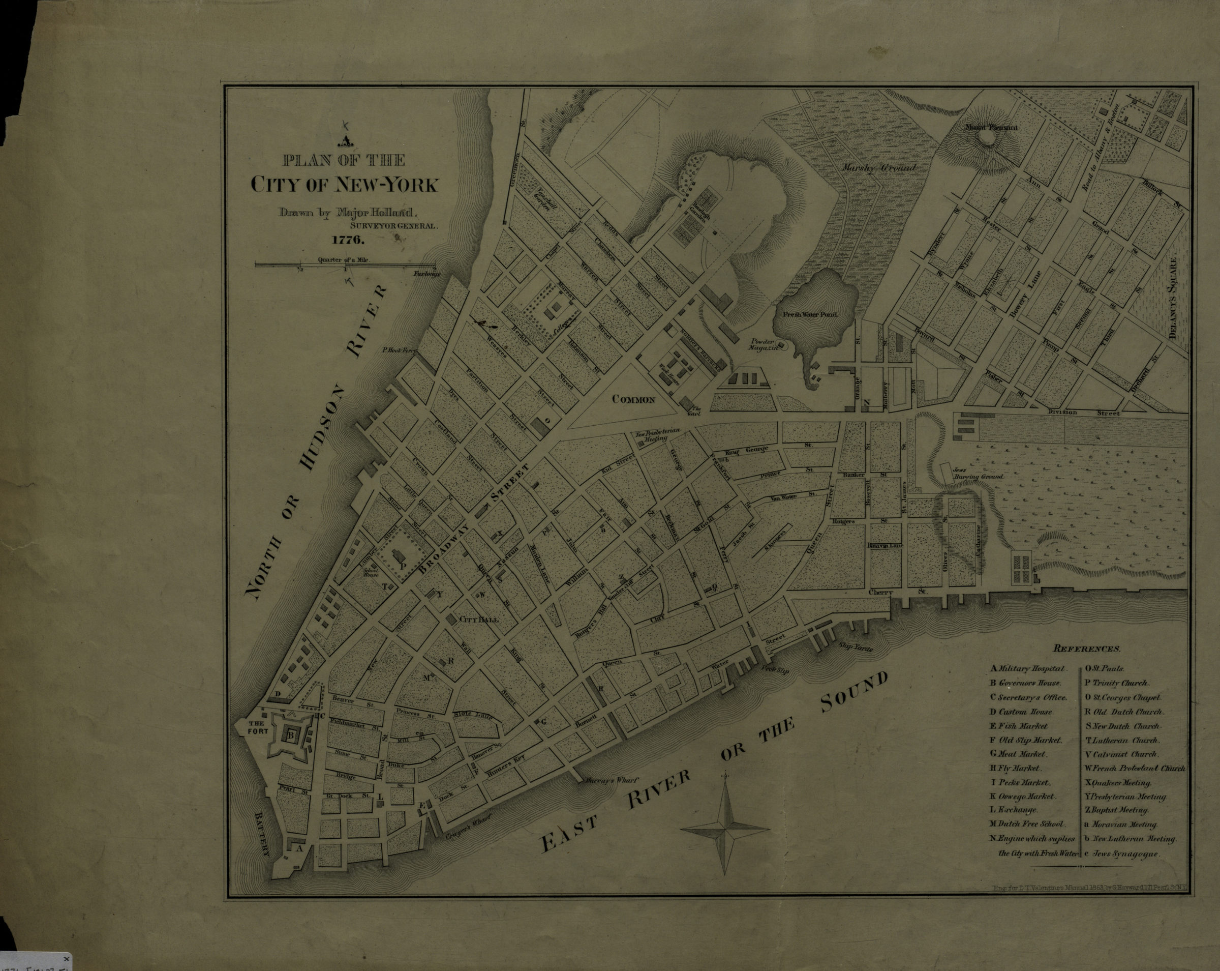
A plan of the city of New-York: drawn by Major Holland, surveyor general [1863]
Map No. M-1776 (1863).Fl
Covers Lower Manhattan. Shows roads, churches, markets, public buildings, slips, and wharves. Relief shown by hachures. Facsimile of inset on map by Samuel Holland and Thomas Pownall: The provinces of New York and New Jersey, with part of Pensilvania, and the province of Quebec, 1776. “Engr. for D.T. Valentine’s Manual 1863 …” Includes index to points of interest.
Map area shown
Genre
MapRelation
Full catalog recordSize
33 × 39 cmDownload
Low Resolution Image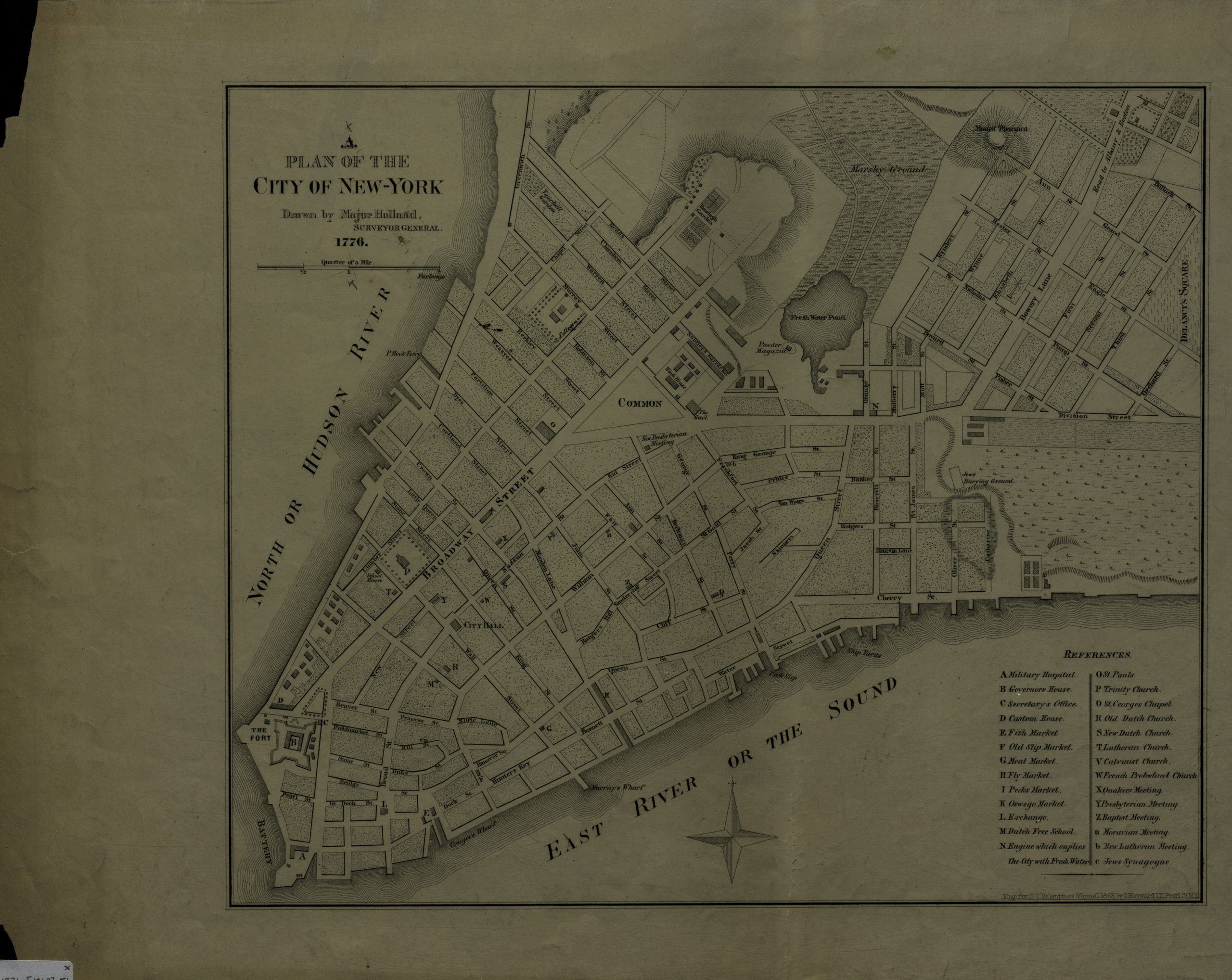
Creator
Holland, Samuel,Publisher
Brooklyn Historical SocietyCitation
A plan of the city of New-York: drawn by Major Holland, surveyor general; [1863], Map Collection, M-1776 (1863).Fl; Brooklyn Historical Society.Scale
Scale [ca. 1:5,560]Loading zoom image... 