A plan of the city of New York from an actual survey: made by Iames [i.e. James] Lyne [18??]
Map No. M-1728 (18--?).Fl
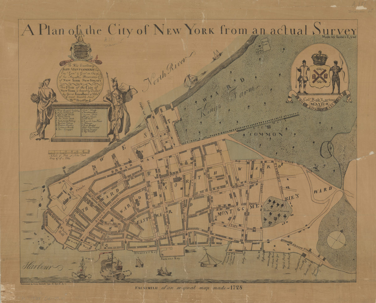
Facsimile covering Lower Manhattan. Shows streets, ship yards, and some public structures. Ships shows pictorially. “Facsimile of an original map made-1728.” Oriented with north to the upper right. “To His Excellency John Montgomerie, Esq. Capt. Genl. & Gov. in Chief of his Majestis Provinces of New York, New Jersey &c. This Plan of the City of New York is humbly dedicd by Your Excellancy’s Obet & most humble servt, Wm. Bradford.”–Cartouche. “Colt. Robt. Lurting, Mayor 1728.”–Seal at upper right. Includes index, seal, and decorative cartouche. BHS copy varnished, mounted on linen.
Map area shown
Relation
Full catalog recordSize
42 × 54 cmDownload
Low Resolution Image
Creator
Lyne, James,Publisher
Brooklyn Historical SocietyCitation
A plan of the city of New York from an actual survey: made by Iames [i.e. James] Lyne; [18??], Map Collection, M-1728 (18--?).Fl; Brooklyn Historical Society.Scale
Scale [ca. 1:2,400]Loading zoom image...