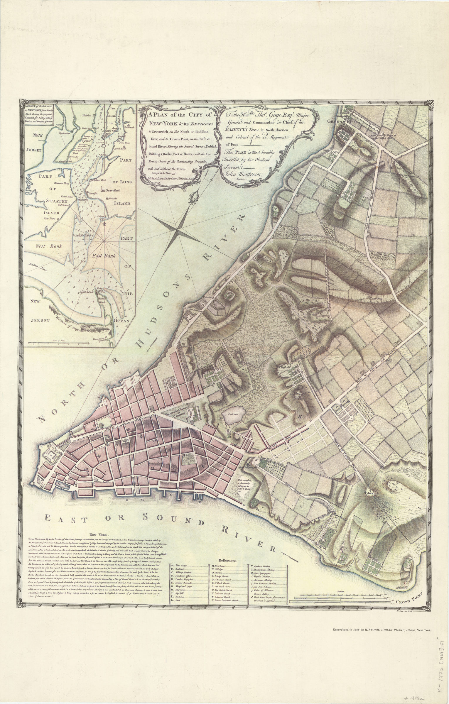
A plan of the city of New-York & its environs: to Greenwich, on the North or Hudsons River, and to Crown Point, on the East or Sound River, shewing [i.e. showing] the several streets, publick [i.e. public] buildings, docks, fort & battery 1968
Map No. M-1775 (1968).Fl
Covers Manhattan north to Greenwich. Shows places of worship, wharfs and quays, military structures, public buildings and schools. Relief shown by hachures. Depths shown by soundings (on inset). Oriented with north to the upper right. Dedicated to Major General Thos. Gage. Includes descriptive note, index, and inset. Inset: A chart of the entrance to New York from Sandy Hook, shewing [i.e. showing] the properest channel for sailing w/ ye banks and depths of water. Scale [ca. 1:128,000].
Map area shown
Relation
Full catalog recordSize
51 × 63 cmDownload
Low Resolution Image
Creator
Montrésor, John,Publisher
Brooklyn Historical SocietyCitation
A plan of the city of New-York & its environs: to Greenwich, on the North or Hudsons River, and to Crown Point, on the East or Sound River, shewing [i.e. showing] the several streets, publick [i.e. public] buildings, docks, fort & battery; 1968, Map Collection, M-1775 (1968).Fl; Brooklyn Historical Society.Scale
Scale [ca. 1:6,300]Loading zoom image... 