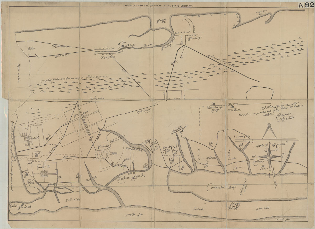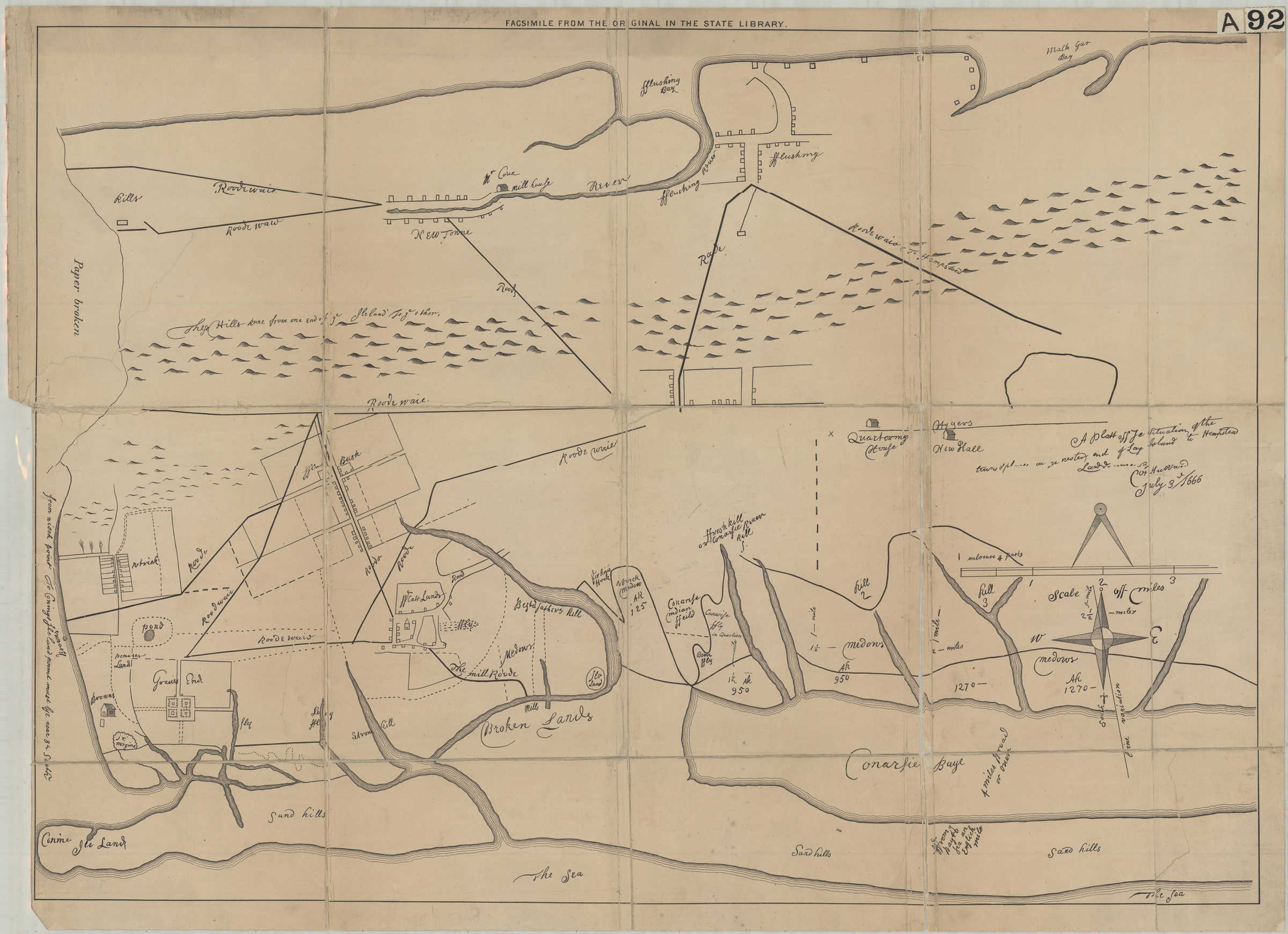
A plott of ye situations of the towns & places on ye wester end of Long Island to Hempstead: laid down by … [text illegible] Hubbard, July 3rd, 1666 [18??]
Map No. B P-1666 (18--?).Fl.Folio
Facsimile of manuscript map. Covers area north from Coney Island to Flushing Bay. Shows property (including buildings), names of landowners, and landscape details. Relief shown pictorially. Possibly attributed to William Hubbard, 1621 or 2-1704. Oriented with north to the upper left. “Facsimile from the original in the State Library”–Upper center margin.
Map area shown
Genre
Cadastral mapsRelation
Full catalog recordSize
57 × 80 cmDownload
Low Resolution Image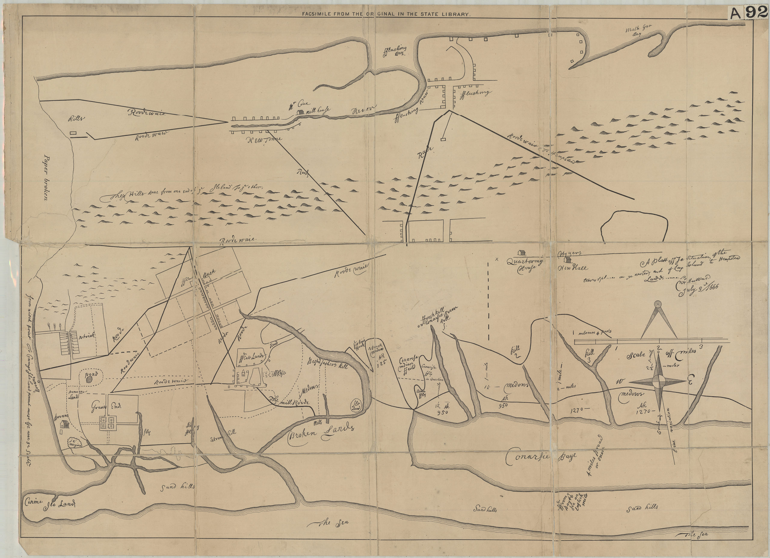
Creator
Publisher
Brooklyn Historical SocietyCitation
A plott of ye situations of the towns & places on ye wester end of Long Island to Hempstead: laid down by … [text illegible] Hubbard, July 3rd, 1666; [18??], Map Collection, B P-1666 (18--?).Fl.Folio; Brooklyn Historical Society.Scale
Scale [ca. 1:34,560]Loading zoom image...