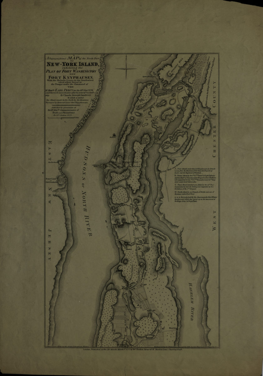
A topographical map of the north part of New-York Island: exhibiting the plan of Fort Washington now Fort Knyphausen, with the rebels lines to the southward which where [sic] forced by the troops, 16th. Novr. 1776 [1859]
Map No. Rev. War-1776 (1859).Fl
Facsimile. Covers Manhattan north from McGowan’s Pass to modern-day Washington Heights. Also covers portions of the Bronx and eastern New Jersey. Shows troop movements, batteries, and barracks. Relief shown pictorially and by hachures. “Copied from a Map in the State Library at Albany.” “Engraved for D.T. Valentine’s Manual for 1859 …” Includes index.
Map area shown
Genre
Military mapsRelation
Full catalog recordSize
43 × 26 cmDownload
Low Resolution Image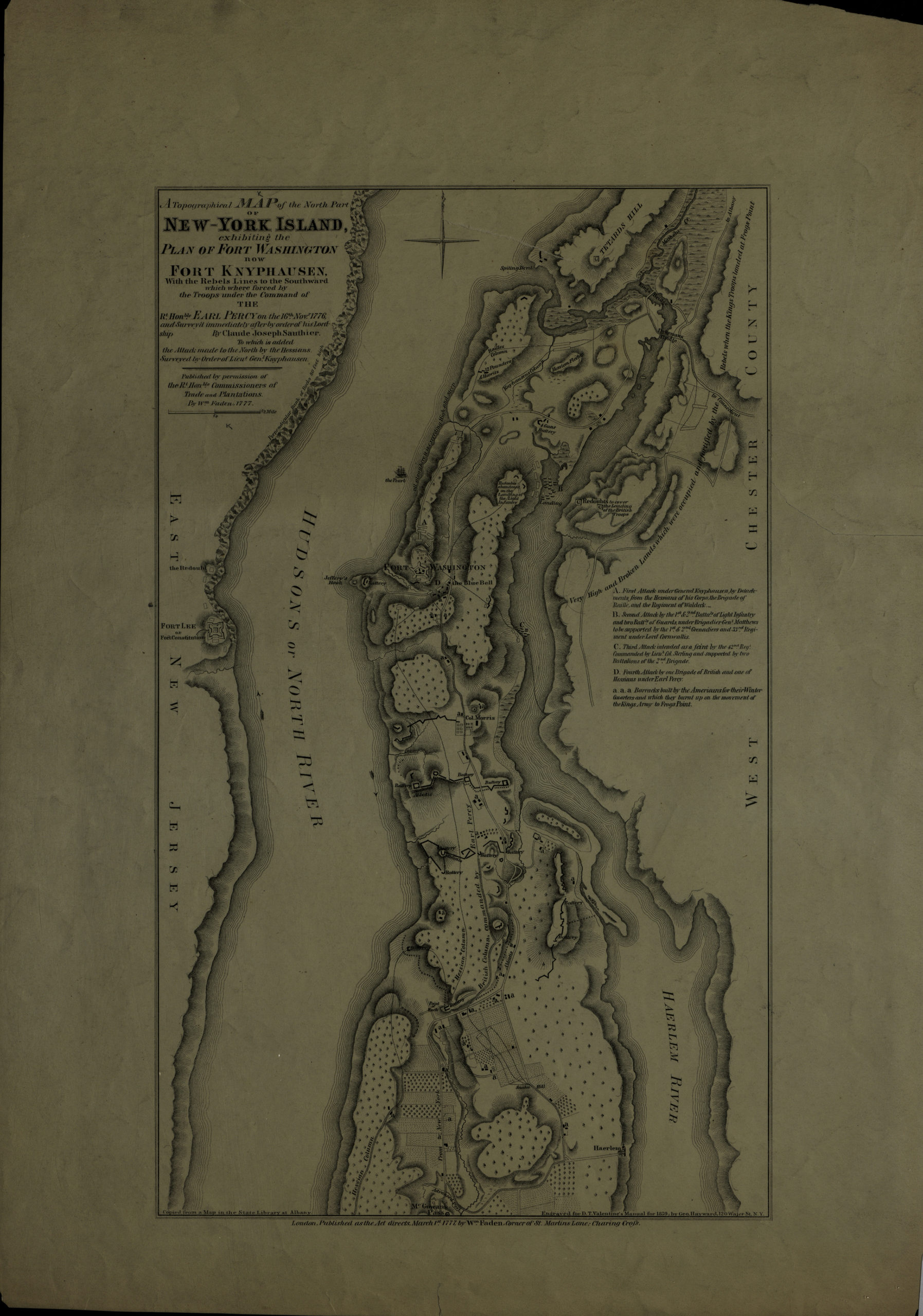
Creator
Sauthier, Claude Joseph,Publisher
Brooklyn Historical SocietyCitation
A topographical map of the north part of New-York Island: exhibiting the plan of Fort Washington now Fort Knyphausen, with the rebels lines to the southward which where [sic] forced by the troops, 16th. Novr. 1776; [1859], Map Collection, Rev. War-1776 (1859).Fl; Brooklyn Historical Society.Scale
Scale [ca. 1:20,689]Loading zoom image...