A user’s guide to the Brooklyn waterfront greenway: 2007-2008 [2007; 2007]
Map No. B A-2007.Fl
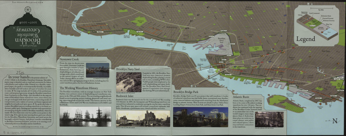
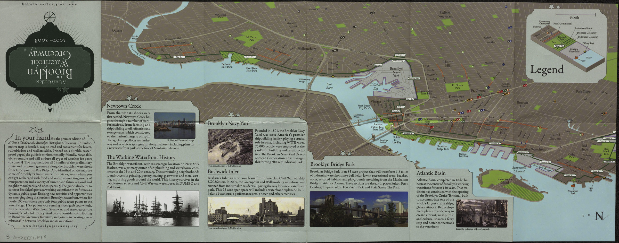
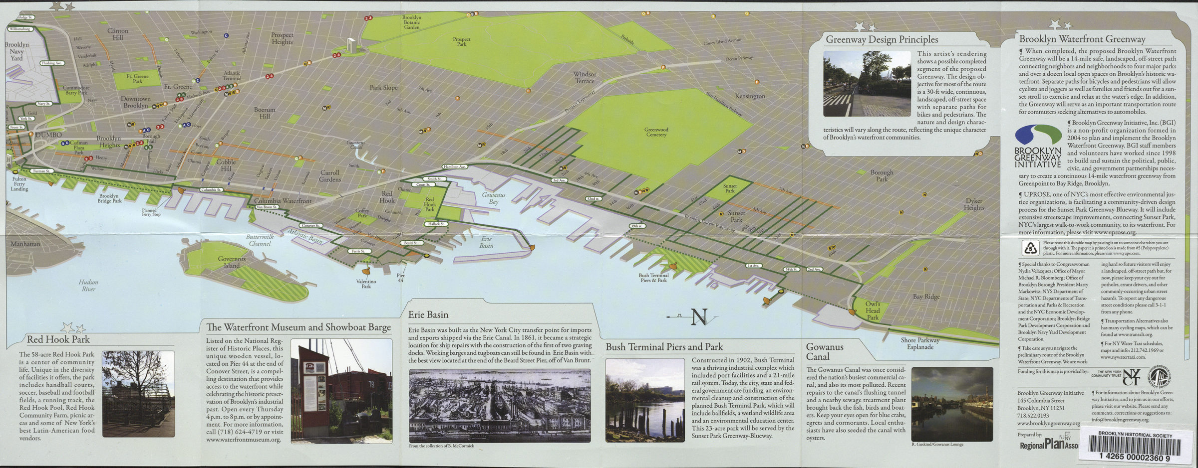
Maps cover the Brooklyn waterfront from Newtown Creek to Pier 44, and from Fulton Ferry Landing to Shore Parkway Esplanade in Bay Ridge. Shows parks, subway stations, food and commercial areas, existing and proposed greenway routes, views, and water taxi stations. Includes illustrations and text.
Subjects
Places
Map area shown
Genre
Pictorial mapsRelation
Full catalog recordSize
22 × 47 cmDownload
Low Resolution Image
Creator
Brooklyn Greenway Initiative,Publisher
Brooklyn Historical SocietyCitation
A user’s guide to the Brooklyn waterfront greenway: 2007-2008; [2007; 2007], Map Collection, B A-2007.Fl; Brooklyn Historical Society.Scale
Scale approximately 1:23,Loading zoom image...