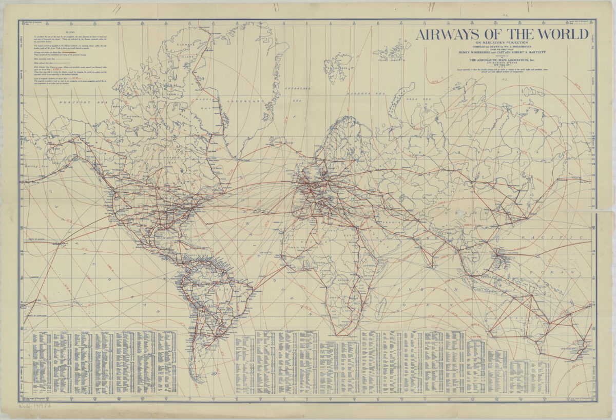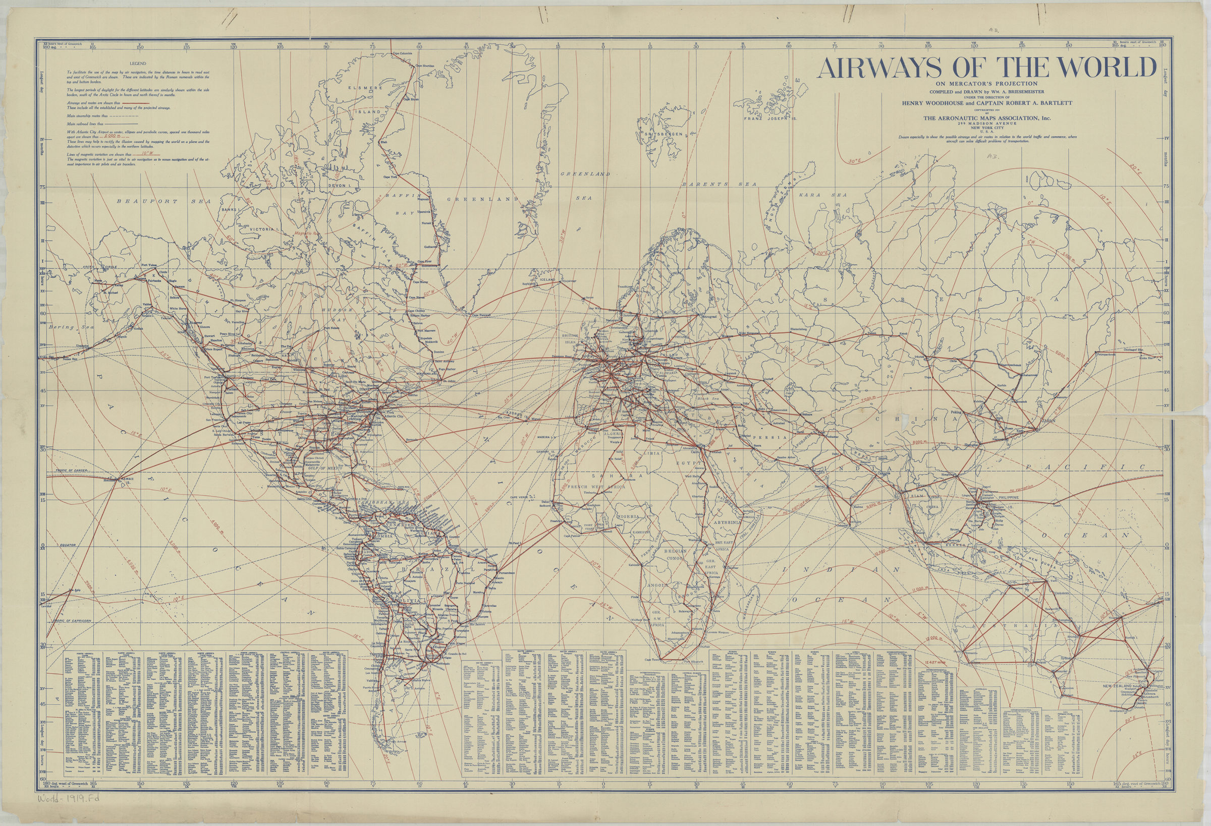
Airways of the world on Mercator’s projection: compiled and drawn by Wm. A. Briesemeister 1919
Map No. World-1919.A
Includes table of the lengths of continental and intercontinental airways.
Subjects
Map area shown
Genre
MapsRelation
Full catalog recordSize
64 × 98 cmDownload
Low Resolution Image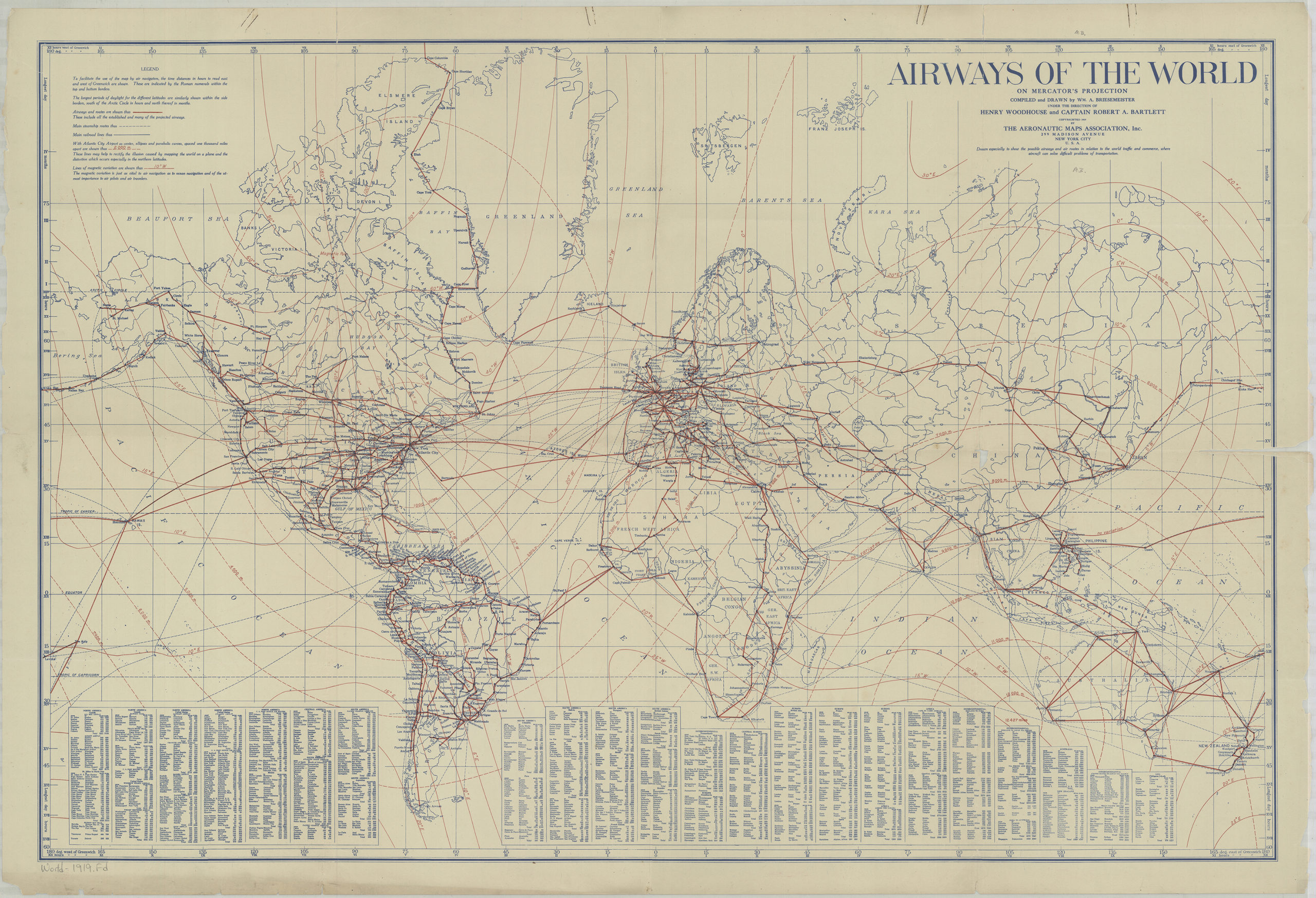
Creator
Briesemeister, William A.,Publisher
Brooklyn Historical SocietyCitation
Airways of the world on Mercator’s projection: compiled and drawn by Wm. A. Briesemeister; 1919, Map Collection, World-1919.A; Brooklyn Historical Society.Scale
Scale [ca. 1:40,600,000]Loading zoom image...