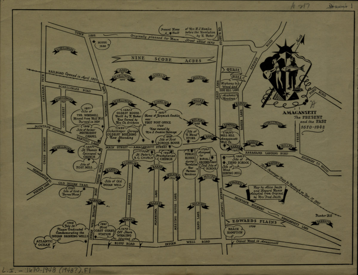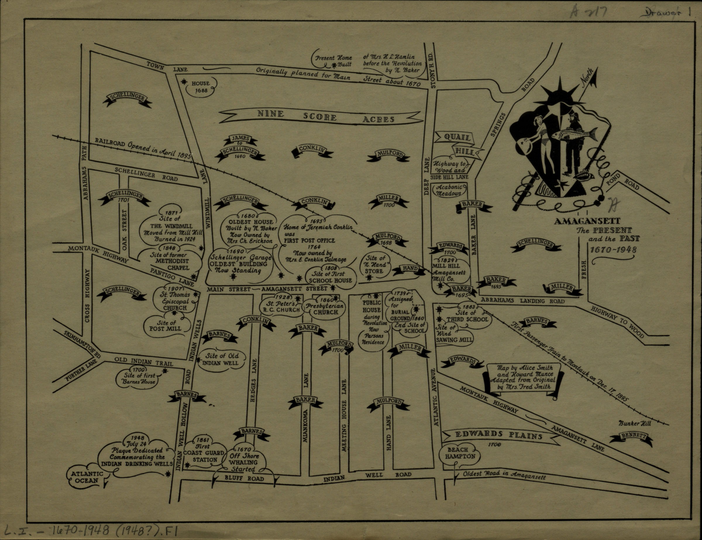
Amagansett: the present and the past, 1670-1948: map by Alice Smith and Howard Munce ; adapted from original by Mrs. Fred Smith [1948]
Map No. L.I.-1670-1948 (1948?).Fl
Covers area north from Bluff Road to Town Lane and east from Abrahams Path to Bunker Hill. Shows churches, burial grounds, schools, and names of landowners. Oriented with north to the upper right. Includes ill. and historical notes.
Map area shown
Genre
Historical mapsRelation
Full catalog recordSize
20 × 27 cmDownload
Low Resolution Image
Creator
Smith, Alice,Publisher
Brooklyn Historical SocietyCitation
Amagansett: the present and the past, 1670-1948: map by Alice Smith and Howard Munce ; adapted from original by Mrs. Fred Smith; [1948], Map Collection, L.I.-1670-1948 (1948?).Fl; Brooklyn Historical Society.Scale
Scale not givenLoading zoom image...