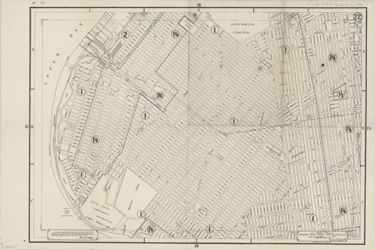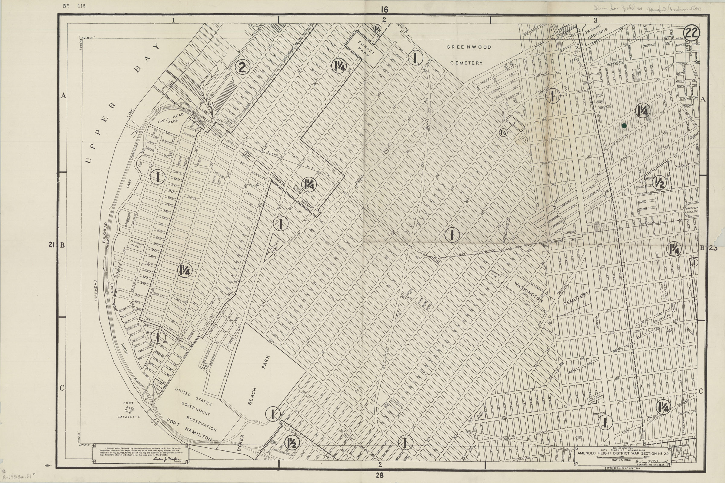
Amended use district map, section no. 22: City of New York, City Planning Commission, Irving F. Ashworth, senior civil engineer 1953
Map No. B A-1953a.Fl
Covers Sunset Park, Fort Hamilton, Bay Ridge, Dyker Heights and Bensonhurst. Shows street names, parks, and cemeteries. At head of sheet: “No. 115.” “Copyright City of New York.” “I, Pauline J. Malter, Secretary, City Planning Commission do hereby certify that the zoning designations shown on this Area District Map no. 22 have been legally adopted and are effective as of July 20, 1953 for the area of this map and supersede all designations shown on maps heretofore adopted and effective for this area prior to May 27, 1953.” Numerically keyed to index no index present.
Subjects
Places
Map area shown
Genre
Zoning mapsRelation
Full catalog recordSize
61 × 92 cmDownload
Low Resolution Image
Creator
New York (N.Y.).; City Planning Commission,Publisher
Brooklyn Historical SocietyCitation
Amended use district map, section no. 22: City of New York, City Planning Commission, Irving F. Ashworth, senior civil engineer; 1953, Map Collection, B A-1953a.Fl; Brooklyn Historical Society.Scale
Scale approximately 1:980Loading zoom image...