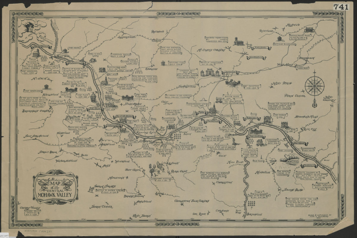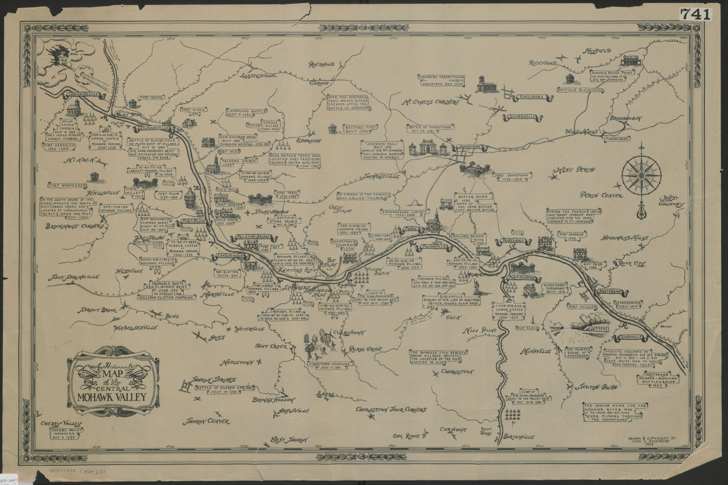
An historical map of the central Mohawk Valley: drawn and copyright[ed] by John C. Devendorf [ca. 1934]
Map No. NYS-1600-1800 (1934).Fl
Relief shown by hachures and spot heights. Shows some forts, houses, events pictorially and includes textual notes on events ca. 1600-1800. Title from ornamental cartouche.
Map area shown
Relation
Full catalog recordSize
48 X 76 cmDownload
Low Resolution Image
Creator
Devendorf, John C.,Publisher
Brooklyn Historical SocietyCitation
An historical map of the central Mohawk Valley: drawn and copyright[ed] by John C. Devendorf; [ca. 1934], Map Collection, NYS-1600-1800 (1934).Fl; Brooklyn Historical Society.Scale
Scale not givenLoading zoom image...