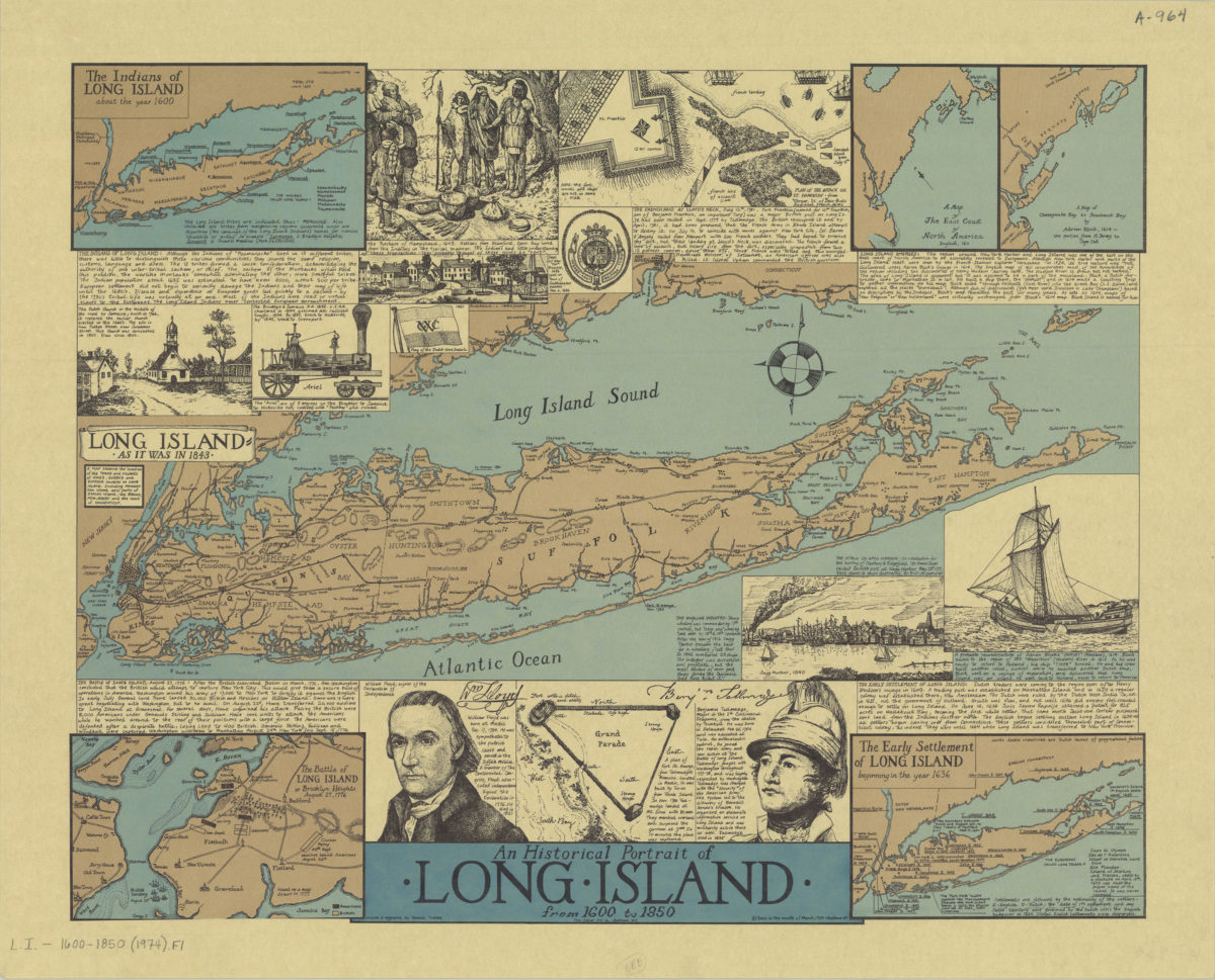
An historical portrait of Long Island from 1600 to 1850: drawn & engraved by Ronald Toelke [ca. 1974]
Map No. L.I.-1600-1850 (1974).Fl c.2;L.I.-1600-1850 (1974).Fl
Relief shown by hachures on some maps. Orientations differ. Includes text and ill. Long Island as it was in 1843 : a map showing the location of the towns and villages of King’s, Queen’s, and Suffolk Counties on Long Island, including Manhattan Island and parts of Staten Island, the Bronx, New Jersey and the coast of Connecticut. The Indians of Long Island about the year 1600. A map of the east coast of New America, English, 1611. A map of Chesepeake Bay to Penobscot Bay by Adrien Block, 1614, the portion from N. Jersey to Cape Cod. The early settlement of Long Island, beginning in the year 1636. The Battle of Long Island or Brooklyn Heights, August 27, 1776. BHS has 2 copies.
Places
Map area shown
Genre
Historical mapsRelation
Full catalog recordSize
20 × 48 cmDownload
Low Resolution Image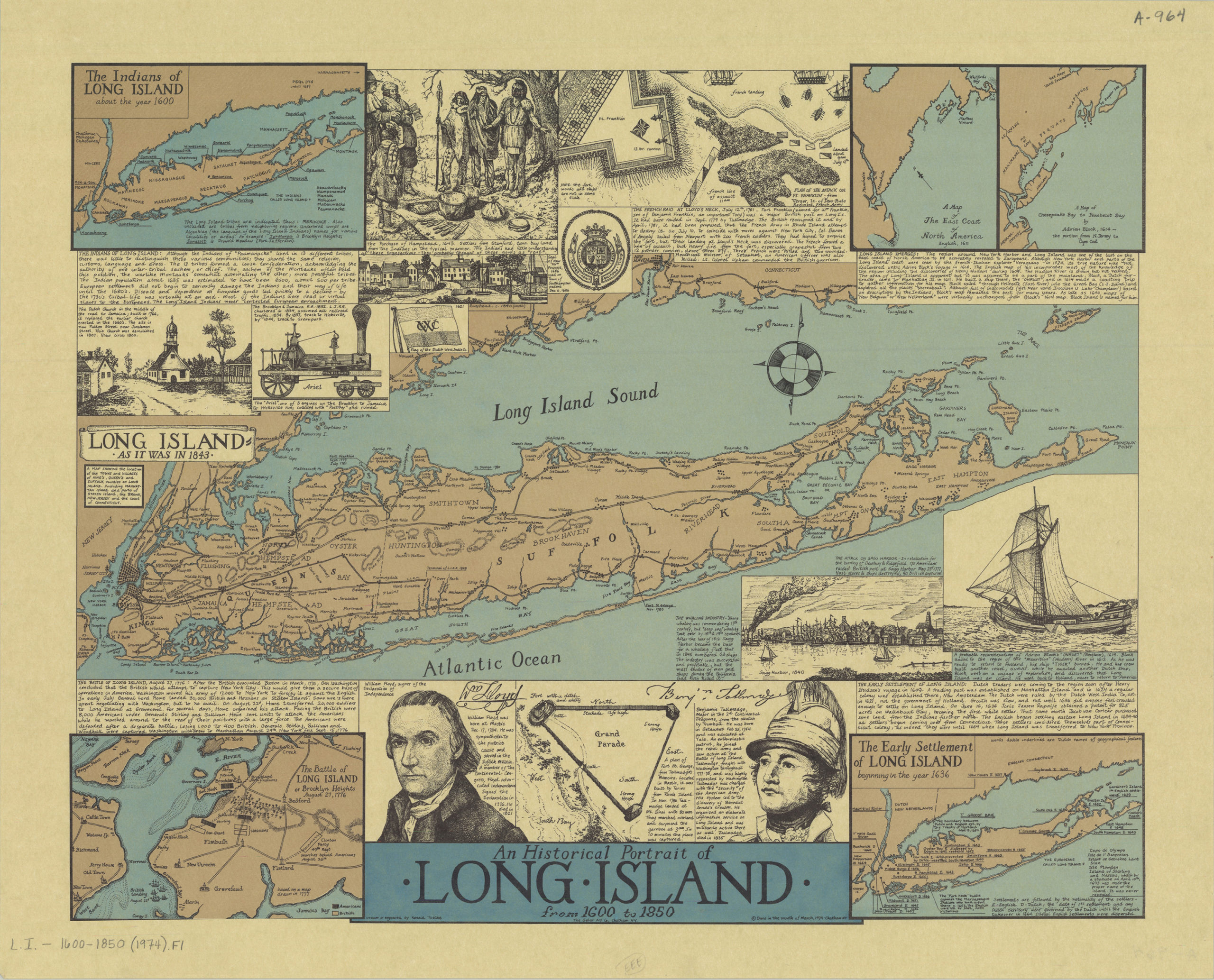
Creator
Toelke, Ron,Publisher
Brooklyn Historical SocietyCitation
An historical portrait of Long Island from 1600 to 1850: drawn & engraved by Ronald Toelke; [ca. 1974], Map Collection, L.I.-1600-1850 (1974).Fl c.2;L.I.-1600-1850 (1974).Fl; Brooklyn Historical Society.Scale
Scale not givenLoading zoom image...