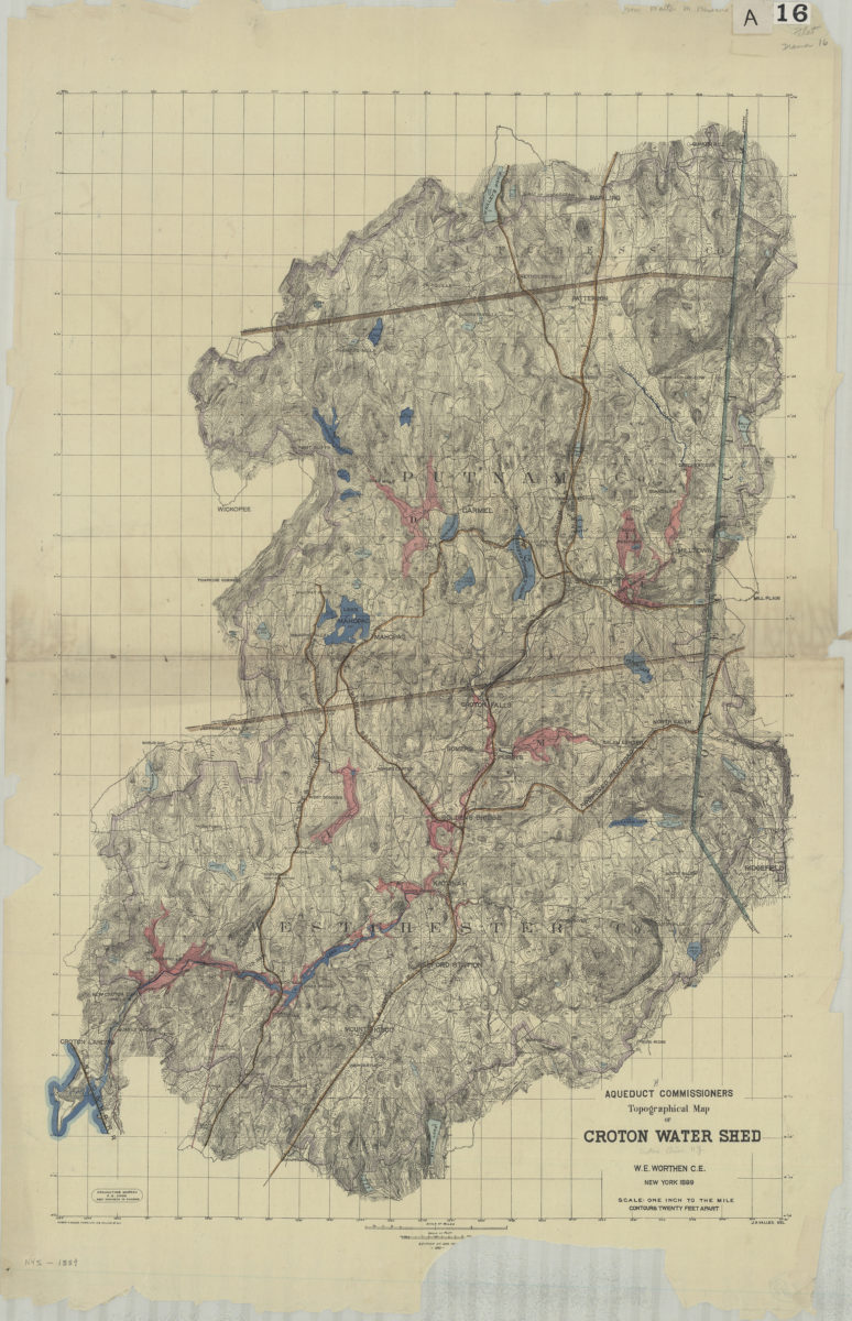
Aqueduct Commissioners topographical map of Croton Water Shed: W.E. Worthen C.E. ; J.A. Valles, del 1889
Map No. NYS-1889.Fl.Folio
Covers the Croton Watershed north from Byram Lake to Quaker Hill and east from Croton Landing to Titicus. Shows dams, reservoirs, bridges, lakes, ponds, county boundaries, shafts, the line of the new aqueduct, and railroads. Also shows underlying drafting grid. Relief shown by countours and spot heights. “Draughting Bureau F.S. Cook Asst. Engineer In Charge.” “- 200 -” Item is imperfect missing portion of lower margin containing edition information.
Map area shown
Genre
Topographic mapsRelation
Full catalog recordSize
96 × 61 cmDownload
Low Resolution Image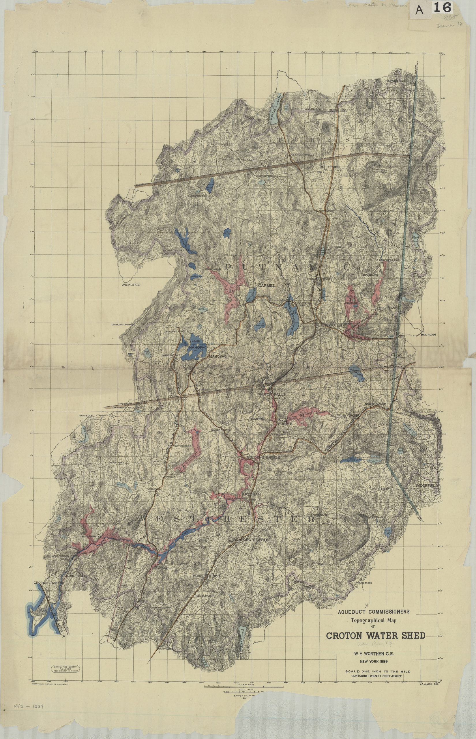
Creator
New York (N.Y.).; Aqueduct Commission,Publisher
Brooklyn Historical SocietyCitation
Aqueduct Commissioners topographical map of Croton Water Shed: W.E. Worthen C.E. ; J.A. Valles, del; 1889, Map Collection, NYS-1889.Fl.Folio; Brooklyn Historical Society.Scale
Scale [1:63,360] 1 inLoading zoom image...