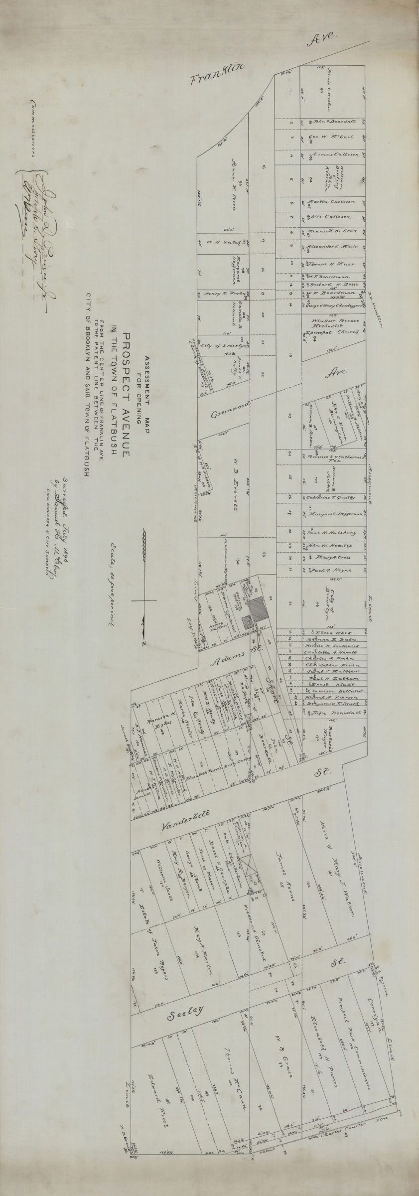
Assessment map for opening Prospect Avenue in the town of Flatbush, from the center line of Franklin Ave. to the patent line between the city of Brooklyn and said town of Flatbush: surveyed … by Samuel H. McElroy, civil engineer & city surveyor July 1896
Map No. B P-1896.Fl.O
Cadastral map covering area in modern-day Windsor Terrace. Shows property (including lot numbers and dimensions), and names of landowners. Oriented with north to the right. Includes commissioners’ signatures.
Map area shown
Relation
Full catalog recordSize
53 × 149 cmDownload
Low Resolution Image
Creator
McElroy, Samuel,Publisher
Brooklyn Historical SocietyCitation
Assessment map for opening Prospect Avenue in the town of Flatbush, from the center line of Franklin Ave. to the patent line between the city of Brooklyn and said town of Flatbush: surveyed … by Samuel H. McElroy, civil engineer & city surveyor; July 1896, Map Collection, B P-1896.Fl.O; Brooklyn Historical Society.Scale
Scale [1:480] 1 in to 40Loading zoom image... 