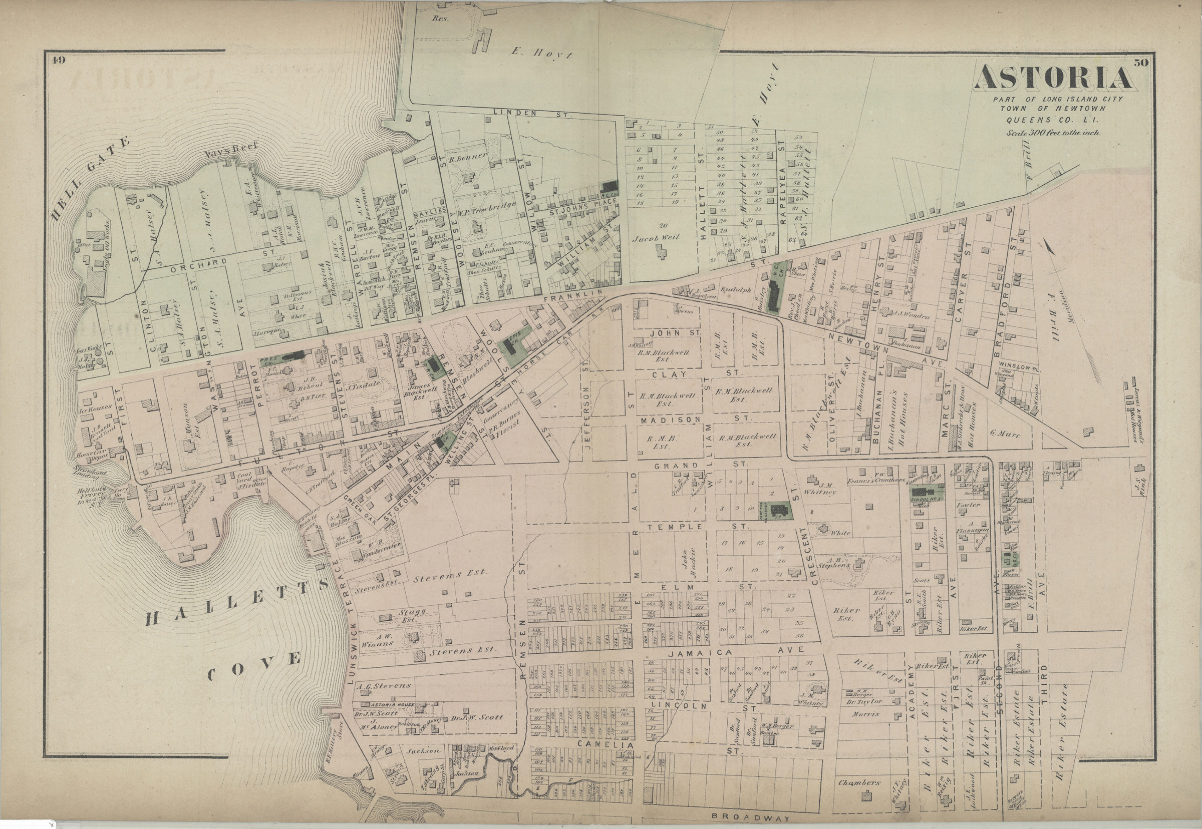
Astoria: part of Long Island City, town of Newtown, Queens Co., L.I. [1873]
Map No. Q-[1873]a.Fl
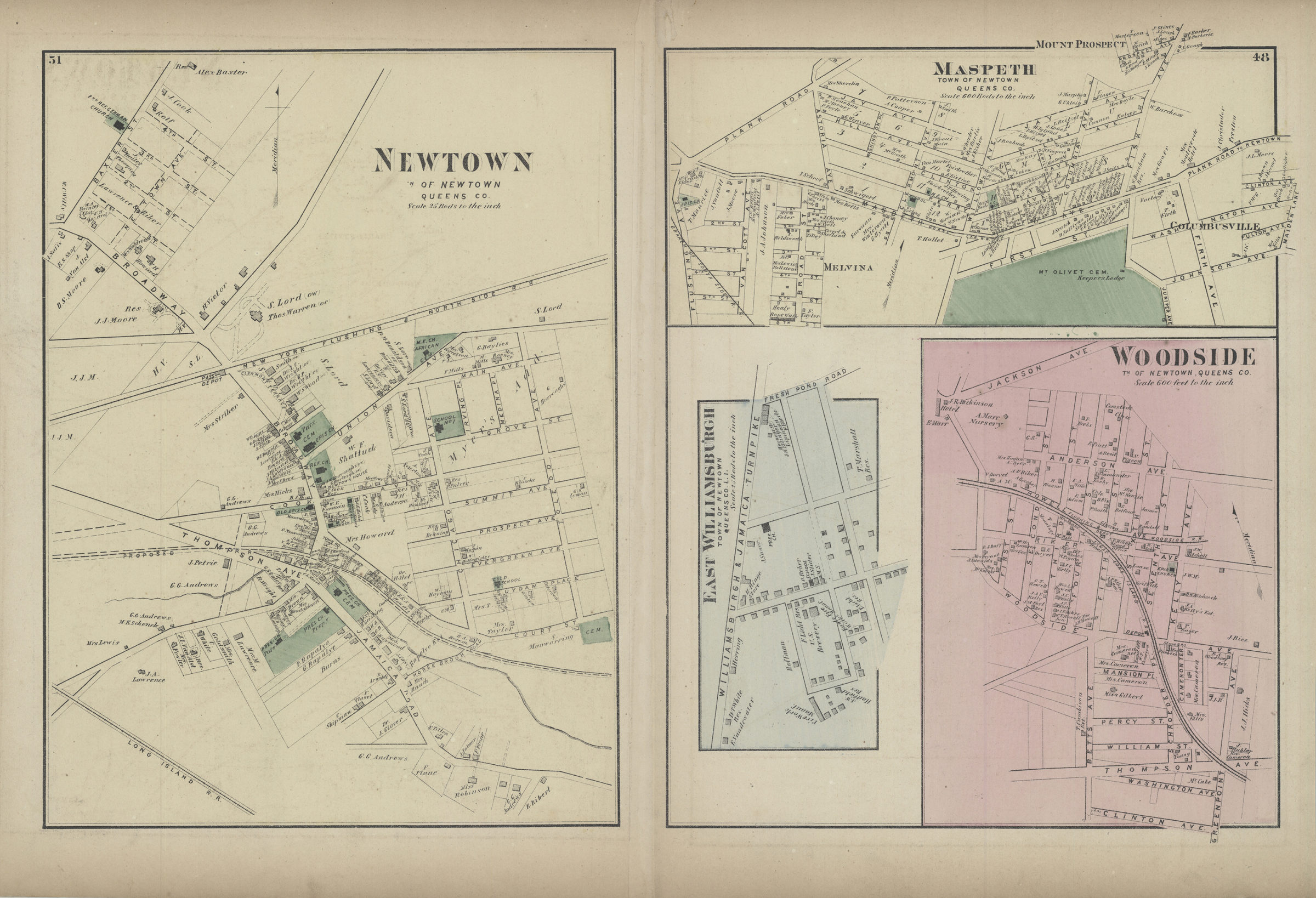
Cadastral map. Shows buildings, lot numbers, landowners’ names, churches, and schools. Extracted from: Atlas of Long Island, New York. New York : Beers, Comstock & Cline, 1873. On verso: 4 ancillary maps. Ancillary maps: Newtown, tn. of Newtown, Queens Co. — Maspeth, town of Newtown, Queens Co. — East Williamsburgh, town of Newtown, Queens Co., L.I. — Woodside, tn. of Newtown, Queens Co. “49”–Upper left corner. “50”–Upper right corner. “51”–Upper left corner of verso. “48”–Upper right corner of verso.
Subjects
Places
Map area shown
Genre
Cadastral mapsRelation
Full catalog recordSize
39 × 54 cmDownload
Low Resolution Image
Creator
Beers, F. W.,Publisher
Brooklyn Historical SocietyCitation
Astoria: part of Long Island City, town of Newtown, Queens Co., L.I.; [1873], Map Collection, Q-[1873]a.Fl; Brooklyn Historical Society.Scale
Scale [1:3,600] 1 in to 3Loading zoom image... 