Atlantic Basin containing 40” 86/100 acres [18??]
Map No. B A-[18--?]c.Fl
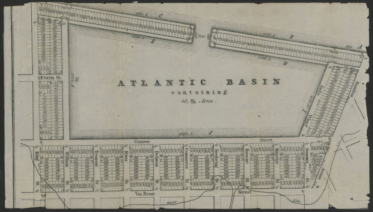
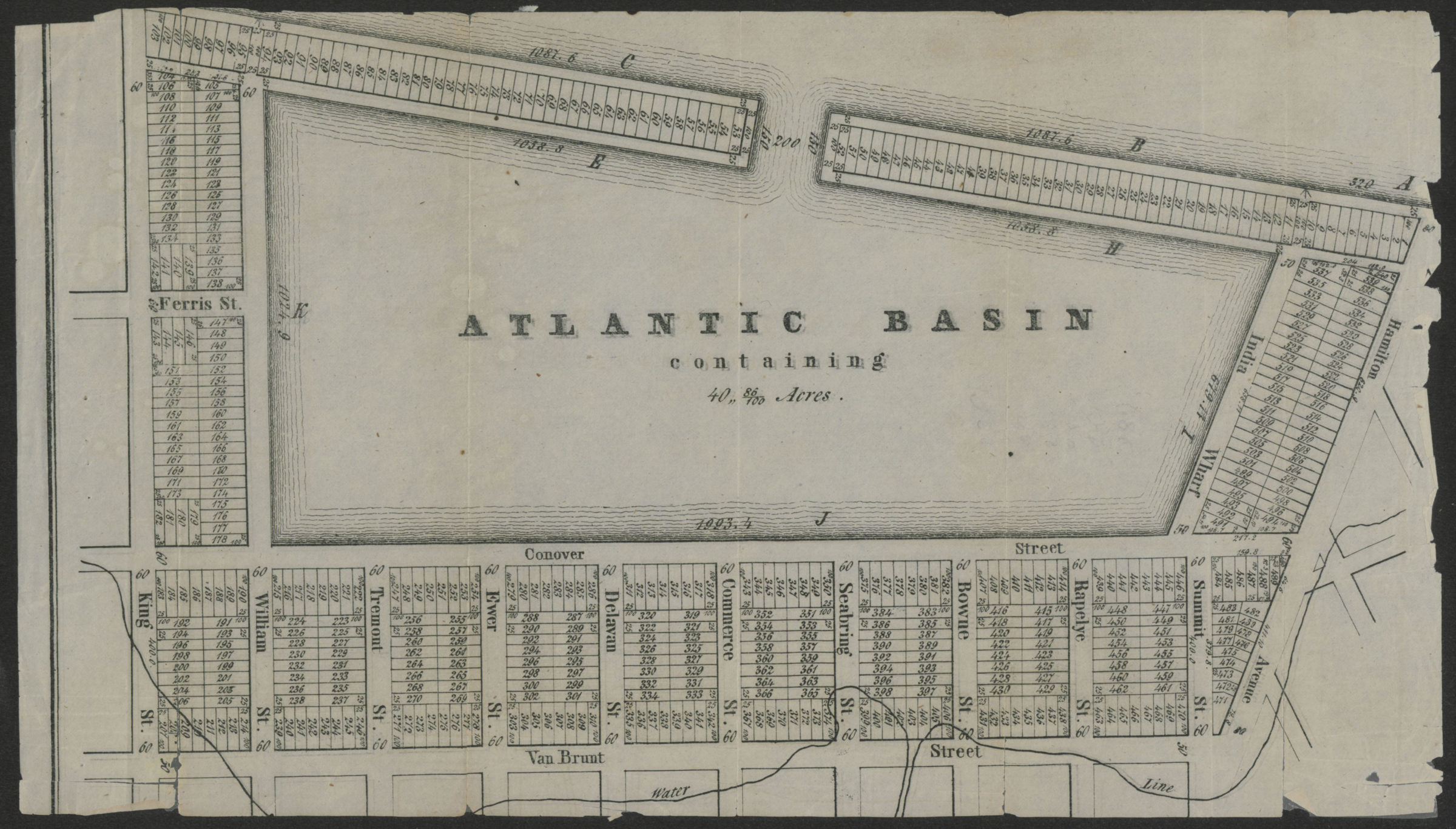
Covers the Atlantic Basin and the area bounded by King St., Van Brunt St., and Hamilton Ave. Shows dimensions of the Basin, the water line, and properties (including lot numbers and dimensions). Extracted from a larger map? Keyed to index no index present.
Subjects
Places
Map area shown
Genre
Cadastral mapsRelation
Full catalog recordSize
21 × 36 cmDownload
Low Resolution Image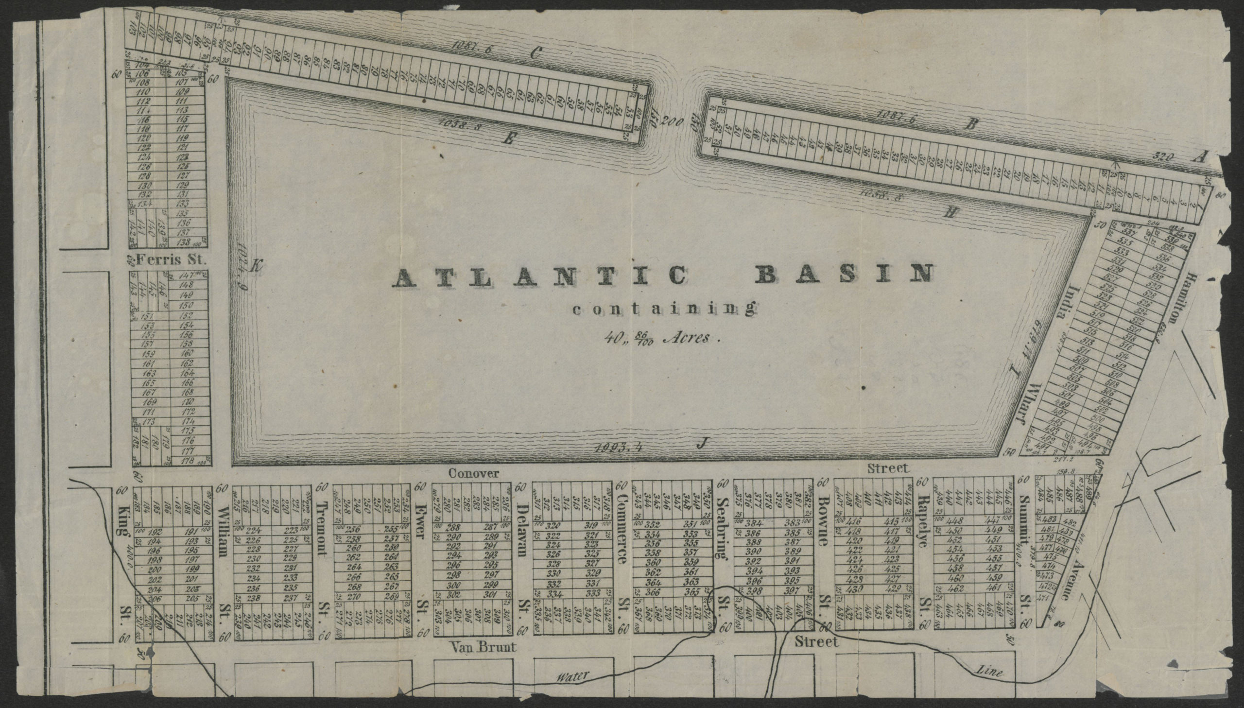
Creator
Publisher
Brooklyn Historical SocietyCitation
Atlantic Basin containing 40” 86/100 acres; [18??], Map Collection, B A-[18--?]c.Fl; Brooklyn Historical Society.Scale
Scale not givenLoading zoom image...