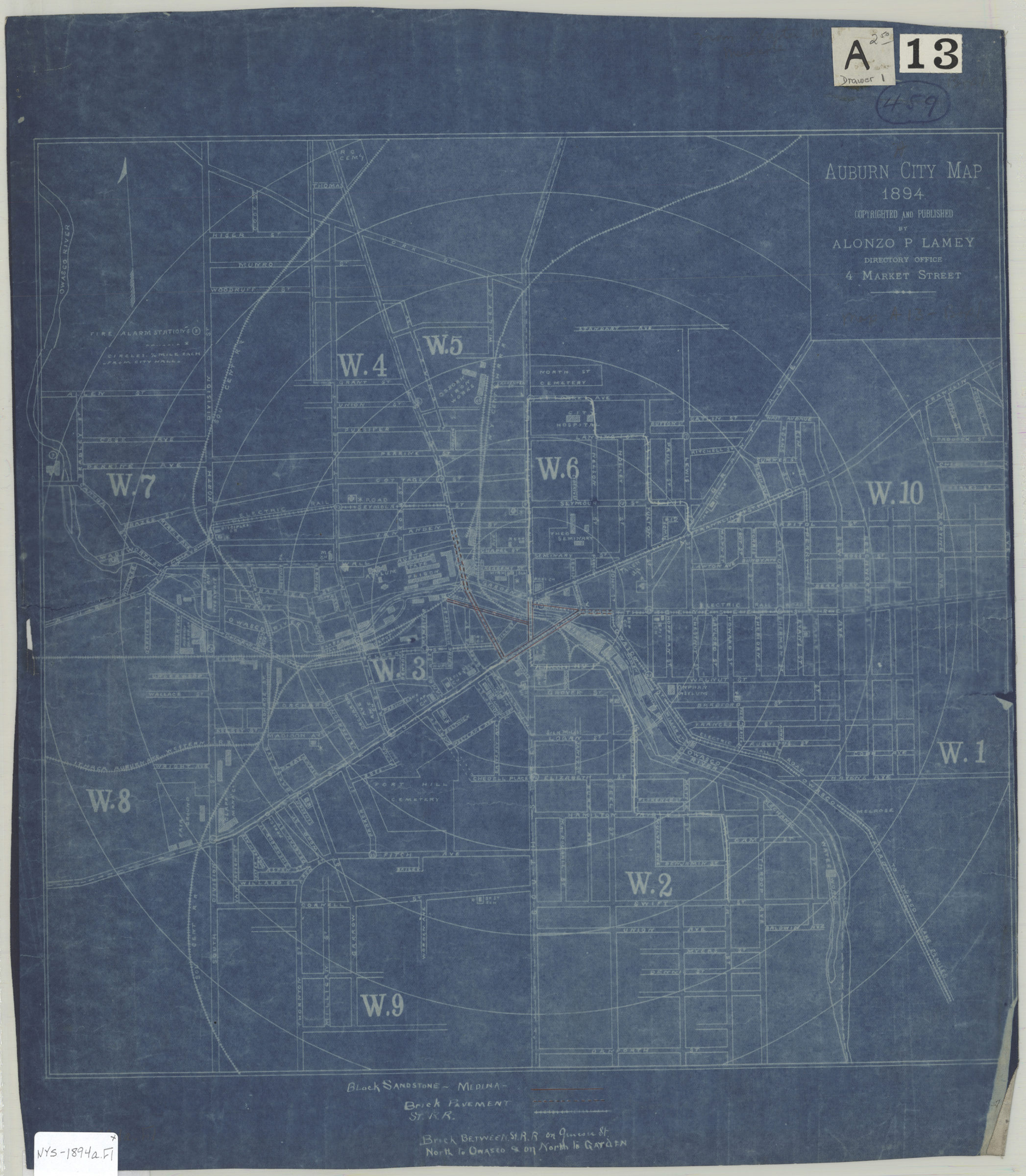
Auburn city map 1894
Map No. NYS-1894a.Fl
Shows wards, roads (by pavement type), railroads, fire alarm stations, and schools. Blueprint. Includes keys. BHS copy annotated in red ink.
Places
Map area shown
Genre
MapRelation
Full catalog recordSize
40 × 41 cmDownload
Low Resolution Image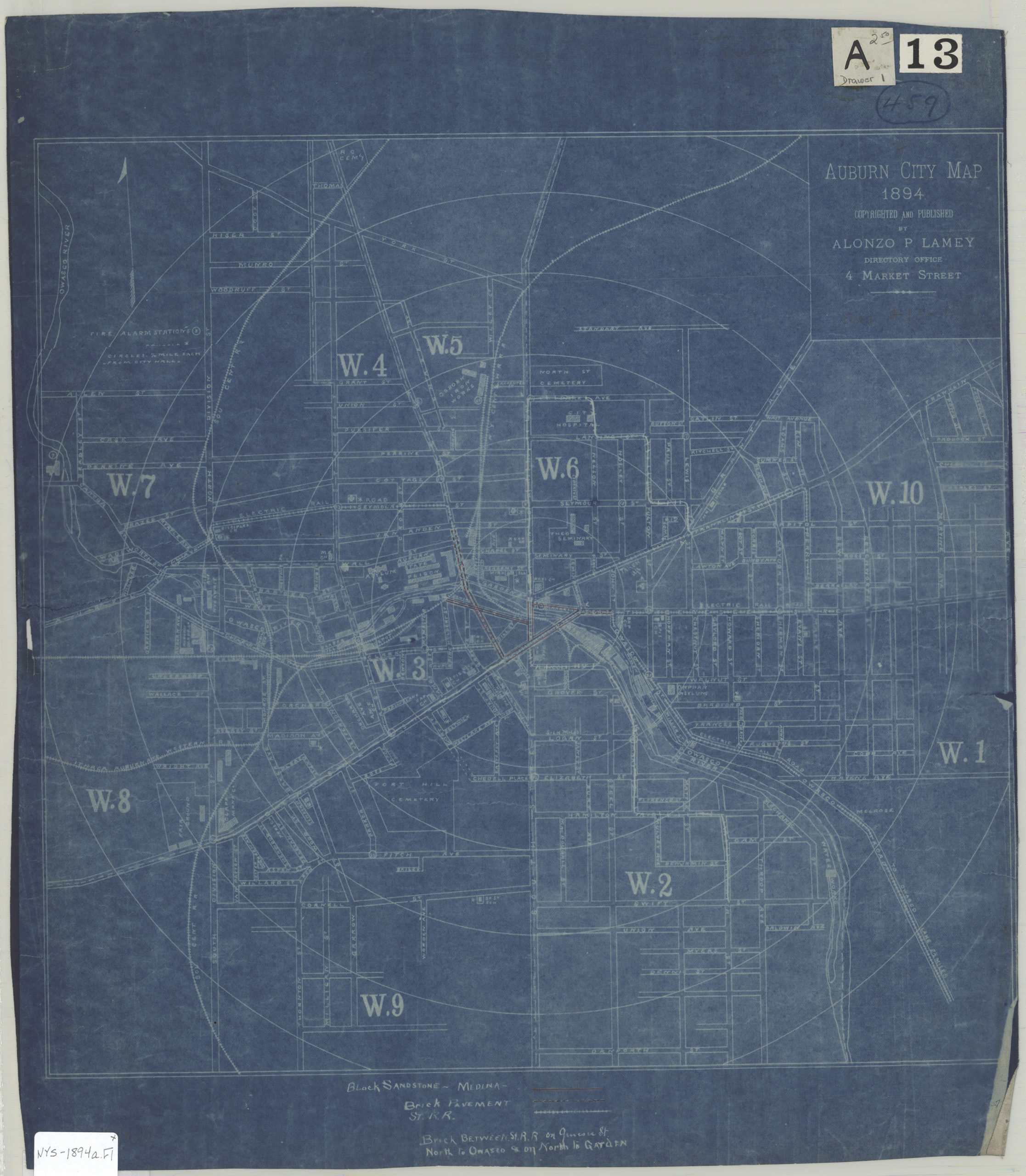
Creator
Lamey, Alonzo P.,Publisher
Brooklyn Historical SocietyCitation
Auburn city map; 1894, Map Collection, NYS-1894a.Fl; Brooklyn Historical Society.Scale
Scale not givenLoading zoom image... 