Baxter gore adjoining stores [18??]
Map No. Pierrepont-[18--?]d.Fl
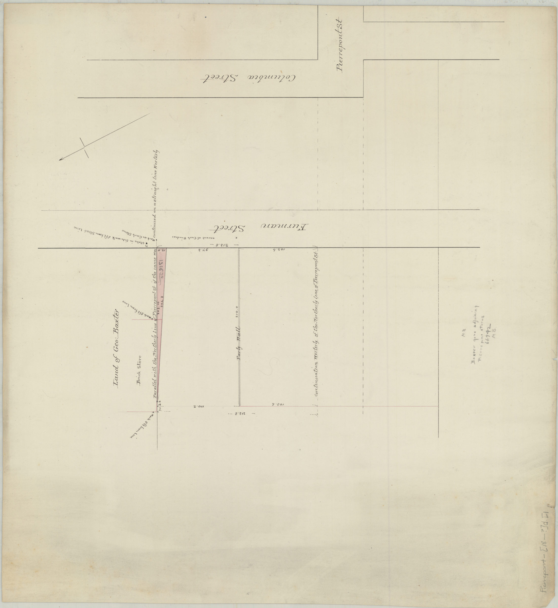
Cadastral map showing land of Geo. Baxter next to the Pierrepont Stores on Furman St. (modern-day Brooklyn Heights). Does not show the Pierrepont stores in detail. Verso title. Oriented with north to the upper left. Includes notes and measurements.
Map area shown
Relation
Full catalog recordSize
47 × 51 cmDownload
Low Resolution Image
Creator
Publisher
Brooklyn Historical SocietyCitation
Baxter gore adjoining stores; [18??], Map Collection, Pierrepont-[18--?]d.Fl; Brooklyn Historical Society.Scale
Scale not givenLoading zoom image... 