
Bay & port of New-York, capital of New-York [1861]
Map No. NYC-1764 (1861).Fl
Nautical chart covering Staten Island in its entirety, and portions of Manhattan, Brooklyn, and New Jersey. Shows settlements, roads, and anchorages. Facsimile. Depths shown by soundings. “From the Collection of Charts and Plans made by order of the Duke de Choiseul and executed by S. Bellin: in 1764.”–Lower margin. “Lith. for D.T. Valentine’s Manual for 1861.”–Lower left margin. BHS copy imperfect missing portion of lower left corner with text on original publication.
Map area shown
Relation
Full catalog recordSize
22 × 17 cmDownload
Low Resolution Image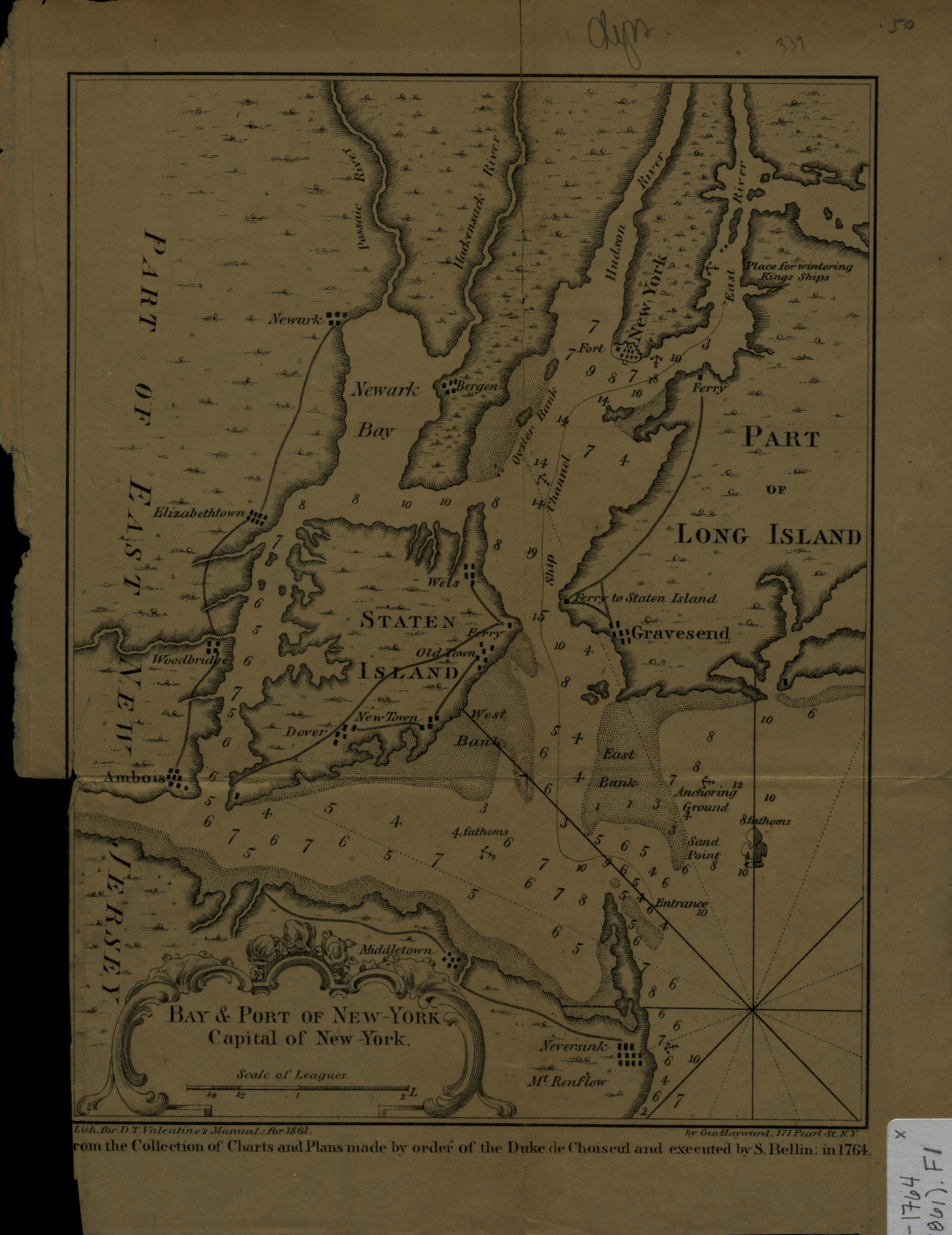
Creator
Bellin, Jacques Nicolas,Publisher
Brooklyn Historical SocietyCitation
Bay & port of New-York, capital of New-York; [1861], Map Collection, NYC-1764 (1861).Fl; Brooklyn Historical Society.Scale
Scale [ca. 1:202,750]Loading zoom image... 