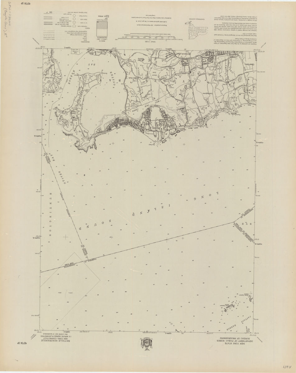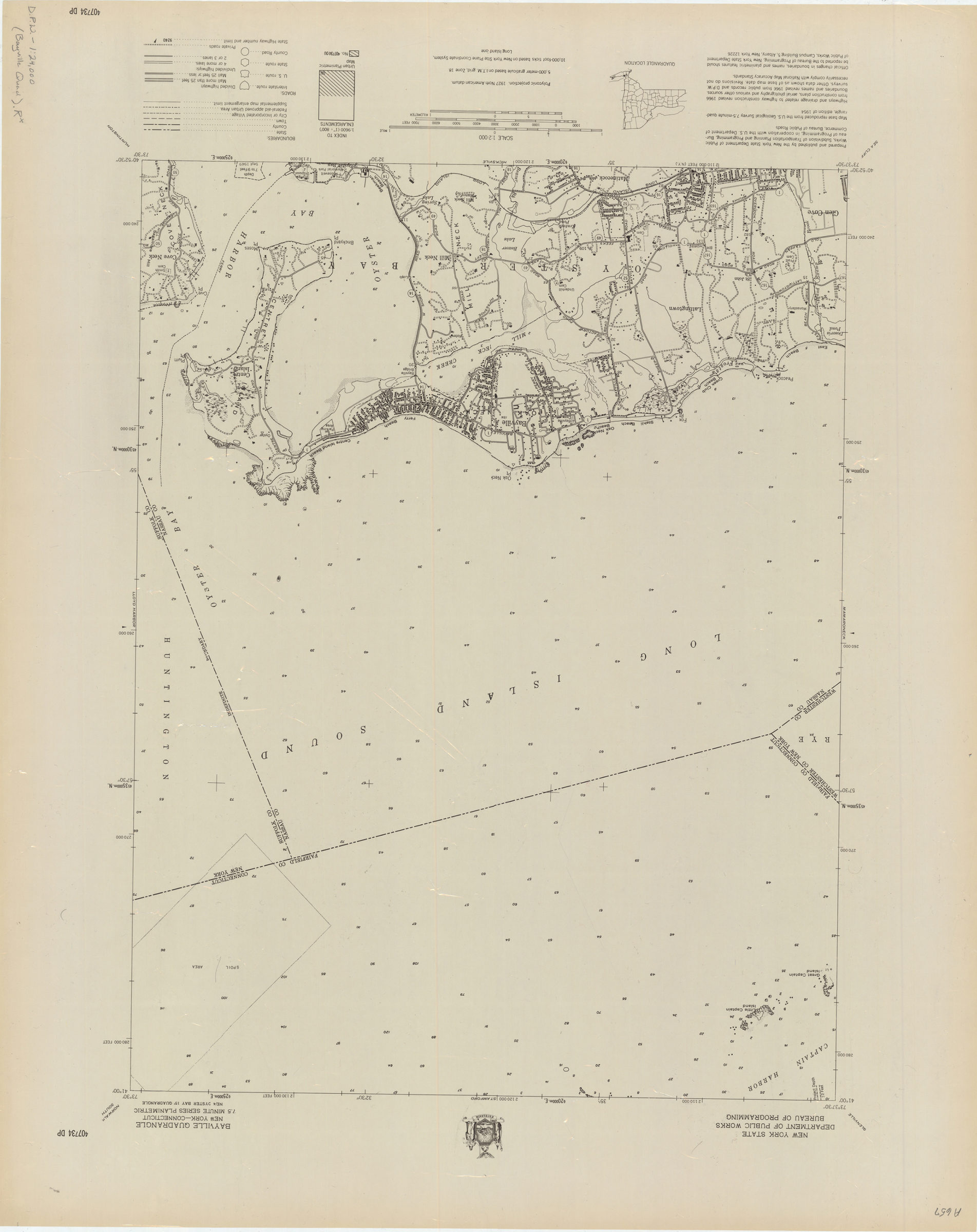
Bayville quadrangle, New York–Connecticut [1966]
Map No. D.P.W.-1:24,000 (Bayville Quad).R
Shows portions Nassau County in New York and Fairfield County in Connecticut. Relief shown by spot heights. Depths shown by soundings. Includes legend, quadrangle location map and index to 1:9600 enlargements series. “Map base reproduced from the U.S. Geological Survey 7.5-minute quadrangle, edition of 1954 … revised 1966….” “NE/4 Oyster Bay 15′ quadrangle.” “?07?34 DP.”
Map area shown
Genre
Bathymetric mapsRelation
Full catalog recordSize
77 × 61 cmDownload
Low Resolution Image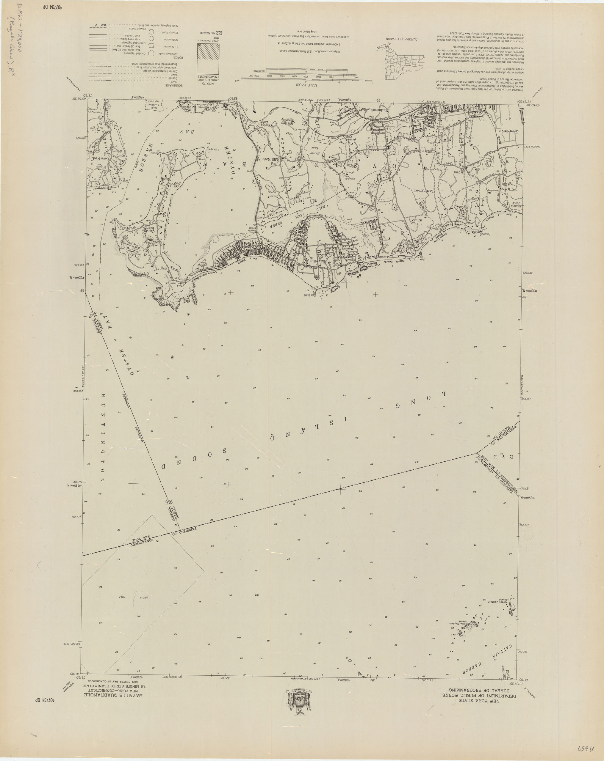
Creator
New York (State); Department of Public Works.; Bureau of Programming,Publisher
Brooklyn Historical SocietyCitation
Bayville quadrangle, New York–Connecticut; [1966], Map Collection, D.P.W.-1:24,000 (Bayville Quad).R; Brooklyn Historical Society.Scale
Scale 1:24,000Loading zoom image...