Bedford-Stuyvesant: a cultural heritage guide [2002]
Map No. B A-[2002?].Fl c.2;B A-[2002?].Fl
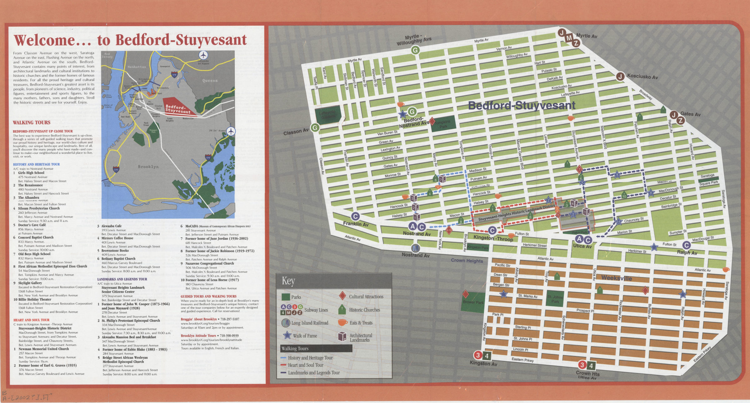
Shows Weeksville, the Stuyvesant Heights Historic Landmark District, and subway stops. Panel title. “Bedford-Stuyvesant: a cultural heritage guide Project Team: The Tate Group, The Weeksville Society, Braggin’ About Brooklyn, Digibomb Design and the Brooklyn Chamber of Commerce.”–Verso. Includes location map and key for 3 walking tours. On verso: Text for historic churches, walk of fame, cultural attractions, architectural landmarks, and eats and treats. BHS copy originally part of the collection of Everett and Evelyn Ortner papers and photographs (ARC.306).
Map area shown
Genre
Tourist mapsRelation
Full catalog recordSize
37 × 60 cmDownload
Low Resolution Image
Creator
Publisher
Brooklyn Historical SocietyCitation
Bedford-Stuyvesant: a cultural heritage guide; [2002], Map Collection, B A-[2002?].Fl c.2;B A-[2002?].Fl; Brooklyn Historical Society.Scale
Scale not givenLoading zoom image... 