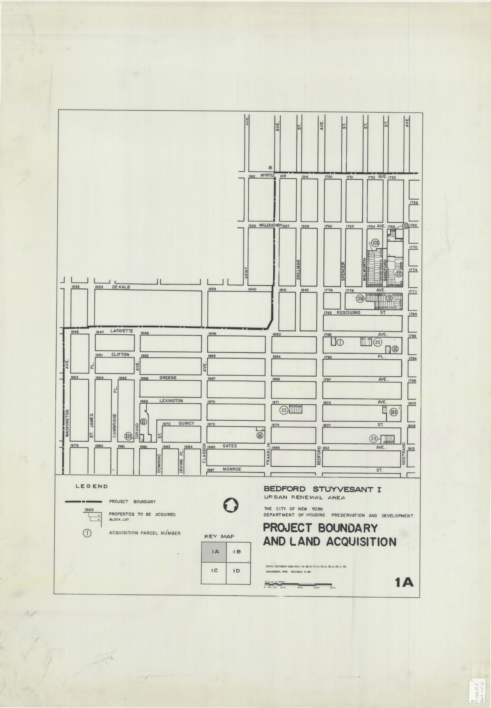
Bedford Stuyvesant I: urban renewal area : project boundary and land acquisition 1988
Map No. B P-1988.FL.Folio
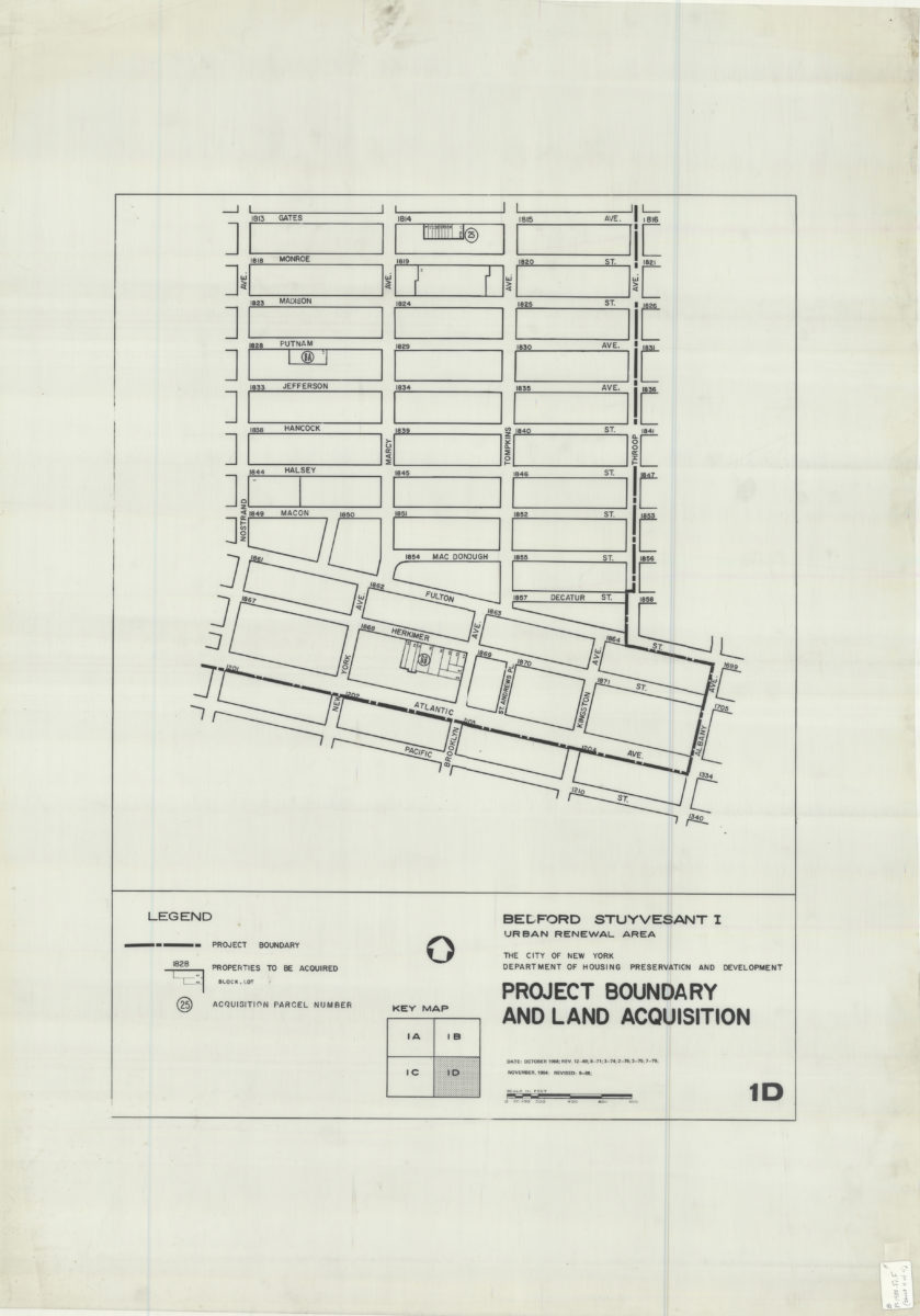
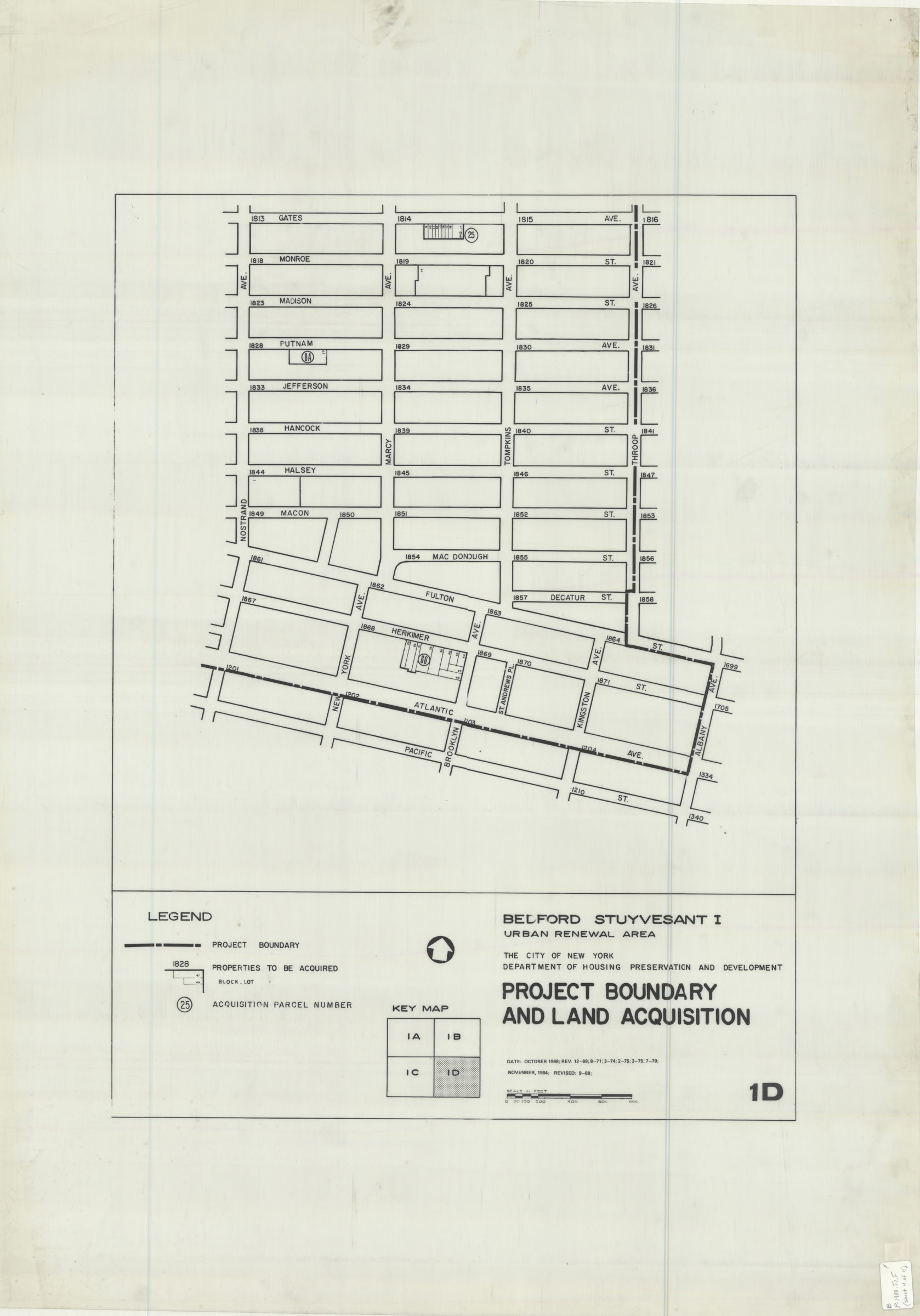
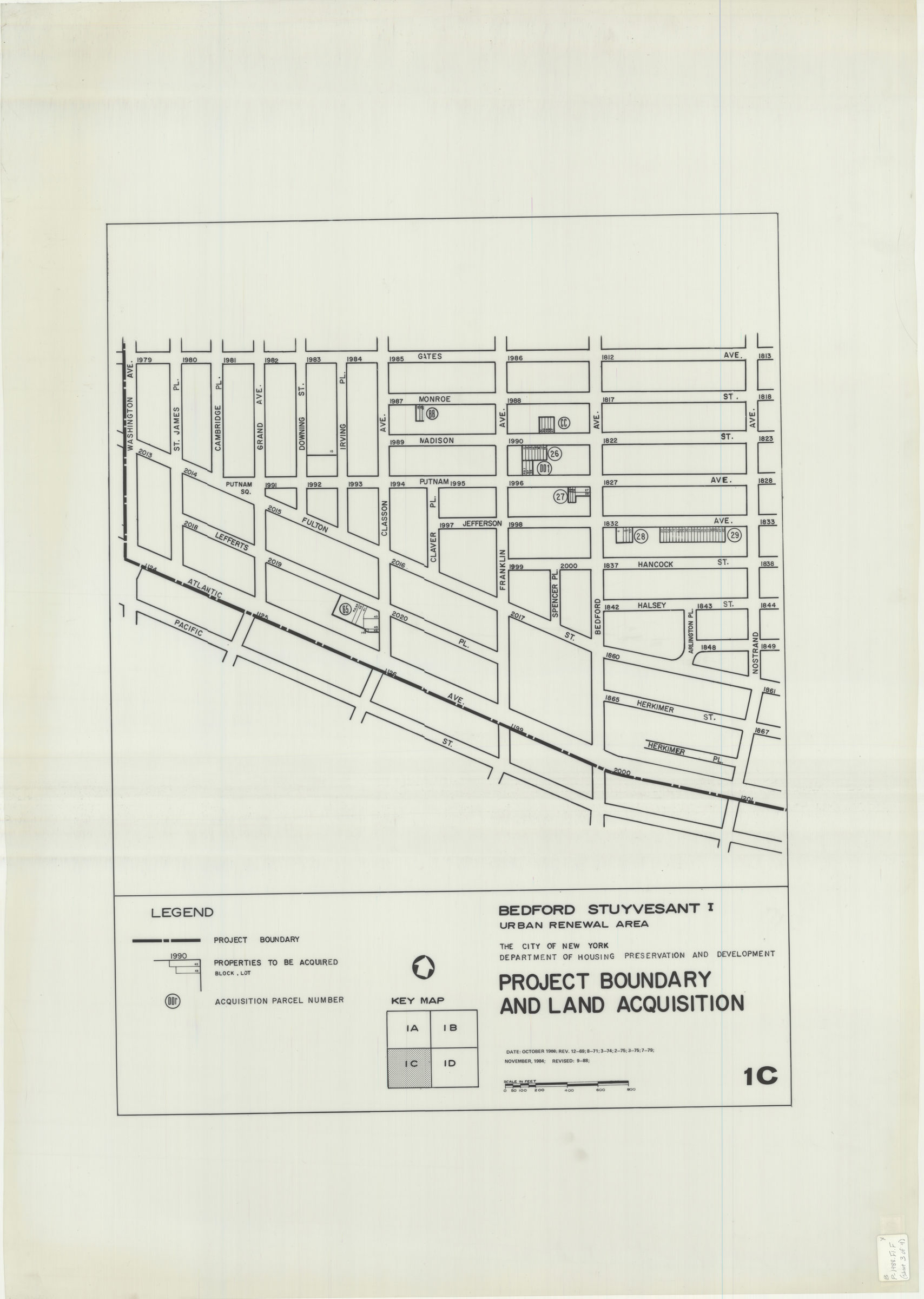
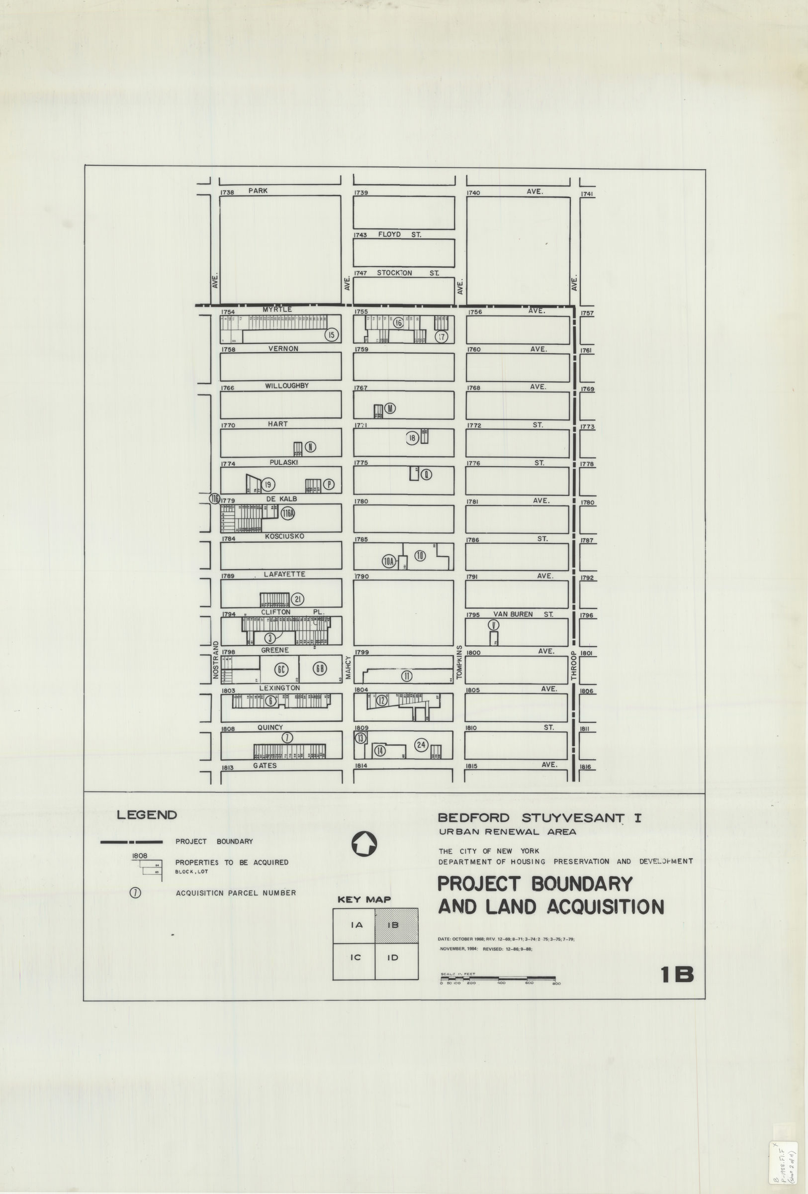
Covers area bounded by Park Avenue, Sumner Avenue, Pacific Avenue, Waverly Avenue, DeKalb Avenue, and Kent Avenue in Bedford Stuyvesant neighborhood. Shows project boundary, properties to be acquired, and acquisition parcel numbers. “Date: October 1968 rev. 12-69 8-71 3-74 2-75 3-75 7-79 November 1984 revised 12-86, 9-88.” Printed on translucent polyester.
Subjects
Places
Map area shown
Genre
MapRelation
Full catalog recordSize
108 × 76 cmDownload
Low Resolution Image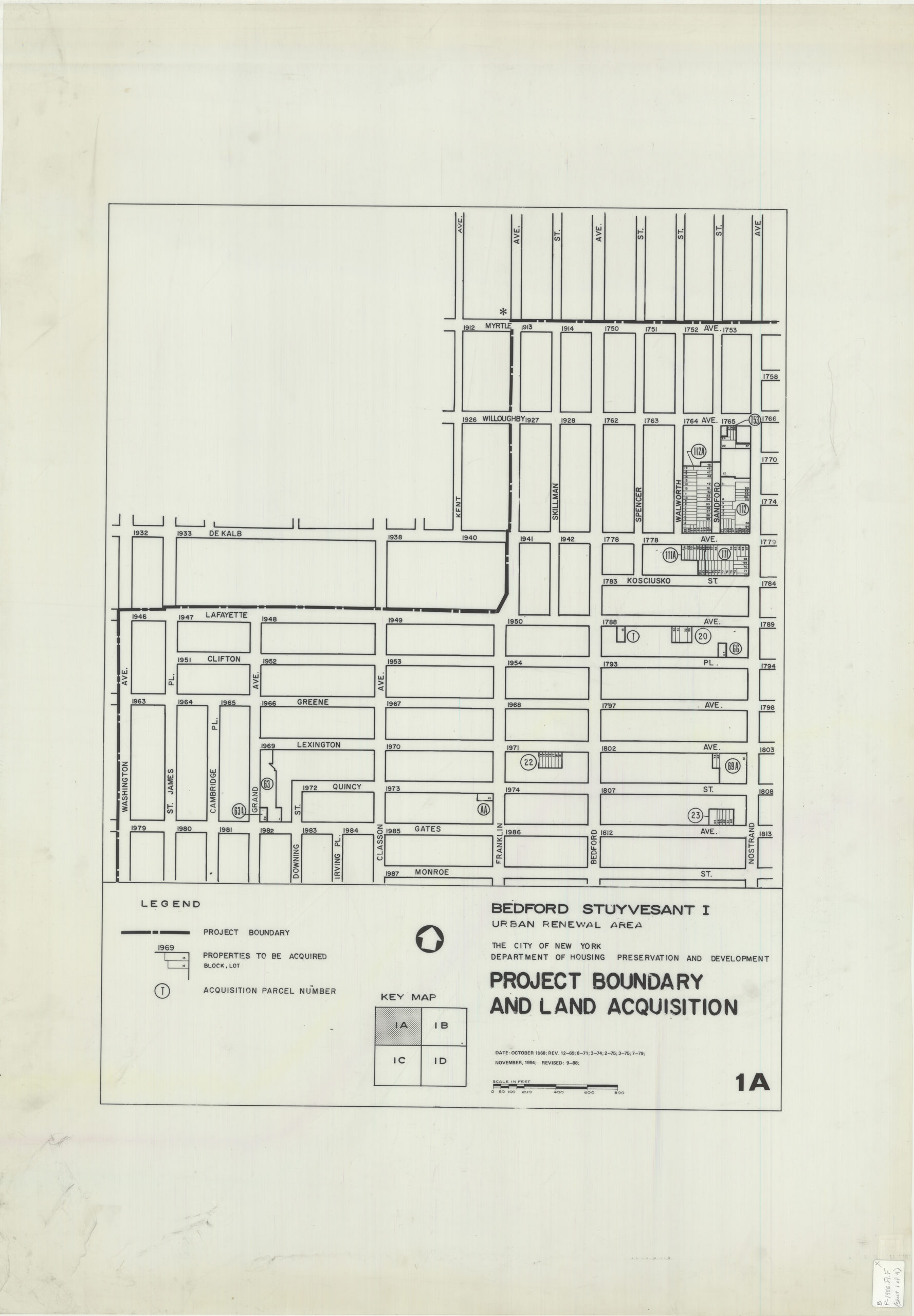
Creator
New York (N.Y.).; Department of Housing Preservation and Development,Publisher
Brooklyn Historical SocietyCitation
Bedford Stuyvesant I: urban renewal area : project boundary and land acquisition; 1988, Map Collection, B P-1988.FL.Folio; Brooklyn Historical Society.Scale
Scale approximately 1:241Loading zoom image...