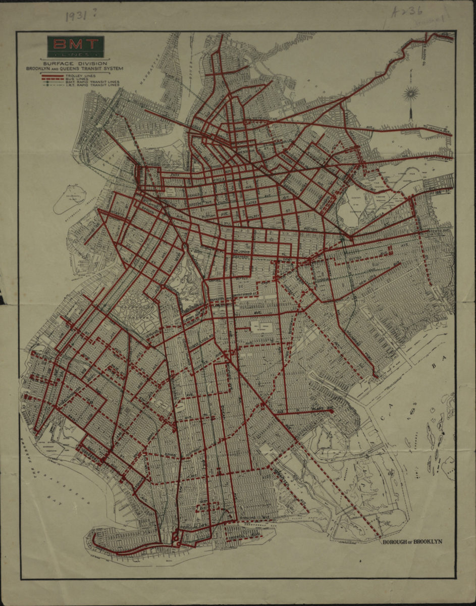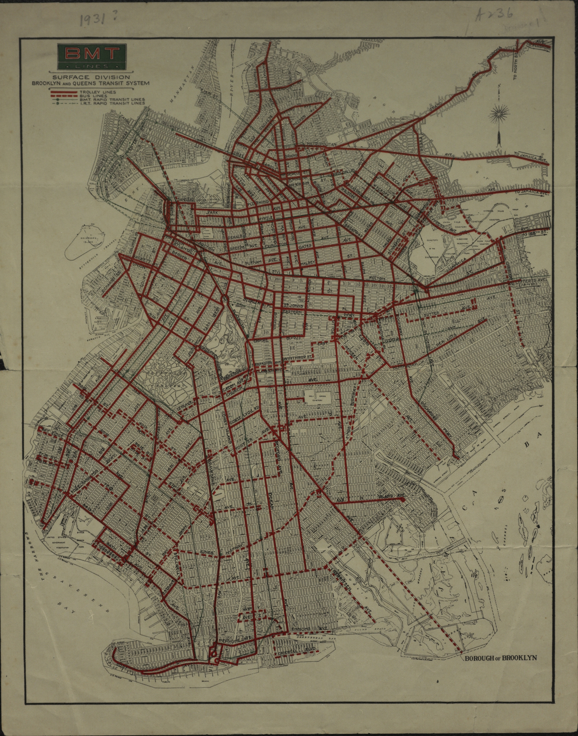
BMT Lines Surface Division, Brooklyn and Queens transit system [193?]
Map No. B C-[193-?].Fl
Also covers portions of lower Manhattan and Queens, as well as Governor’s Island. Shows BMT trolley and bus lines, and BMT and IRT (Interborough Rapid Transit) lines. Includes key. BHS copy affixed to mat frame.
Map area shown
Genre
Transportation mapsRelation
Full catalog recordSize
32 × 26 cmDownload
Low Resolution ImageCreator
Brooklyn-Manhattan Transit Company,Publisher
Brooklyn Historical SocietyCitation
BMT Lines Surface Division, Brooklyn and Queens transit system; [193?], Map Collection, B C-[193-?].Fl; Brooklyn Historical Society.Scale
Scale [ca. 1:64,000]Loading zoom image...