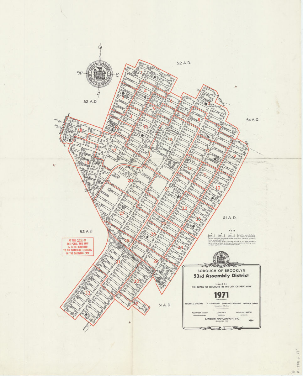
Borough of Brooklyn 53rd Assembly District, 1971: issued by the Board of Elections in the City of New York 1971
Map No. B A-1971o.Fl
The 53rd Assembly District encompassed parts of the Park Slope and Sunset Park neighborhoods. Election districts outlined in red.
Subjects
Places
Map area shown
Genre
Zoning mapsRelation
Full catalog recordSize
73 × 59 cmDownload
Low Resolution Image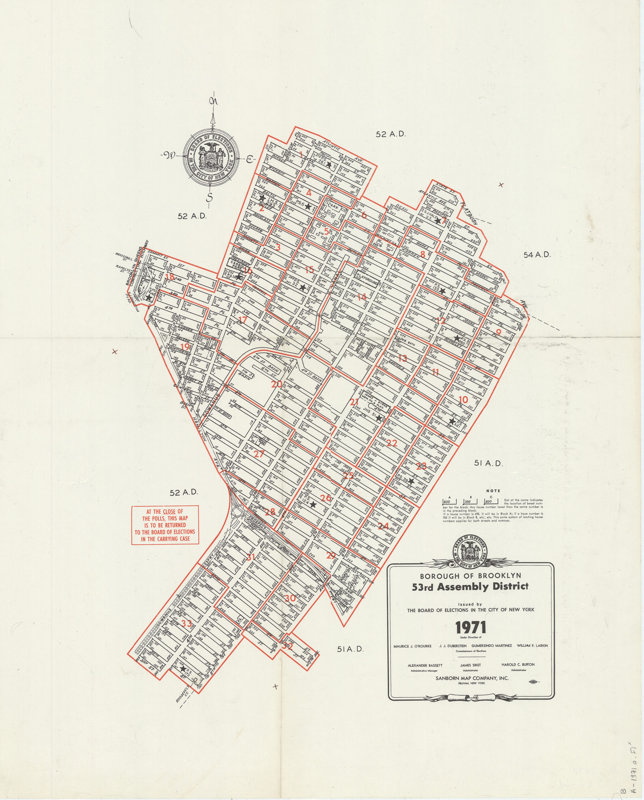
Creator
New York (N.Y.).; Board of Elections,Publisher
Brooklyn Historical SocietyCitation
Borough of Brooklyn 53rd Assembly District, 1971: issued by the Board of Elections in the City of New York; 1971, Map Collection, B A-1971o.Fl; Brooklyn Historical Society.Scale
Scale not givenLoading zoom image...