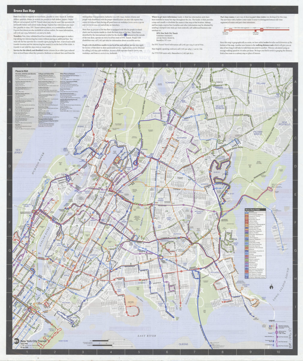
Bronx bus map: MTA, New York City Transit [ca. 1996]
Map No. B R-1996.Fl
Includes text, diagram, index of places to visit, and color-coded numerical list of bus routes. On verso: Text, color-coded bus-route directory with time and frequency information, and advertisements. “22-30-1009. 5 4 3 2 1.”
Map area shown
Genre
Transportation mapsRelation
Full catalog recordSize
64 × 54 cmDownload
Low Resolution Image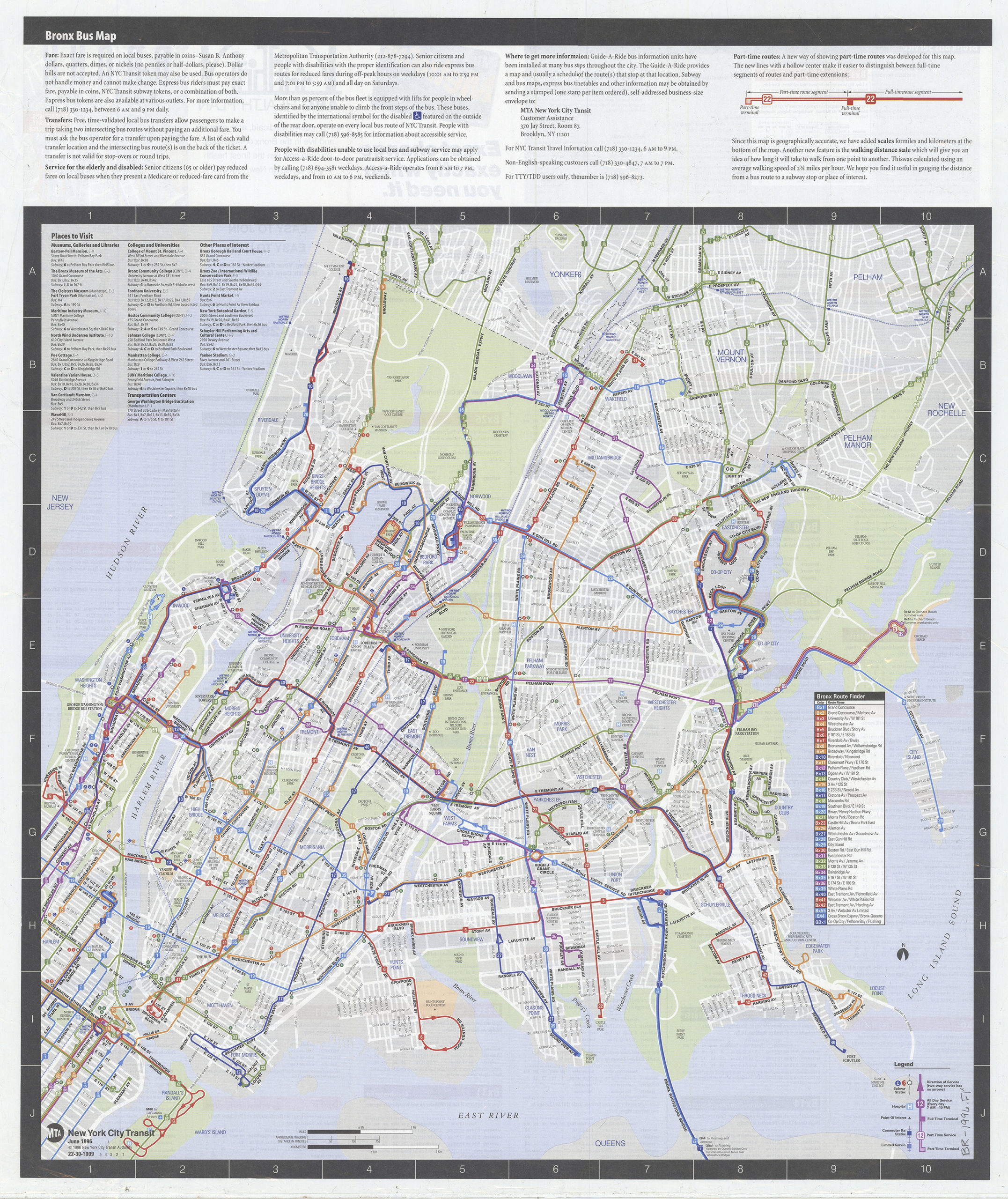
Creator
New York City Transit Authority,Publisher
Brooklyn Historical SocietyCitation
Bronx bus map: MTA, New York City Transit; [ca. 1996], Map Collection, B R-1996.Fl; Brooklyn Historical Society.Scale
Scale [ca. 1:27,750]Loading zoom image...