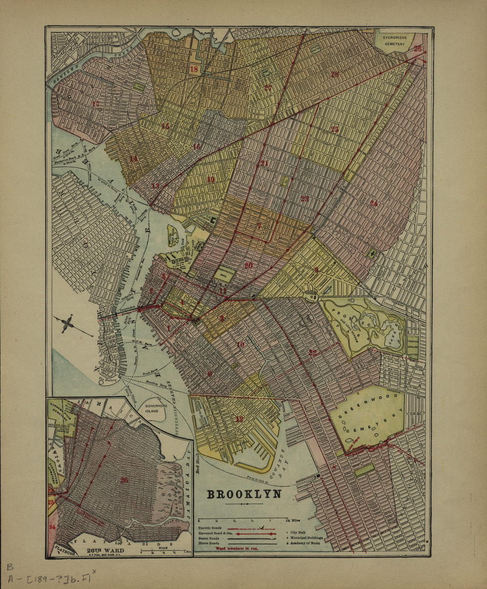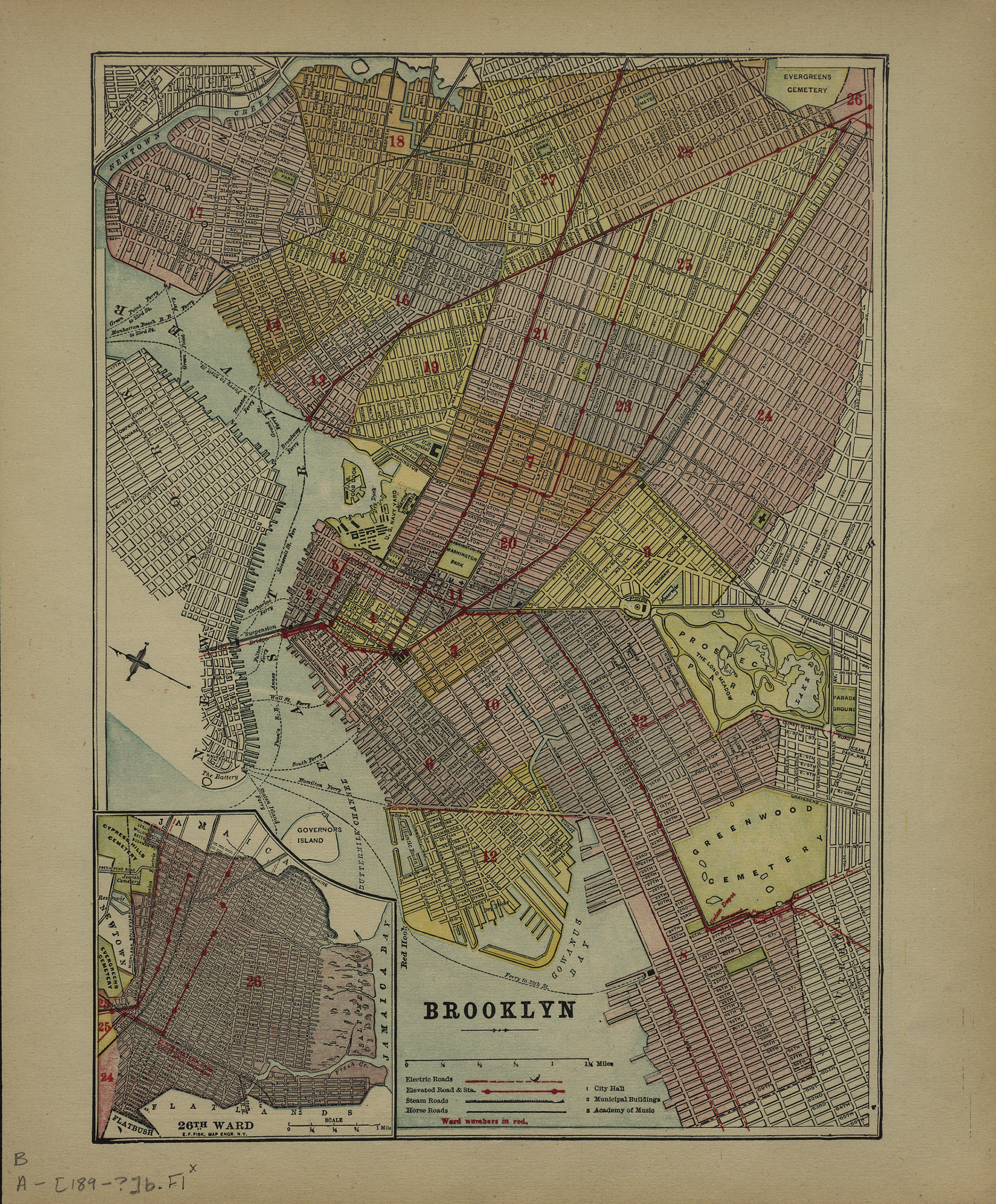
Brooklyn [189?]
Map No. B A-[189-?]b.Fl
Covers the city of Brooklyn north from 59th St. to Greenpoint and east to Evergreens Cemetery. Also covers a portion of lower Manhattan. Shows wards, electric roads, elevated roads, steam roads, horse roads, and ferry lines. Extracted from: The historical atlas. Oriented with north to the upper left. On recto: Index, key, and inset of the 26th Ward. On verso: Text (concerning New York City and Brooklyn) and ill. “242 The Historical Atlas”–Verso.
Map area shown
Genre
MapRelation
Full catalog recordSize
32 × 23 cmDownload
Low Resolution Image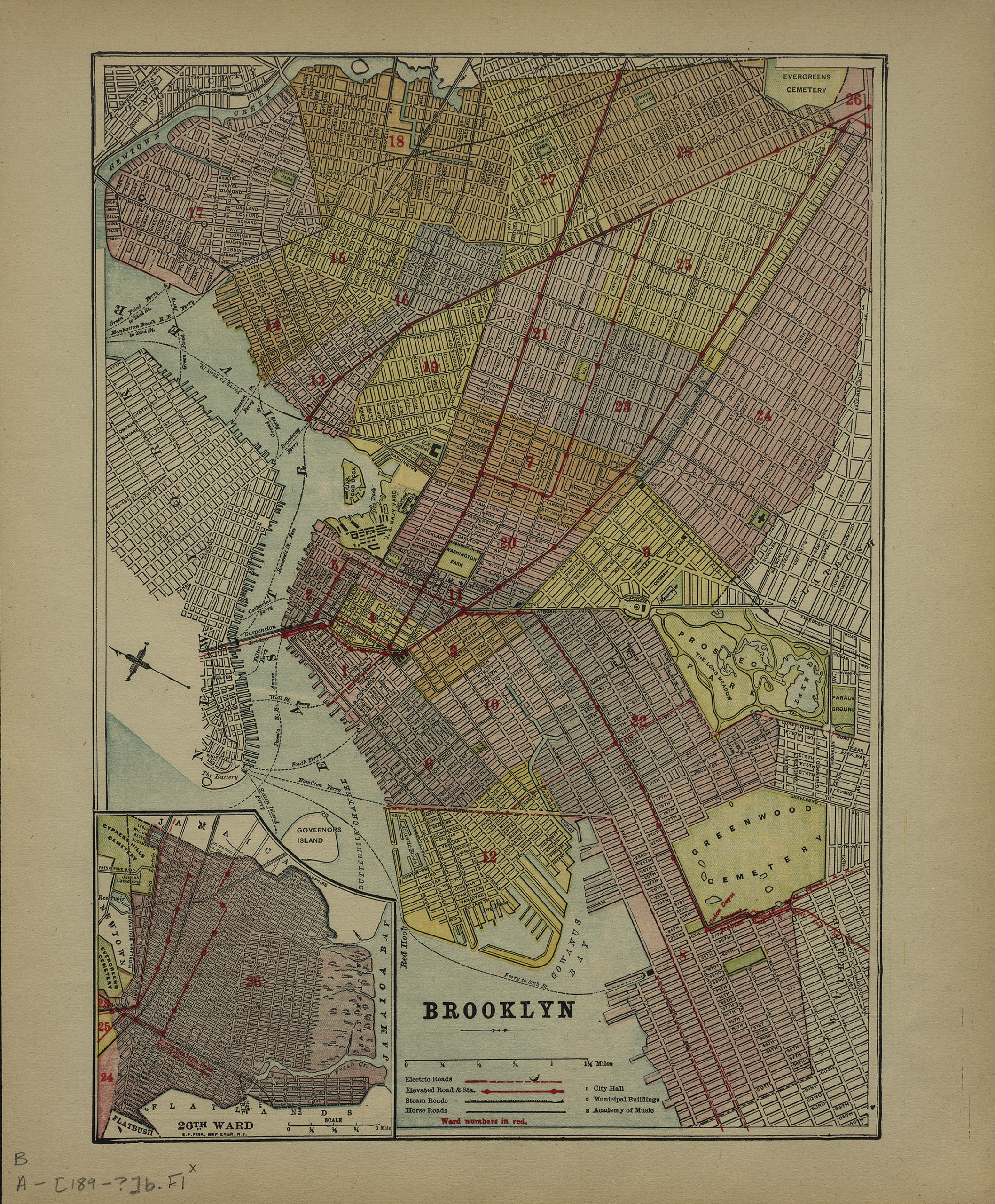
Creator
Publisher
Brooklyn Historical SocietyCitation
Brooklyn; [189?], Map Collection, B A-[189-?]b.Fl; Brooklyn Historical Society.Scale
Scale [ca. 1:35,200]Loading zoom image...