Center for Brooklyn History
Map Collections
Search
About
Othmer Library & Archives
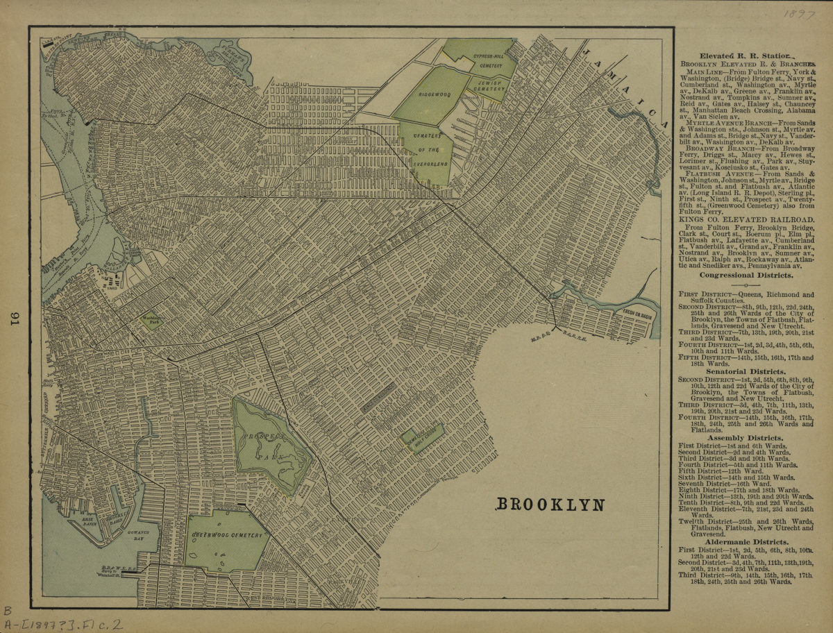
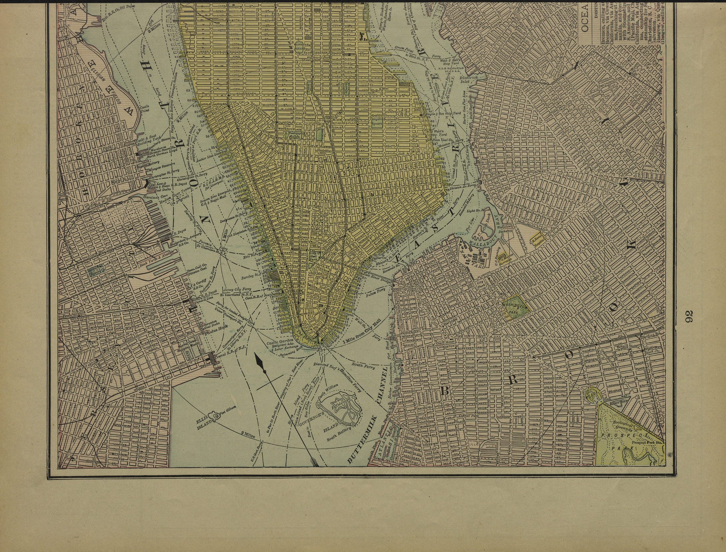
Brooklyn
[1897]
Map No. B A-[1897?]a.Fl
Places
Brooklyn (New York, N.Y.)
Map area shown
Genre
Zoning maps
Download
Low Resolution Image
Citation
Brooklyn; , , ; Brooklyn Historical Society.
Loading zoom image...
