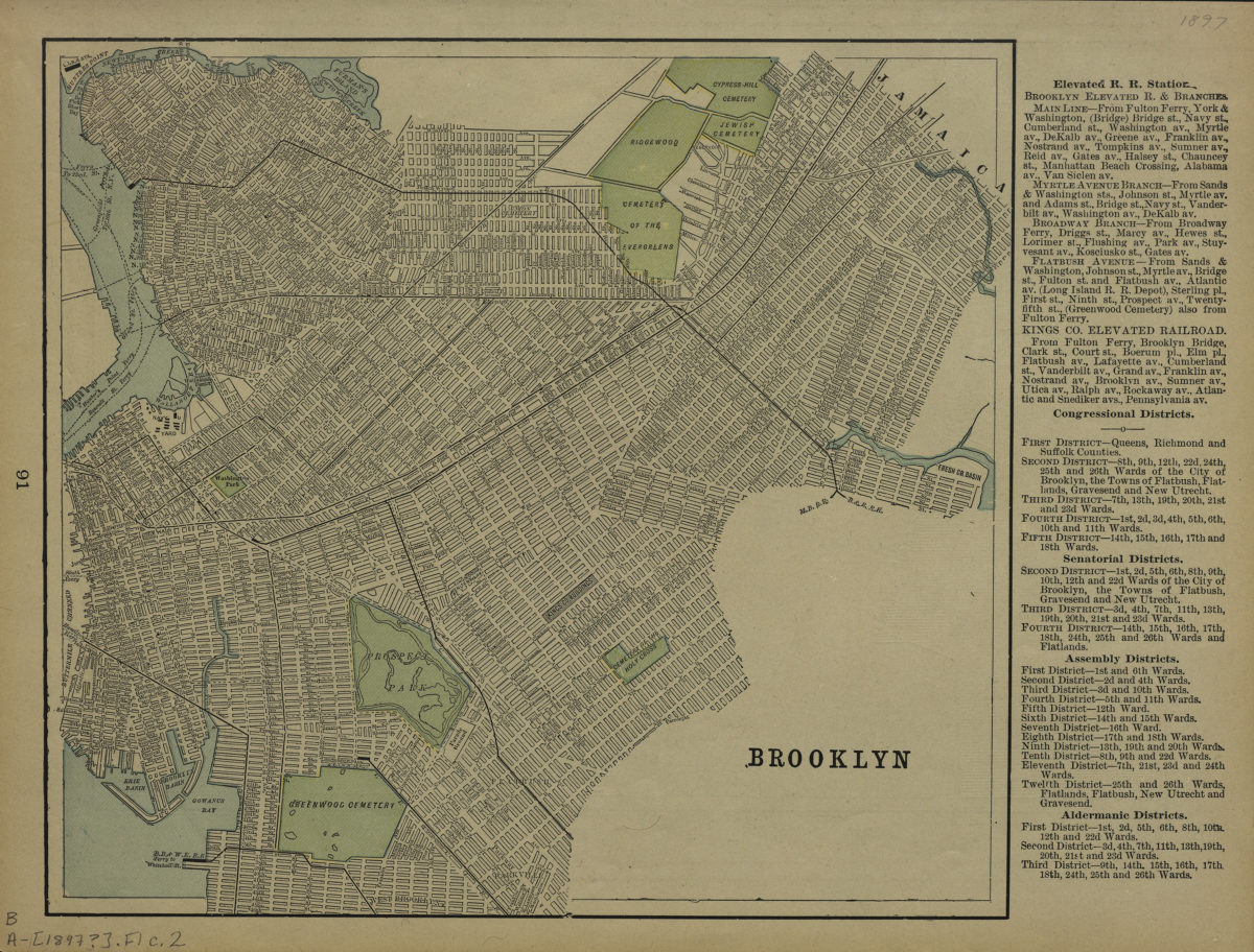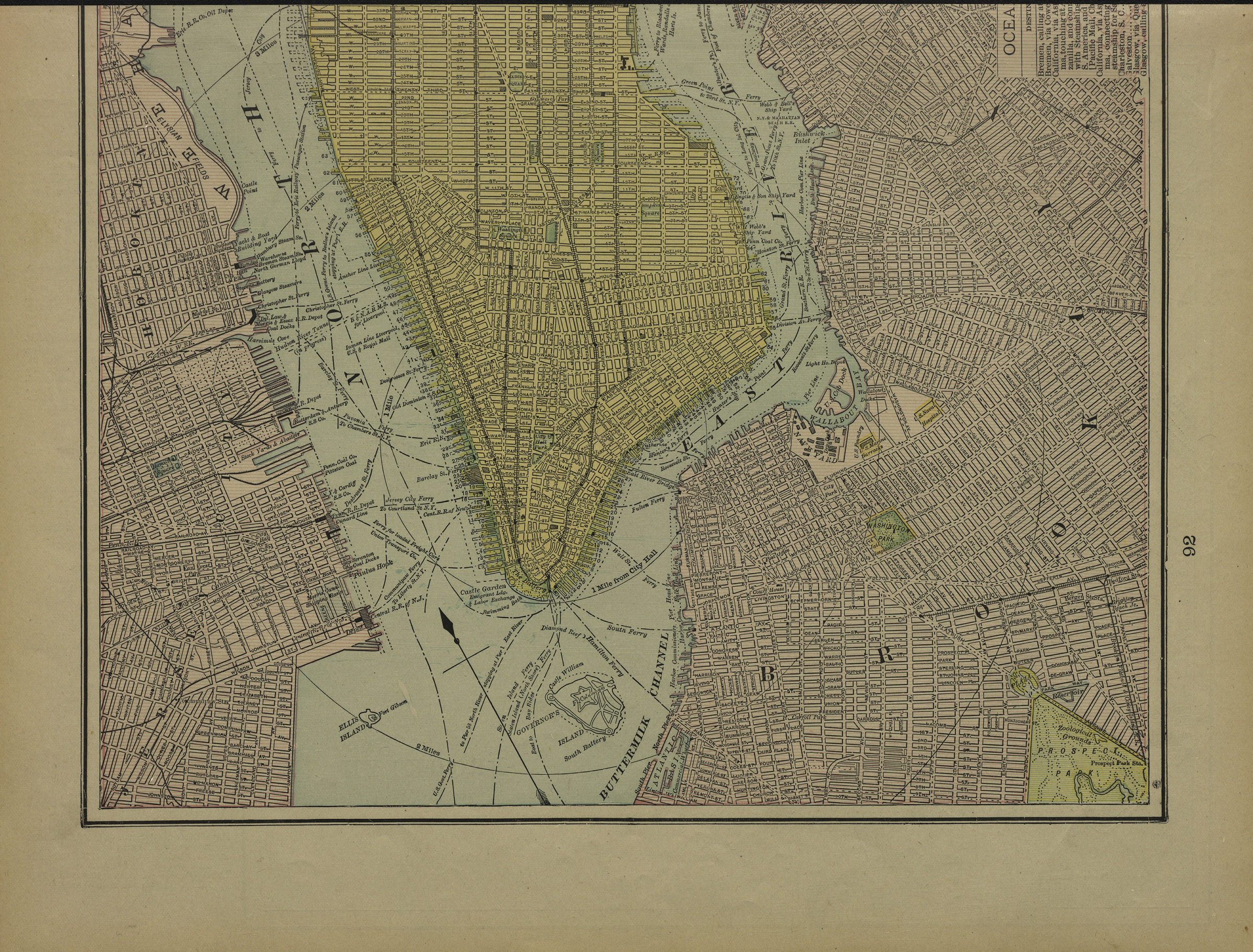
Brooklyn [1897]
Map No. B A-[1897?]a.Fl
Covers Brooklyn north from 46th St. to Greepoint and east to East New York. Shows streets, railroads, and ferry lines. Extracted from an unknown atlas. Includes list of elevated railroad stations, congressional districts, senatorial districts, assembly districts, and aldermanic districts. On verso: [Map of Lower Manhattan and northwest Brooklyn]. Verso map incomplete due to line of extraction on BHS copy. “91”–Left center margin of recto. “92”–Right center margin of verso.
Map area shown
Genre
Zoning mapsRelation
Full catalog recordSize
26 × 28 cmDownload
Low Resolution Image
Creator
Publisher
Brooklyn Historical SocietyCitation
Brooklyn; [1897], Map Collection, B A-[1897?]a.Fl; Brooklyn Historical Society.Scale
Scale not givenLoading zoom image...