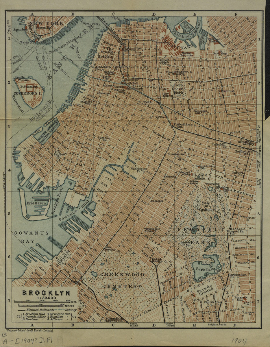
Brooklyn [1904]
Map No. B A-[1904?].Fl
Covers Brooklyn from Wallabout Channel to Greenwood Cemetery, and east to Bedford Avenue. Also covers a portion of lower Manhattan. Shows streets, elevated railroads, subway under construction, and clubs. Detached from an unidentified atlas.
Map area shown
Genre
MapRelation
Full catalog recordSize
22 × 18 cmDownload
Low Resolution Image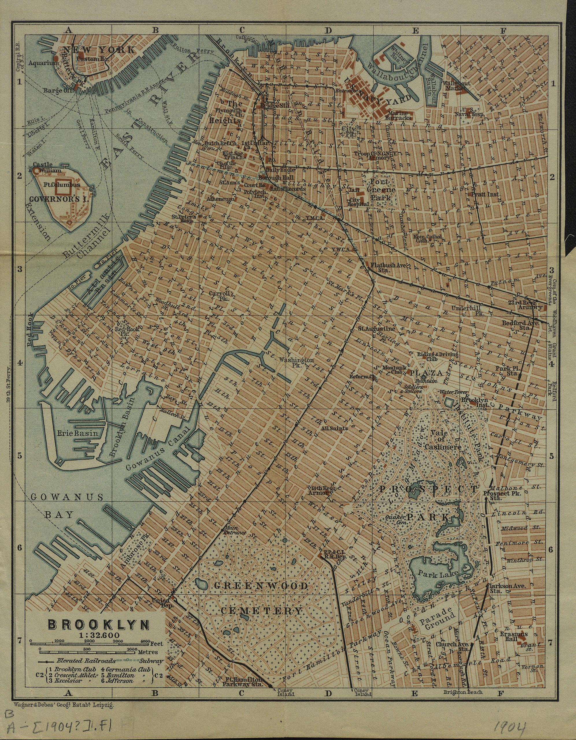
Creator
Wagner & Debes,Publisher
Brooklyn Historical SocietyCitation
Brooklyn; [1904], Map Collection, B A-[1904?].Fl; Brooklyn Historical Society.Scale
Scale 1:32,600Loading zoom image...