![](https://mapcollections.brooklynhistory.org/wp-content/uploads/sites/8/2020/02/bhs_bb004049462_a.jpg)
![](https://mapcollections.brooklynhistory.org/wp-content/uploads/sites/8/2020/02/bhs_bb004049462r_a.jpg)
Brooklyn Botanic Garden [2011]
Map No. B B-[2011].Fl
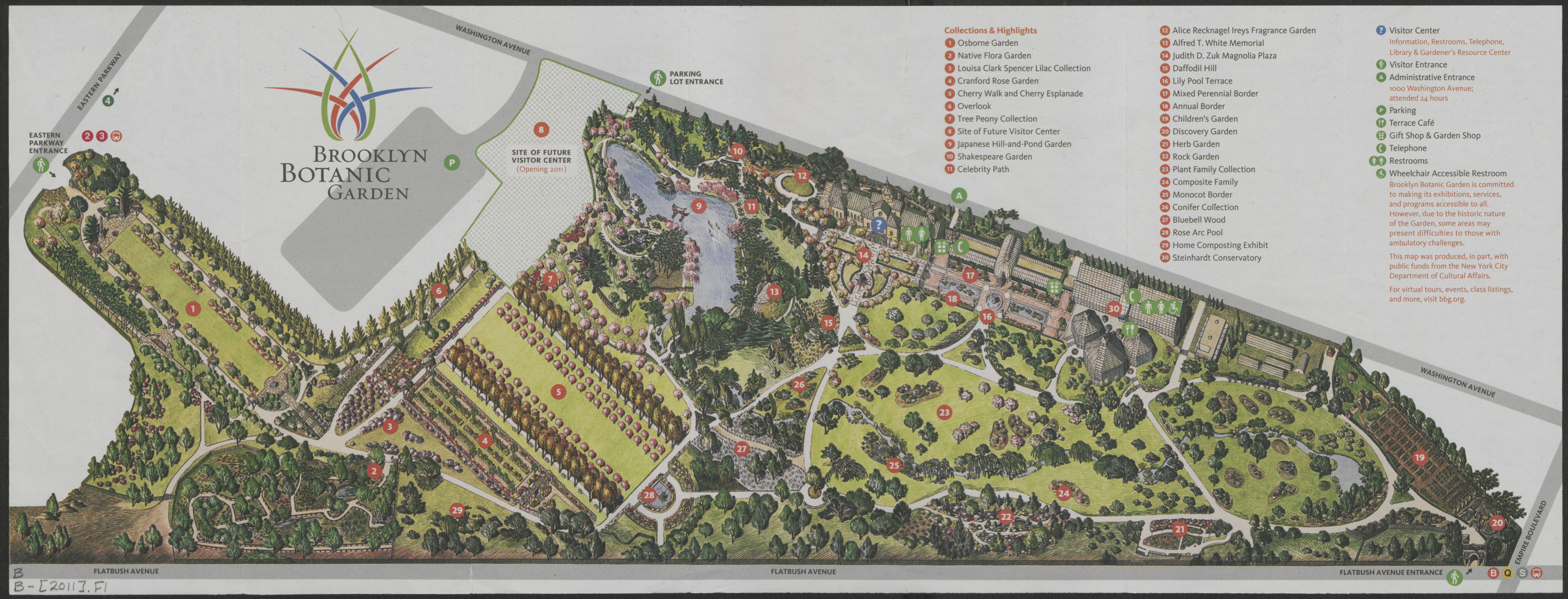
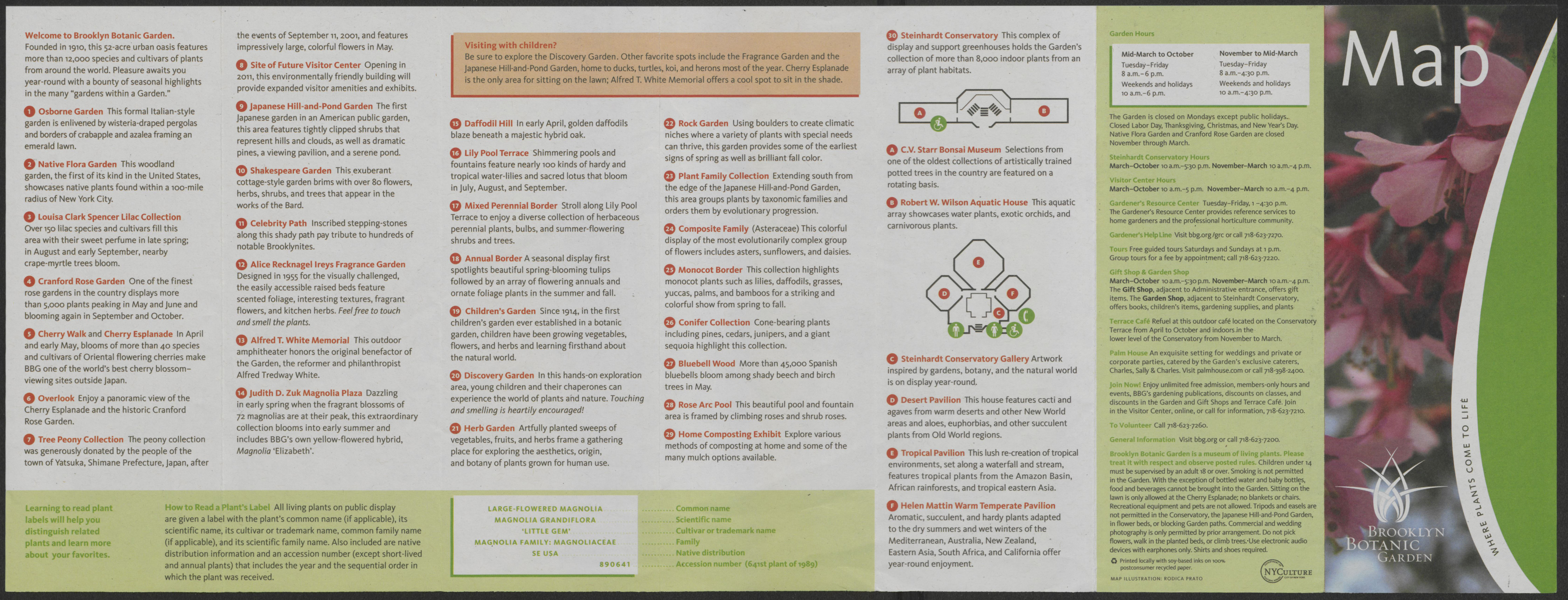
“Map illustration: Rodica Prato.” Includes index. Text on verso.
Map area shown
Relation
Full catalog recordSize
22 × 57 cmDownload
Low Resolution ImageCreator
Prato, Rodica,Publisher
Brooklyn Historical SocietyCitation
Brooklyn Botanic Garden; [2011], Map Collection, B B-[2011].Fl; Brooklyn Historical Society.Scale
Scale not givenLoading zoom image... ![](https://mapcollections.brooklynhistory.org/wp-content/uploads/sites/8/2020/02/bhs_bb004049462_a-1200x458.jpg)
![](https://mapcollections.brooklynhistory.org/wp-content/uploads/sites/8/2020/02/bhs_bb004049462_a-1200x458.jpg)