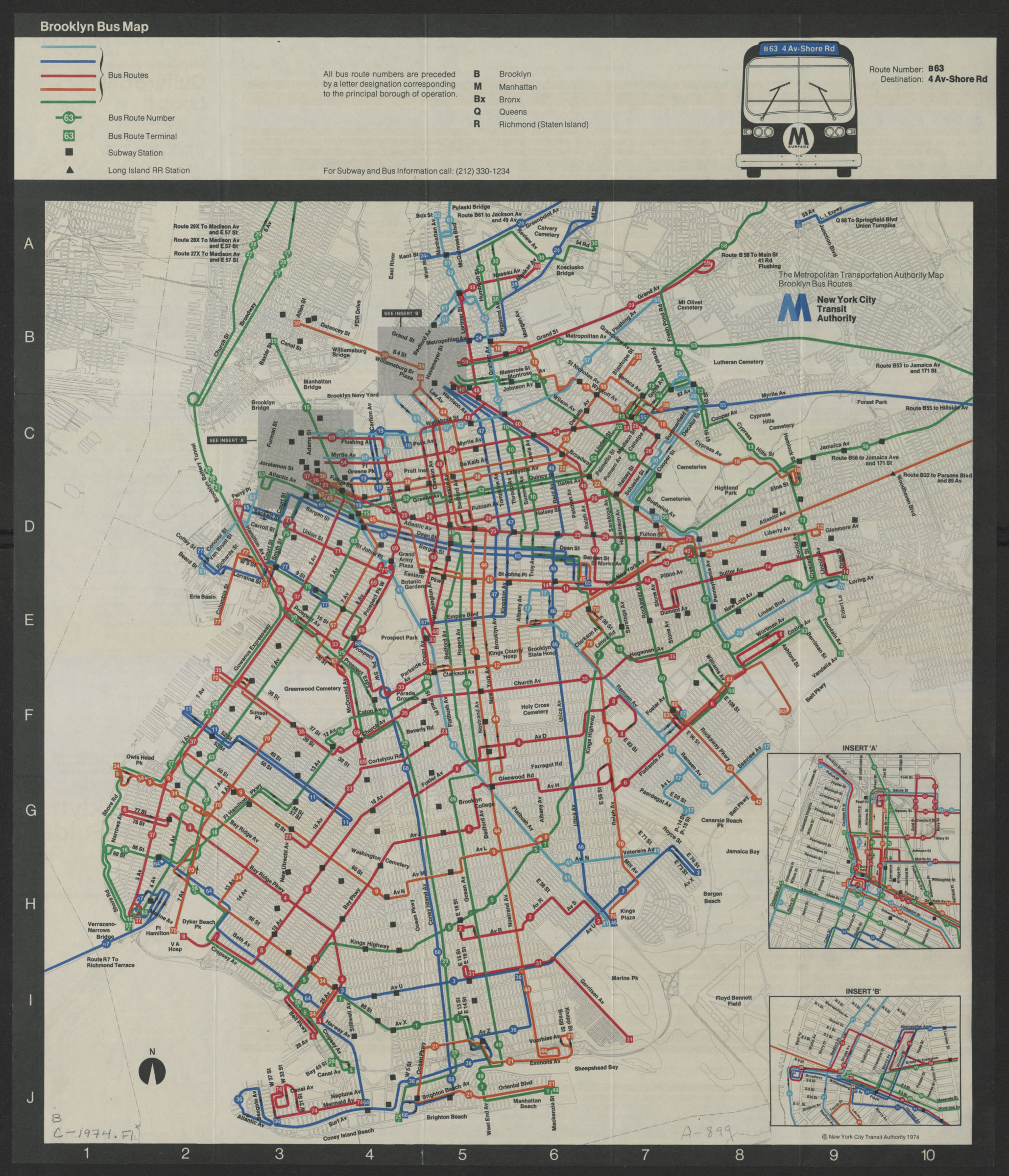
Brooklyn bus map [ca. 1974]
Map No. B C-1974.Fl
Also covers portions of Queens, Manhattan, and New Jersey. Shows bus route numbers and terminals, subway stations, and Long Island Rail Road stations. Keyed to index no index present. Includes keys, ill., explanation of bus numbers, and insets of Williamsburg and the downtown Brooklyn/Brooklyn Heights area. On verso: Route schedules, text, and ill.
Map area shown
Genre
Transportation mapsRelation
Full catalog recordSize
46 × 46 cmDownload
Low Resolution Image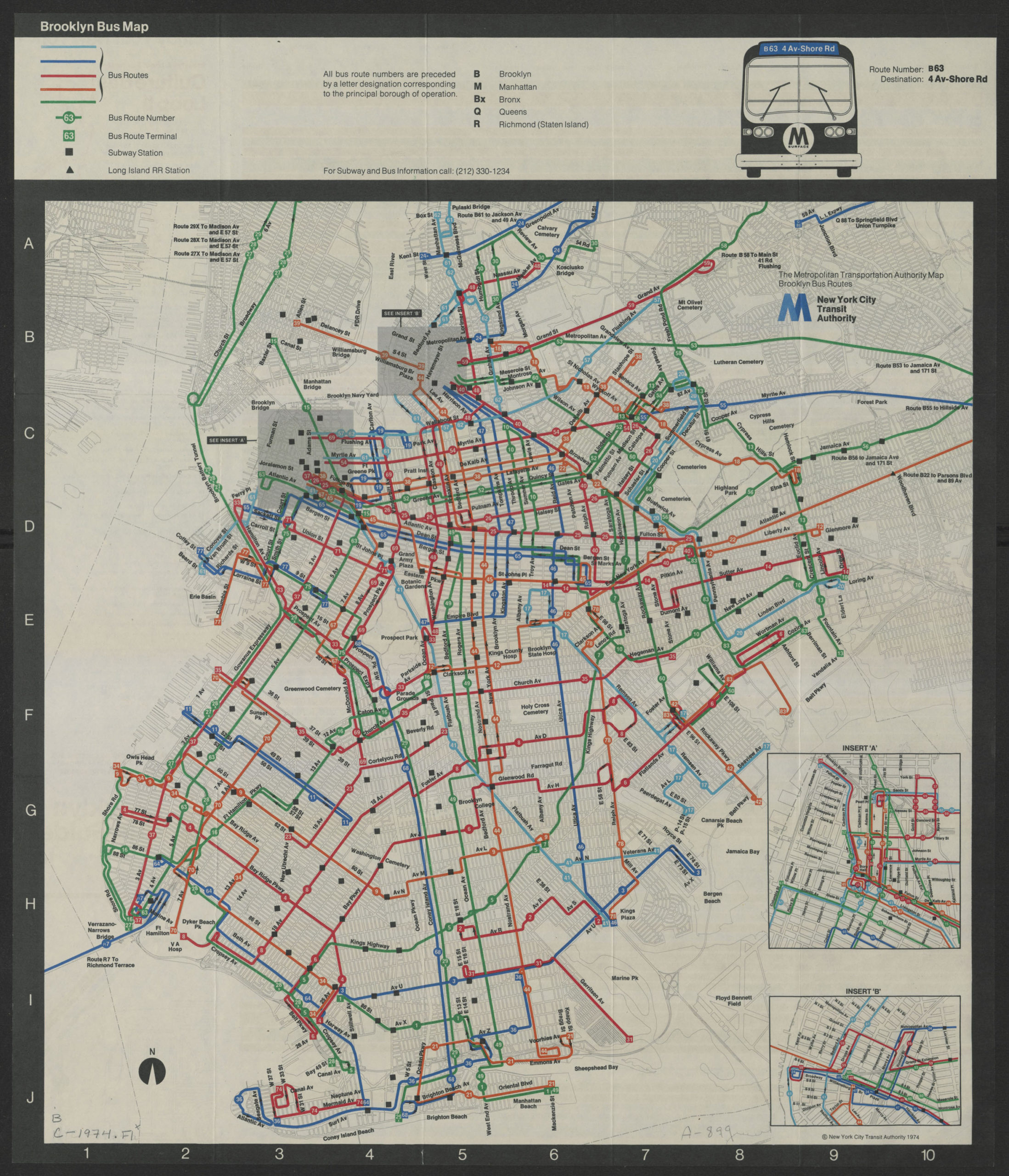
Creator
New York City Transit Authority,Publisher
Brooklyn Historical SocietyCitation
Brooklyn bus map; [ca. 1974], Map Collection, B C-1974.Fl; Brooklyn Historical Society.Scale
Scale not givenLoading zoom image... 