Brooklyn circumferential boulevard and parkway system [193?]
Map No. B C-[193-?]a.Fl
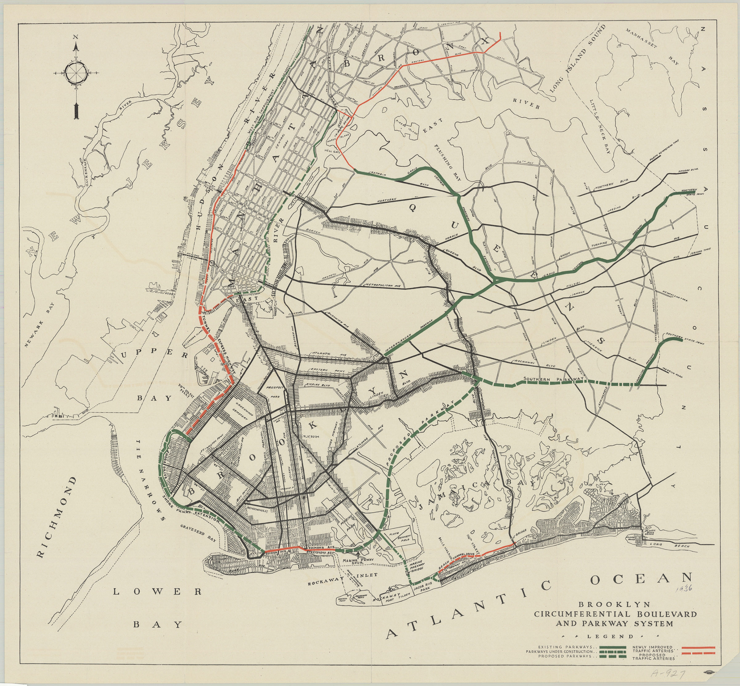
Road map also covering Manhattan and portions of Queens, the Bronx, Staten Island, Nassau County, New Jersey, and Staten Island. Shows existing parkways, proposed parkways, parkways under construction, newly improved traffic arteries, and proposed traffic arteries. “Allied Printing Trades Union Area Council New York”–Lower right margin. Includes key. BHS copy affixed to mat frame. BHS copy imperfect missing lower right corner.
Map area shown
Relation
Full catalog recordSize
46 × 50 cmDownload
Low Resolution Image
Creator
Publisher
Brooklyn Historical SocietyCitation
Brooklyn circumferential boulevard and parkway system; [193?], Map Collection, B C-[193-?]a.Fl; Brooklyn Historical Society.Scale
Scale not givenLoading zoom image... 