


[Brooklyn & Coney Island Plank Road surveys] [ca. 1850]
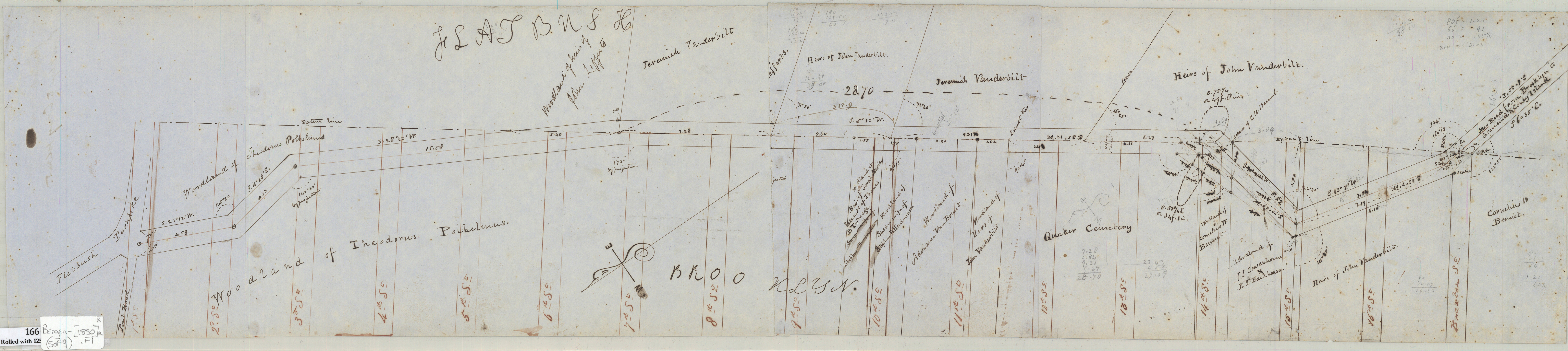
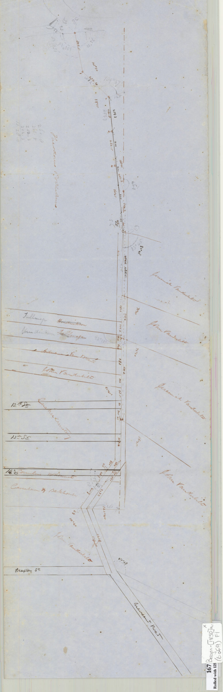
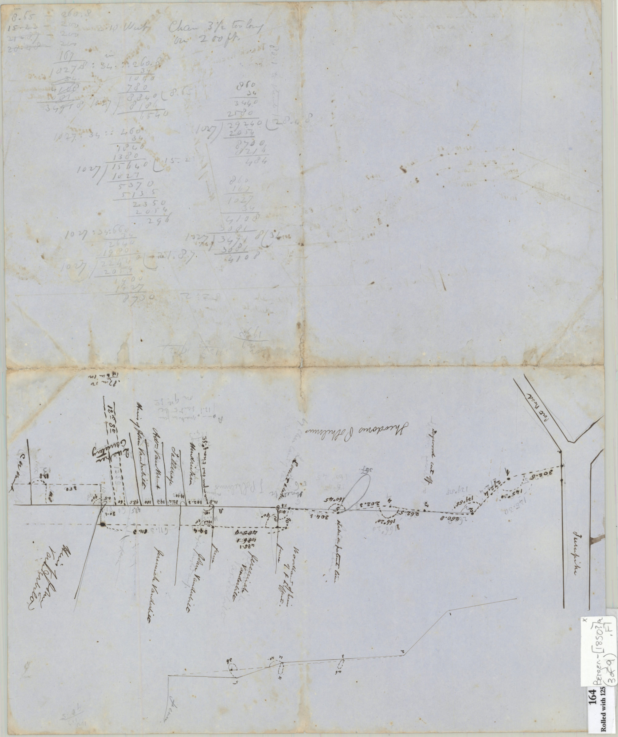
Cadastral survey maps and grade profiles of Coney Island Plank Road in modern-day Flatbush. Show measurements, property, and names of landowners. Cadastral survey map in modern-day Coney Island. Shows streets, property, names of landowners, creeks, salt meadows, duck hills, and sand hills. Grade profile map of 9th Street in modern-day Park Slope. Title devised by cataloger. Attributed to Teunis G. Bergen, based on handwriting. All maps on assembled sheets. Maps covering Brooklyn & Coney Island Plank Road (maps 1-7) oriented with north to the lower left. Profile map of 9th Street “as surveyed Oct. 1850, vertical scale 4ft. to the in., horizontal [scale] 2 ch. to the in., ground gone over but once & not with great care.” Map of part of Coney Island Plank Road on Coney Island has scale 2 chains to the in. Maps found rolled together in BHS archives and cataloged as a unit to preserve context. 1. Sketch of Brooklyn & Coney Island Plank Road on patent line between Brooklyn & Flatbush (165). 2. [Plan and profile of grade of Brooklyn & Coney Island Plank Road on patent line between Brooklyn & Flatbush] (163). 3. [Survey map and grade profile of eastern portion of Brooklyn & Coney Island Plank Road] (164 recto). 4. [Survey map of eastern portion of Brooklyn & Coney Island Plank Road] (164 verso). 5. Plank Road Brooklyn & Coney Island grant (166). 6. [Cadastral survey map of Plank Road Brooklyn & Coney Island Plank Road (167) – 7. [Plan and grade profile of the eastern portion of Brooklyn & Coney Island Plank Road] (168). 8. Map of part of Coney Island Plank Road on Coney Island (125). 9. Profile map of grade of 9th Street from 5th Avenue to Flatbush line (169) a Map 8 oversized and located in 4c.
Subjects
Places
Map area shown
Relation
Full catalog recordSize
20 × 169 cmDownload
Low Resolution Image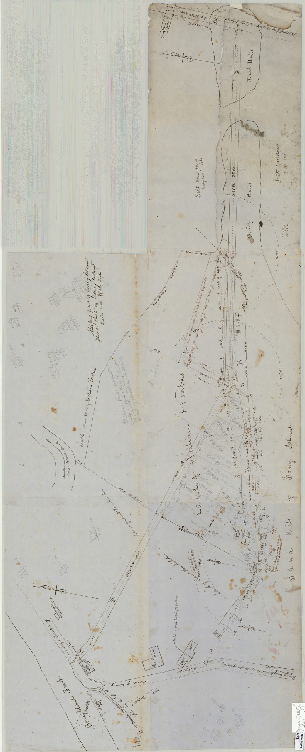
Creator
Bergen, Teunis G.,Publisher
Brooklyn Historical SocietyCitation
[Brooklyn & Coney Island Plank Road surveys]; [ca. 1850], Map Collection, Bergen-[1850?]a.Fl; Brooklyn Historical Society.Scale
Scales differ