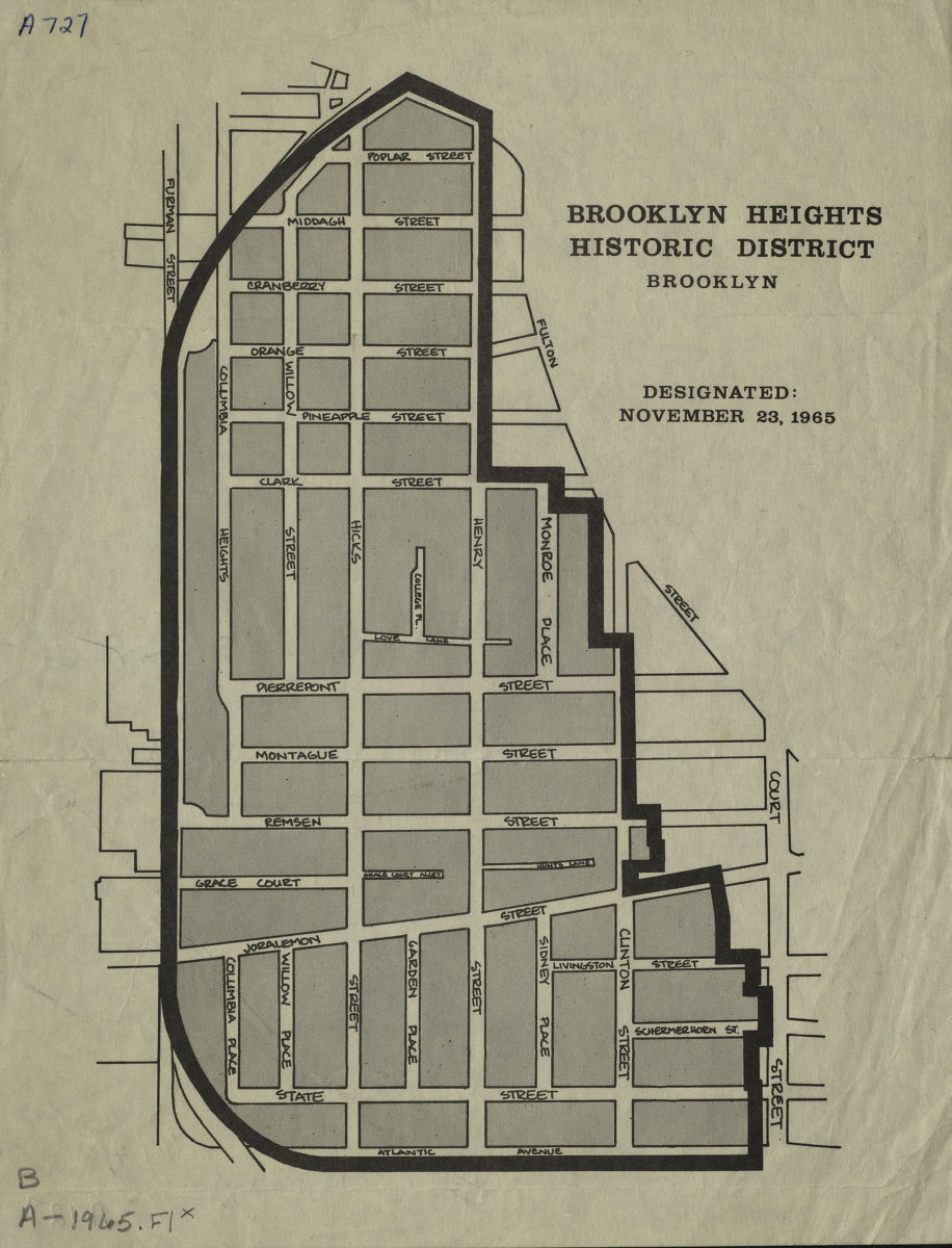
Brooklyn Heights historic district, Brooklyn: designated, November 23, 1965 [1965]
Map No. B A-1965.Fl
Shows outline of historic district and street names.
Map area shown
Genre
Zoning mapsRelation
Full catalog recordSize
28 × 22 cmDownload
Low Resolution Image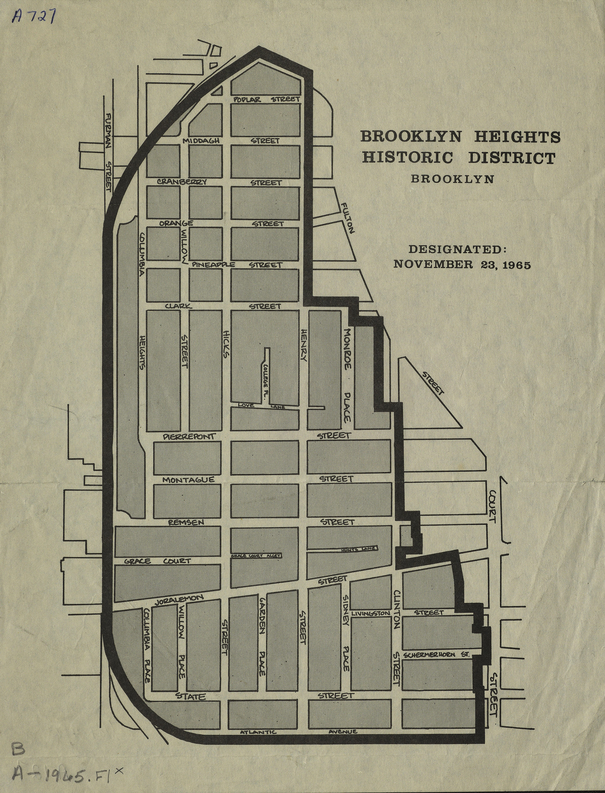
Creator
Publisher
Brooklyn Historical SocietyCitation
Brooklyn Heights historic district, Brooklyn: designated, November 23, 1965; [1965], Map Collection, B A-1965.Fl; Brooklyn Historical Society.Scale
Scale not givenLoading zoom image...