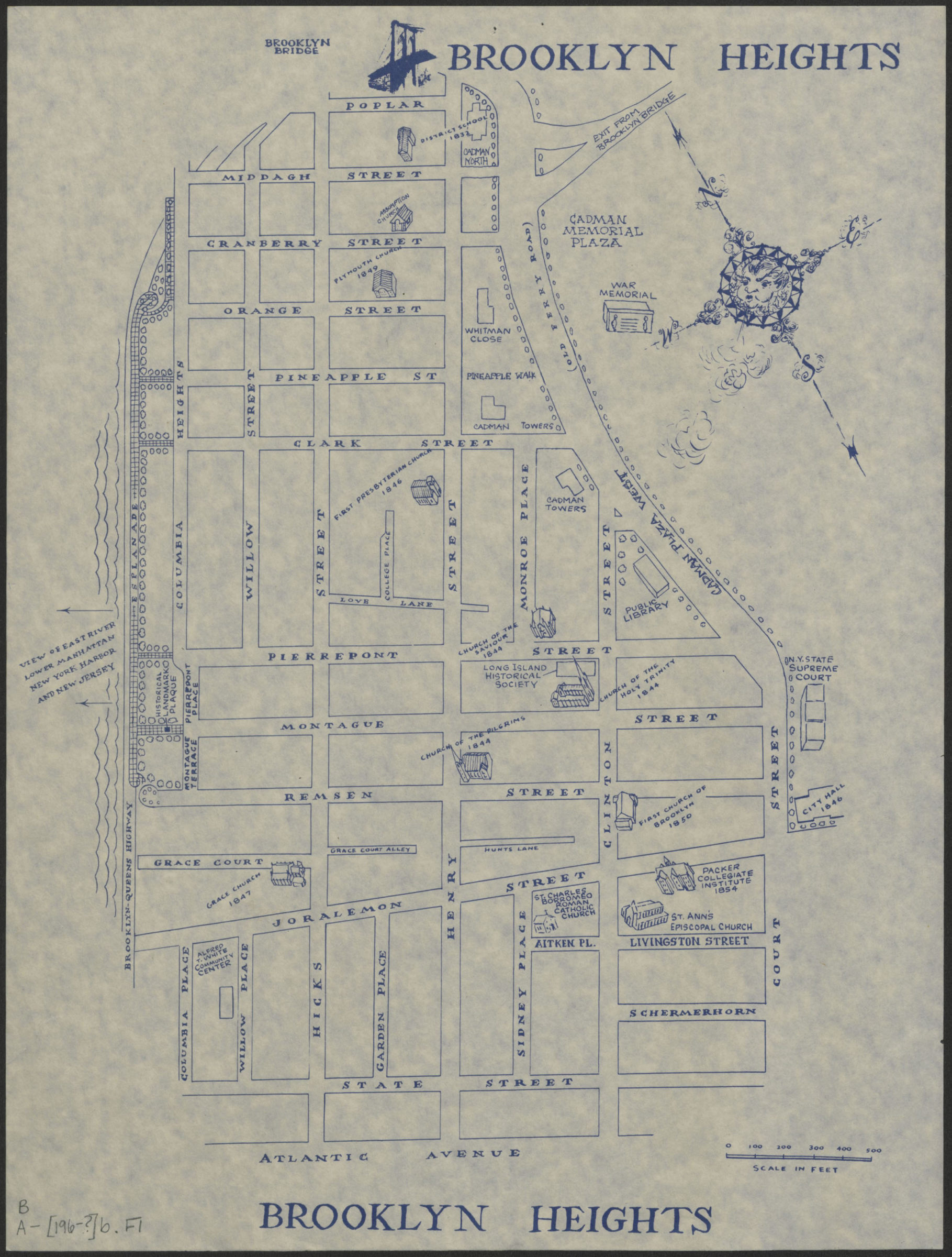
Brooklyn Heights [1969]
Map No. B A-[196-?]b.Fl
Shows street names, civic buildings, 19th century churches and school buildings. Oriented with north to the upper right.
Map area shown
Genre
Tourist mapsRelation
Full catalog recordSize
41 × 31 cmDownload
Low Resolution Image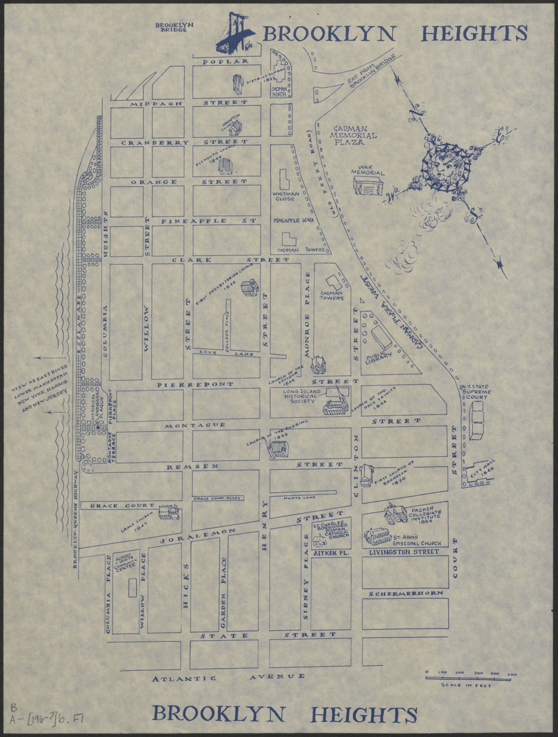
Creator
Publisher
Brooklyn Historical SocietyCitation
Brooklyn Heights; [1969], Map Collection, B A-[196-?]b.Fl; Brooklyn Historical Society.Scale
Scale approximately 1:320Loading zoom image... 