Brooklyn on tour: maps by Cadre Graphics ; graphic design by Keith Godard of Works [ca. 1984]
Map No. B A-1984.Fl;B A-1984.Fl c.2
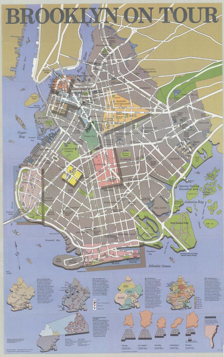
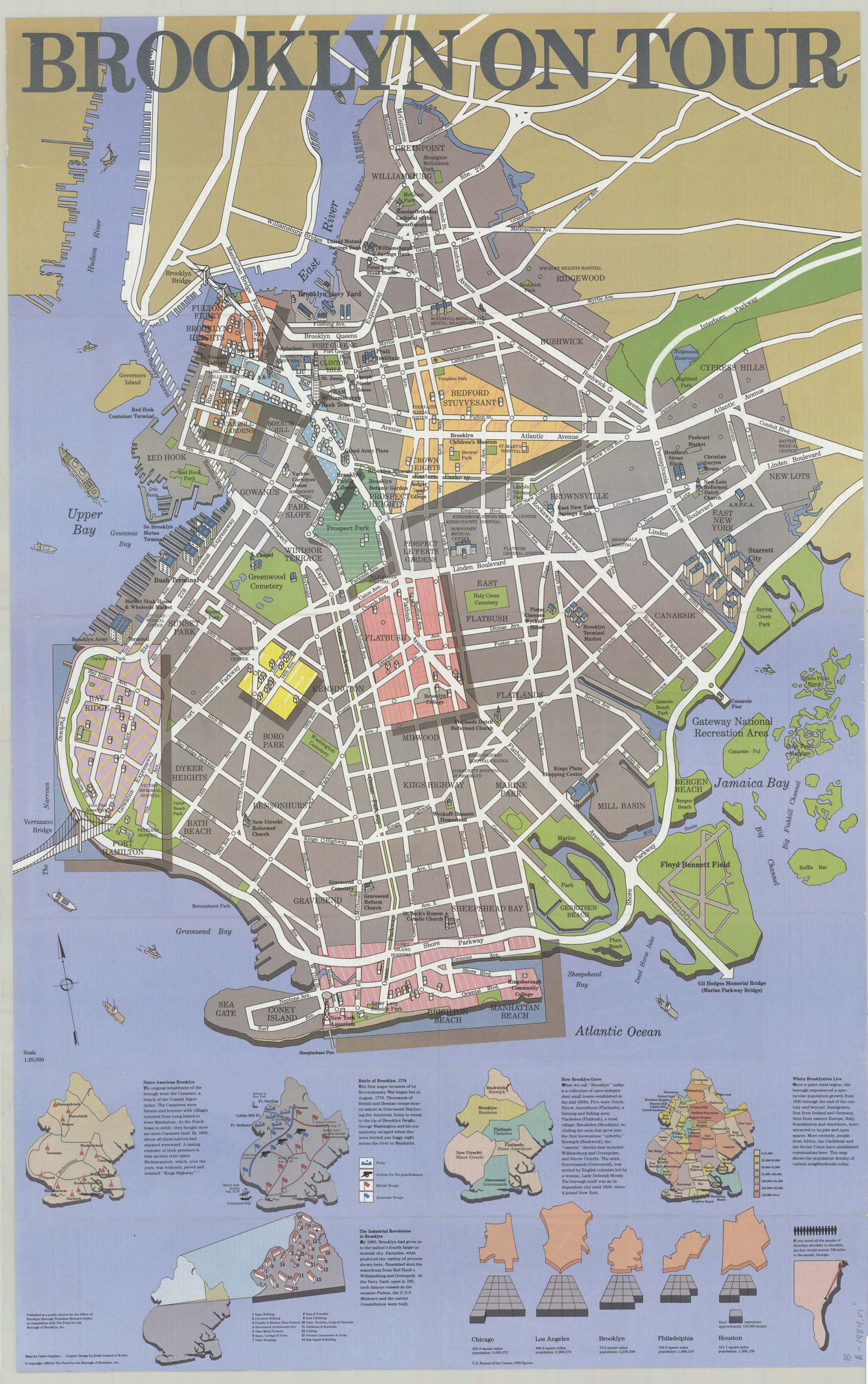
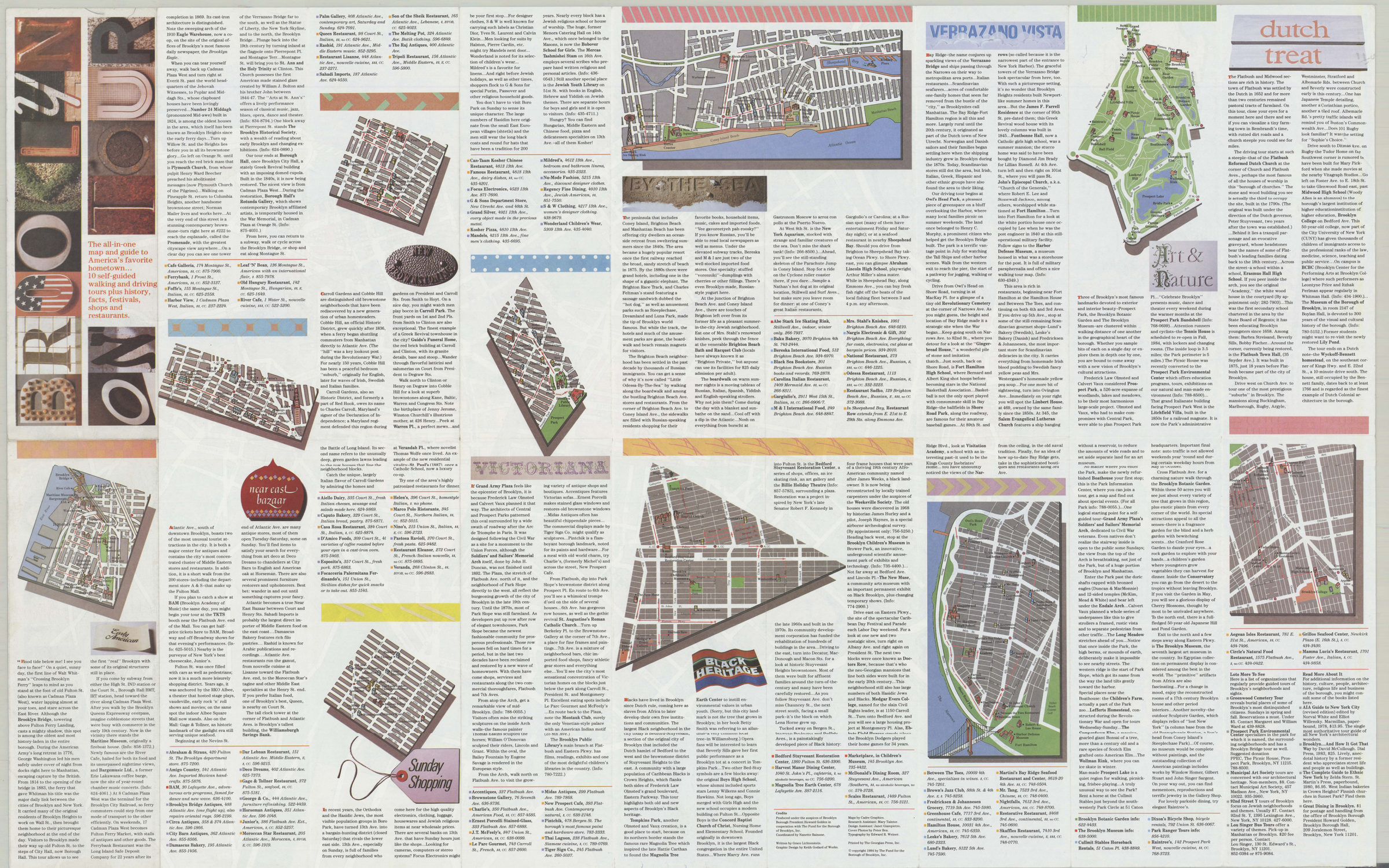
Shows major streets and neighborhoods. Relief shown pictorially. Includes 5 ancillary maps with text comparative area maps and population graphs for Brooklyn, Chicago, Los Angeles, Philadelphia, and Houston and outline map of southeastern U.S. with note. Ancillary maps: Native American Brooklyn — Battle of Brooklyn, 1776 — How Brooklyn grew — Where Brooklynites live — The Industrial Revolution in Brooklyn. On verso: Maps, text, and directories for 10 walking tours. BHS copy 2 originally part of the collection of Everett and Evelyn Ortner papers and photographs (ARC.306).
Map area shown
Relation
Full catalog recordSize
92 × 58 cmDownload
Low Resolution Image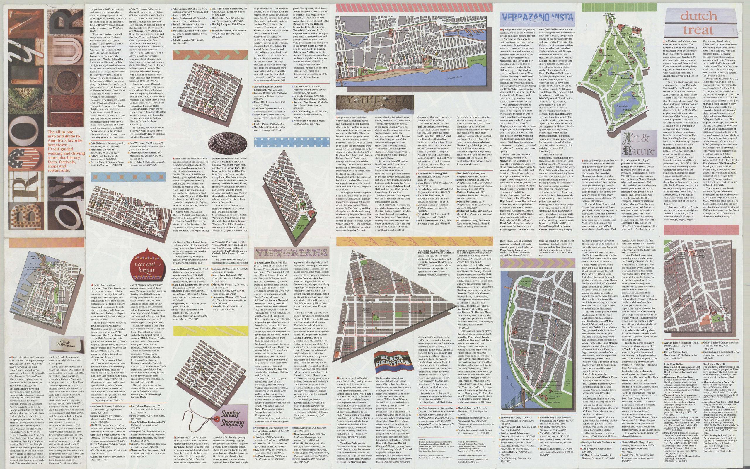
Creator
Cadre Graphics (Firm),Publisher
Brooklyn Historical SocietyCitation
Brooklyn on tour: maps by Cadre Graphics ; graphic design by Keith Godard of Works; [ca. 1984], Map Collection, B A-1984.Fl;B A-1984.Fl c.2; Brooklyn Historical Society.Scale
Scale 1:20,000Loading zoom image...