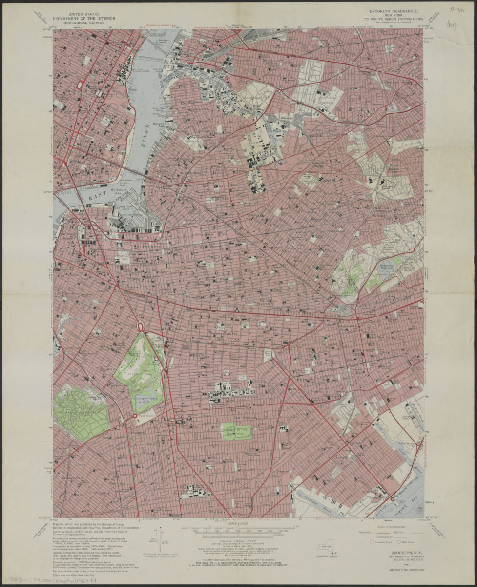
Brooklyn quadrangle, New York 1967
Map No. USGS-1:24,000 (Brooklyn)1967.Fl
Shows portions of Brooklyn, Manhattan, and Queens. “Planimetry by photogrammetric methods from aerial photographs taken 1954, and from USC & GS, Charts … Topography by planetable surveys 1955-1956. Revised from aerial photographs taken 1966. Field checked 1967.” Relief shown by contours and spot heights. Depths shown by isolines and soundings. Includes legend and quadrangle location map. “Entire area lies within New York City.” “NW/4 Brooklyn 15′ quadrangle.” “AMS 6265 III NW–Series V821.”
Map area shown
Relation
Full catalog recordSize
77 × 61 cmDownload
Low Resolution Image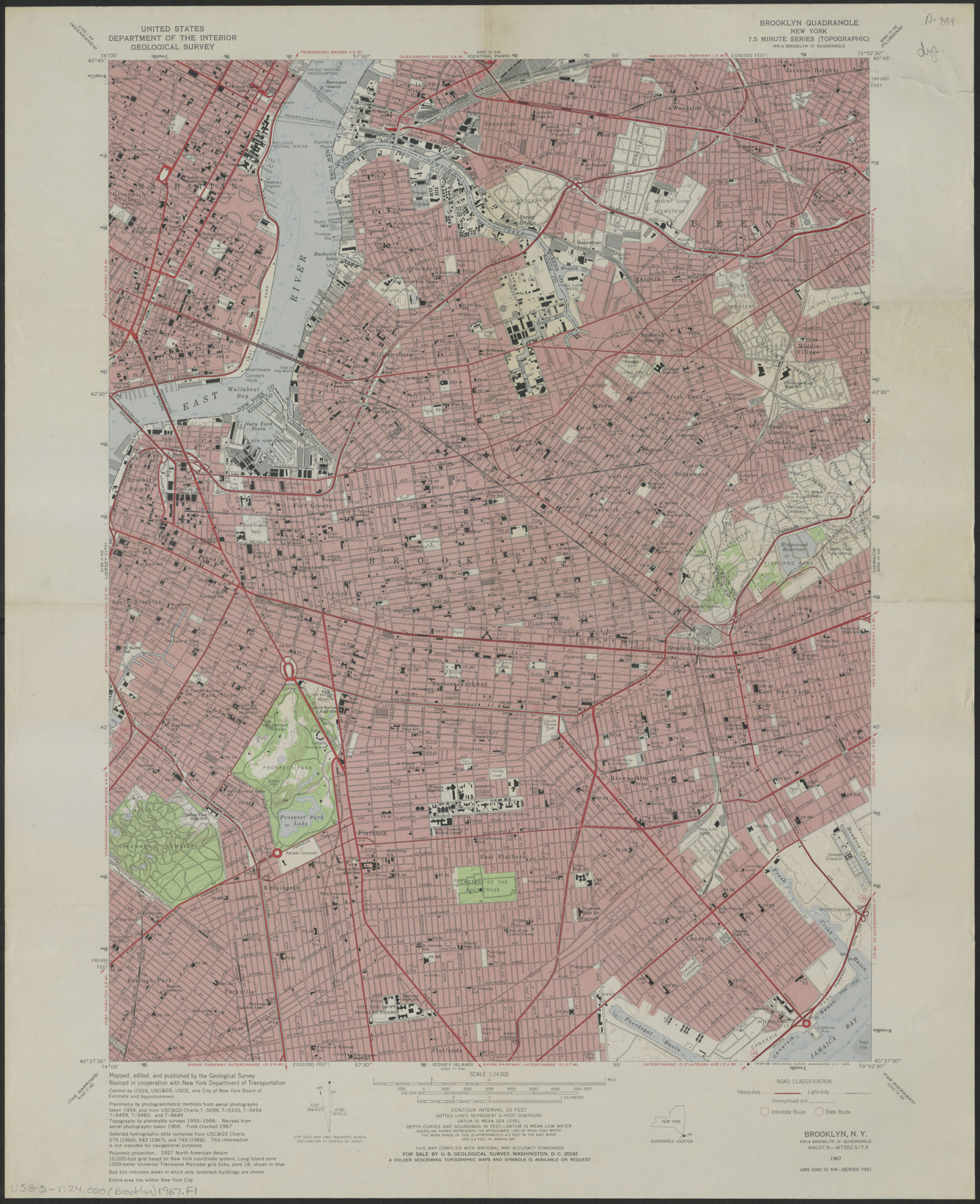
Creator
New York (State); Department of Public Works.; Bureau of Programming,Publisher
Brooklyn Historical SocietyCitation
Brooklyn quadrangle, New York; 1967, Map Collection, USGS-1:24,000 (Brooklyn)1967.Fl; Brooklyn Historical Society.Scale
Scale 1:24,000Loading zoom image...