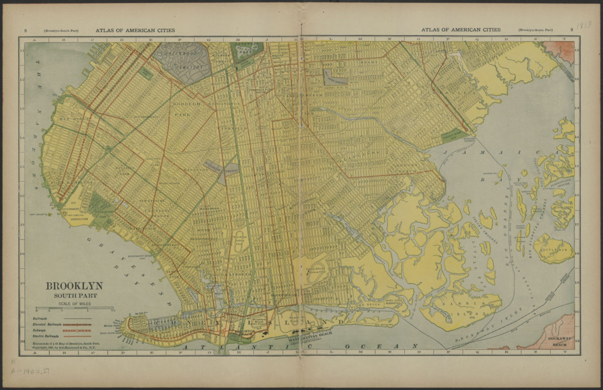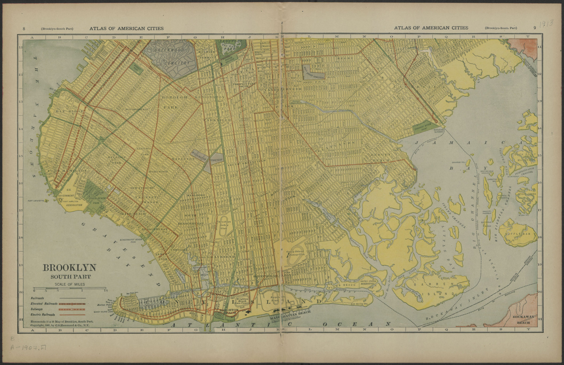

Brooklyn, south part [1907]
Map No. B A-1907.Fl
Shows streets, railroads, elevated railroads, subways, and electric railroads. Detached from Atlas of New York City and suburbs, 1908? On verso: half of Brooklyn, North part showing Bushwick, East New York and Brownsville, and section of the East River and Flushing Bay showing parts of Williamsburg, eastern Queens, the upper East Side of Manhattan and a portion of the Bronx.
Map area shown
Genre
MapRelation
Full catalog recordSize
28 × 39 cmDownload
Low Resolution Image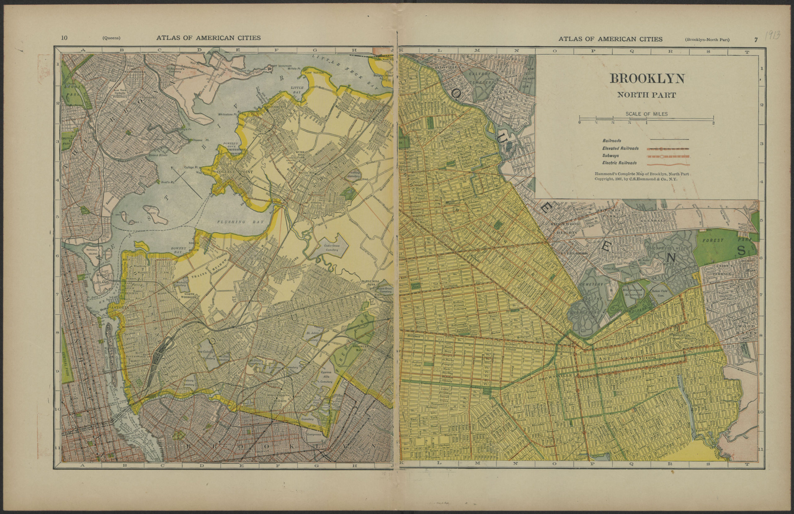
Creator
Publisher
Brooklyn Historical SocietyCitation
Brooklyn, south part; [1907], Map Collection, B A-1907.Fl; Brooklyn Historical Society.Scale
Scale approximately 1:35,Loading zoom image...