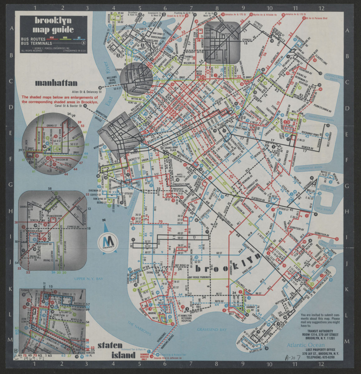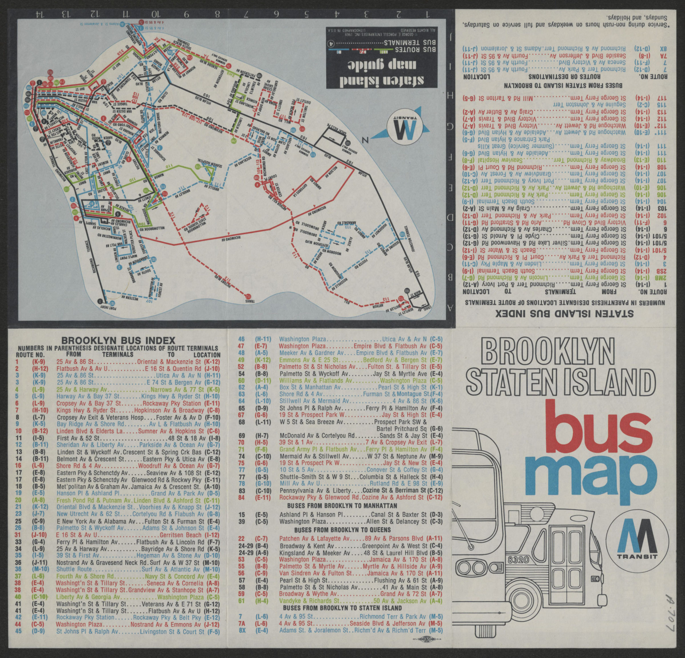
Brooklyn Staten Island bus map: M Transit [ca. 1969]
Map No. B C-1969.Fl
Also covers portions of lower Manhattan and Queens. Shows bus routes and terminals. Panel title. Includes keys, text, ill., indexes, and 3 insets of areas of Brooklyn. Brooklyn map guide. Staten Island map guide. BHS has 2 copies.
Map area shown
Genre
Transportation mapsRelation
Full catalog recordSize
31 × 32 cmDownload
Low Resolution Image
Creator
New York City Transit Authority,Publisher
Brooklyn Historical SocietyCitation
Brooklyn Staten Island bus map: M Transit; [ca. 1969], Map Collection, B C-1969.Fl; Brooklyn Historical Society.Scale
Scale not givenLoading zoom image...