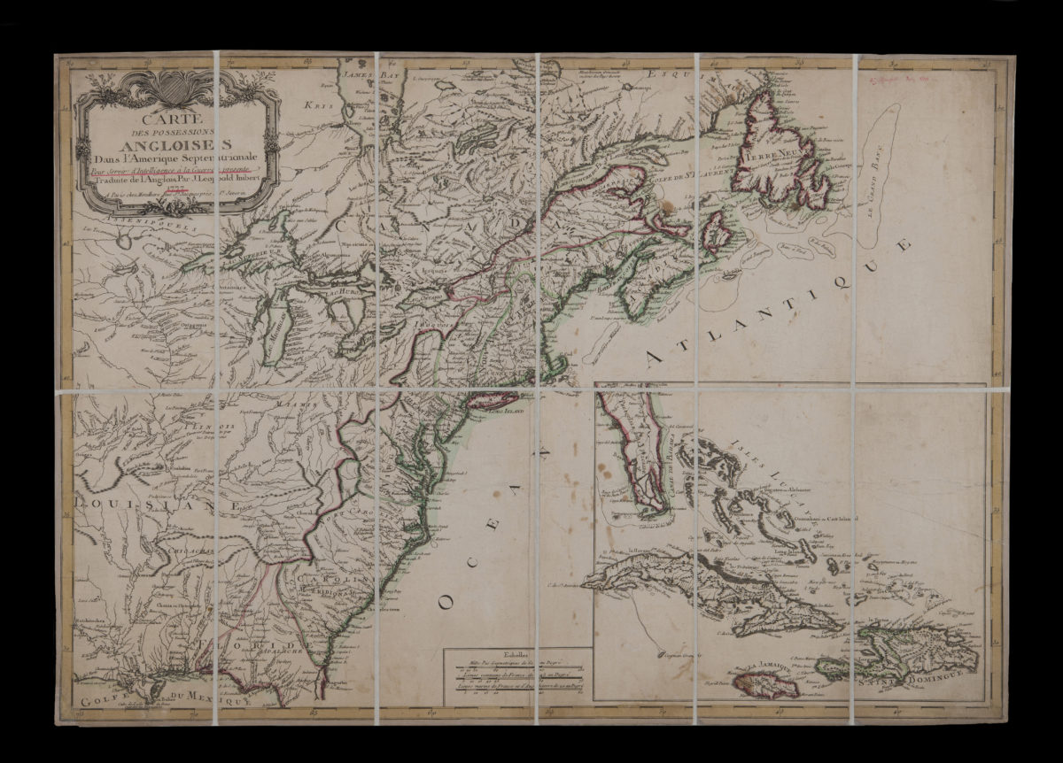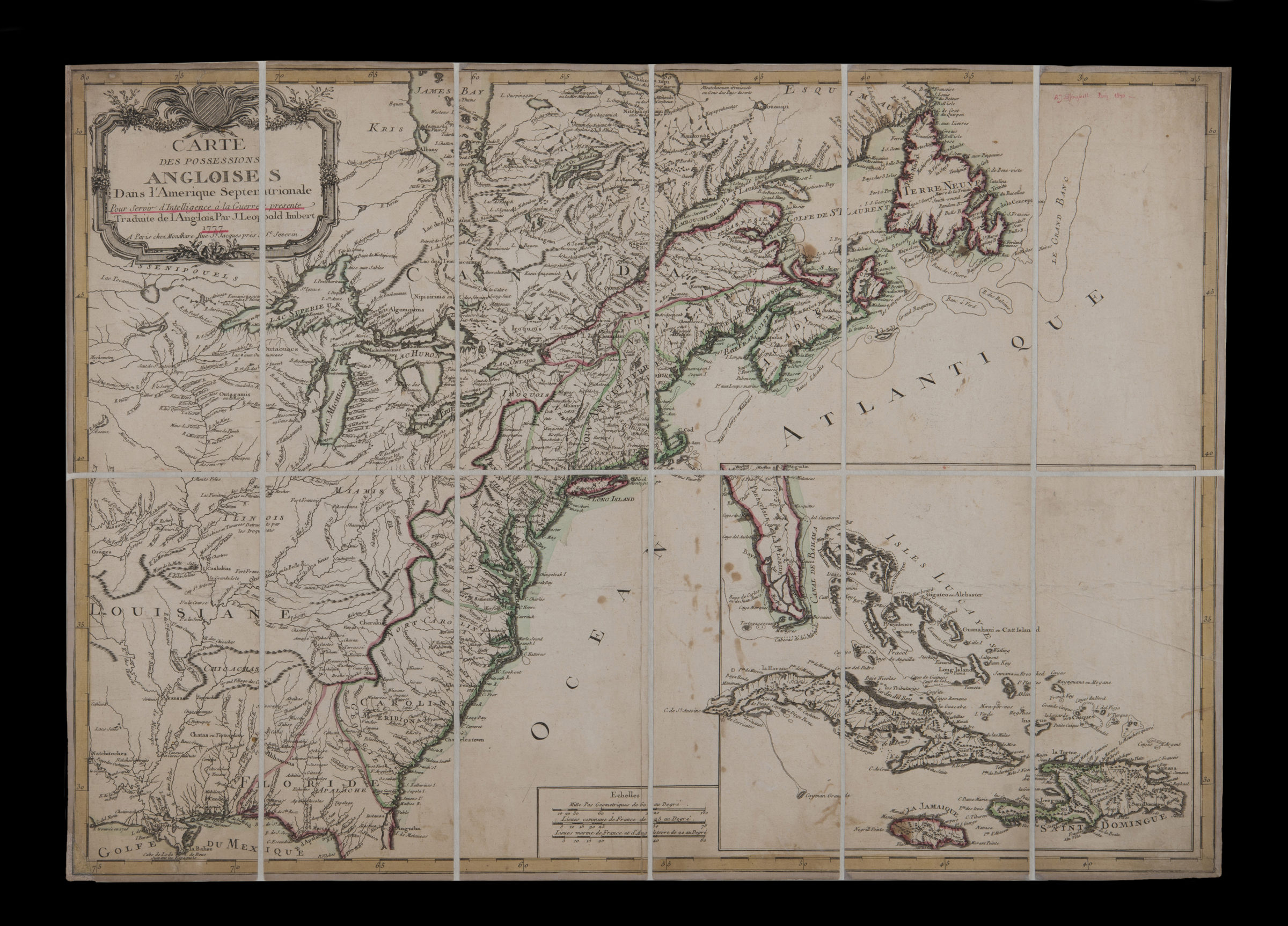
Carte des possessions angloises dans l’Amerique Septentrionale, pour servir d’intelligence à la guerre presente: traduite de l’Anglois: par J. Leopold Imbert 1777
Map No. US-1777.Fl.RA
Relief shown pictorially. Includes decorative cartouche and inset of Isles Lucayes, Cuba, la Jamaique, and Saint Dominigue.
Places
Map area shown
Genre
Early mapsRelation
Full catalog recordSize
54 × 74 cmDownload
Low Resolution Image
Creator
Imbert, J. Leopold,Publisher
Brooklyn Historical SocietyCitation
Carte des possessions angloises dans l’Amerique Septentrionale, pour servir d’intelligence à la guerre presente: traduite de l’Anglois: par J. Leopold Imbert; 1777, Map Collection, US-1777.Fl.RA; Brooklyn Historical Society.Scale
Scale [ca. 1:3,500,000]Loading zoom image...