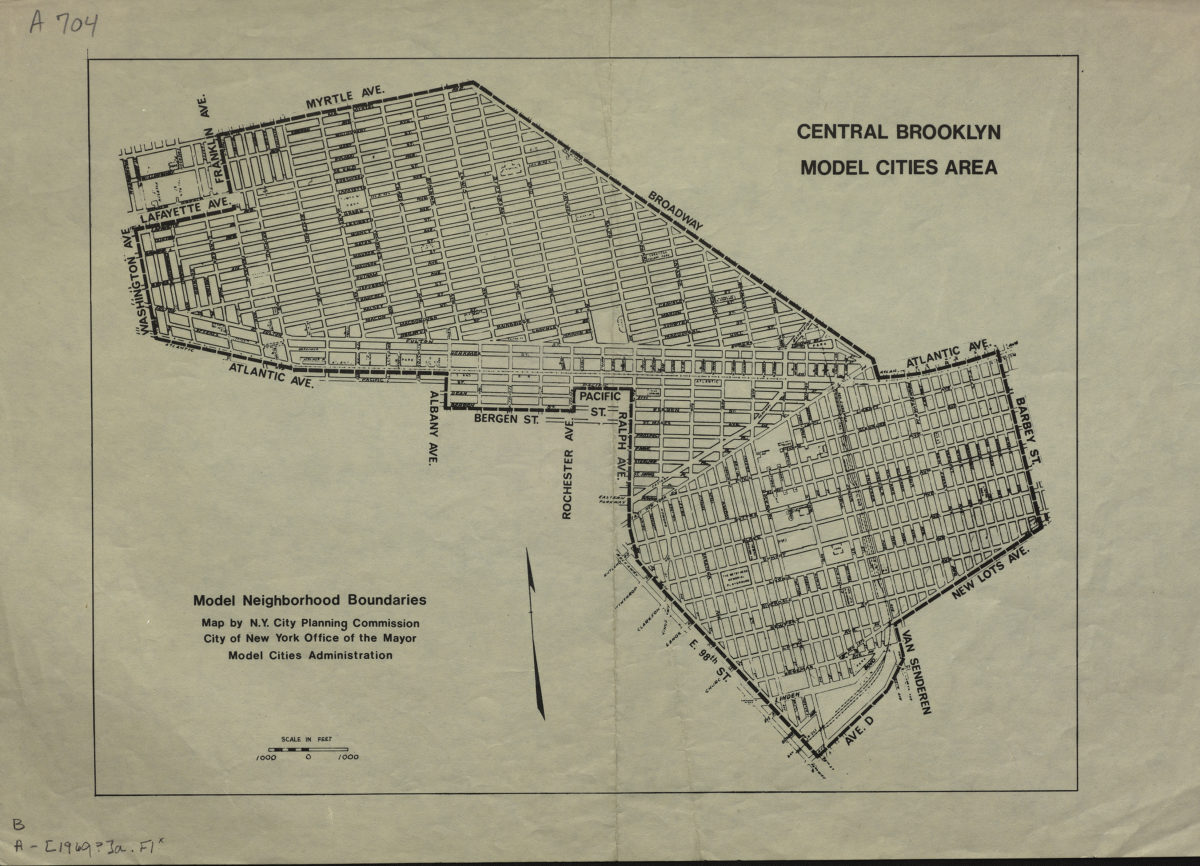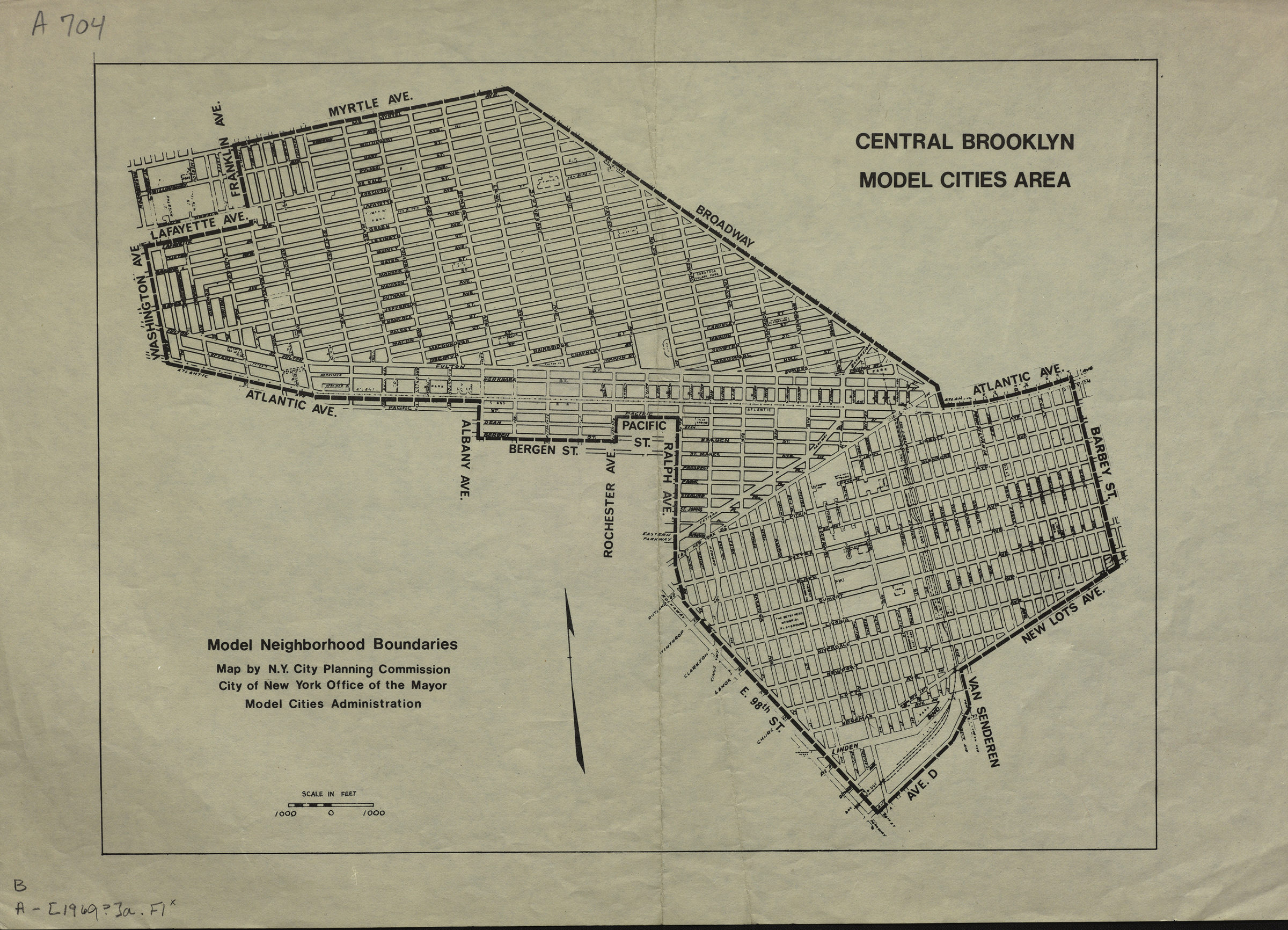
Central Brooklyn model cities area: model neighborhood boundaries: map by N.Y. City Planning Commission, City of New York Office of the Mayor Model Cities Administration 1969
Map No. B A-1969a.Fl
The Central Brooklyn model cities area encompassed the Bedford-Stuyvesant and Brownsville neighborhoods.
Subjects
Places
Map area shown
Genre
Thematic mapsRelation
Full catalog recordSize
32 × 46 cmDownload
Low Resolution Image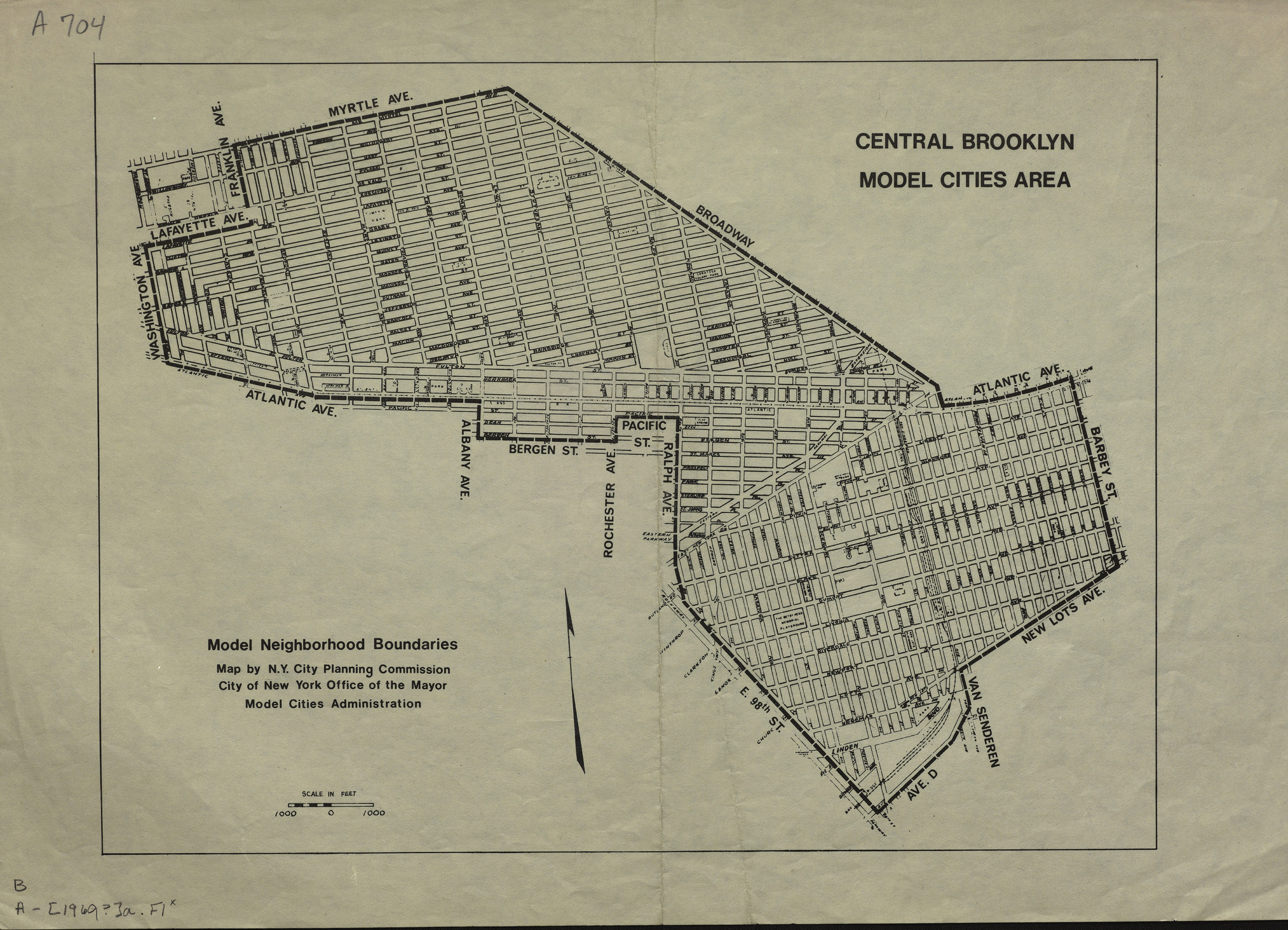
Creator
New York (N.Y.).; City Planning Commission,Publisher
Brooklyn Historical SocietyCitation
Central Brooklyn model cities area: model neighborhood boundaries: map by N.Y. City Planning Commission, City of New York Office of the Mayor Model Cities Administration; 1969, Map Collection, B A-1969a.Fl; Brooklyn Historical Society.Scale
Scale approximately 1:960Loading zoom image...