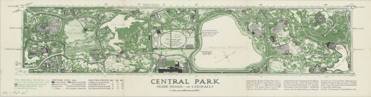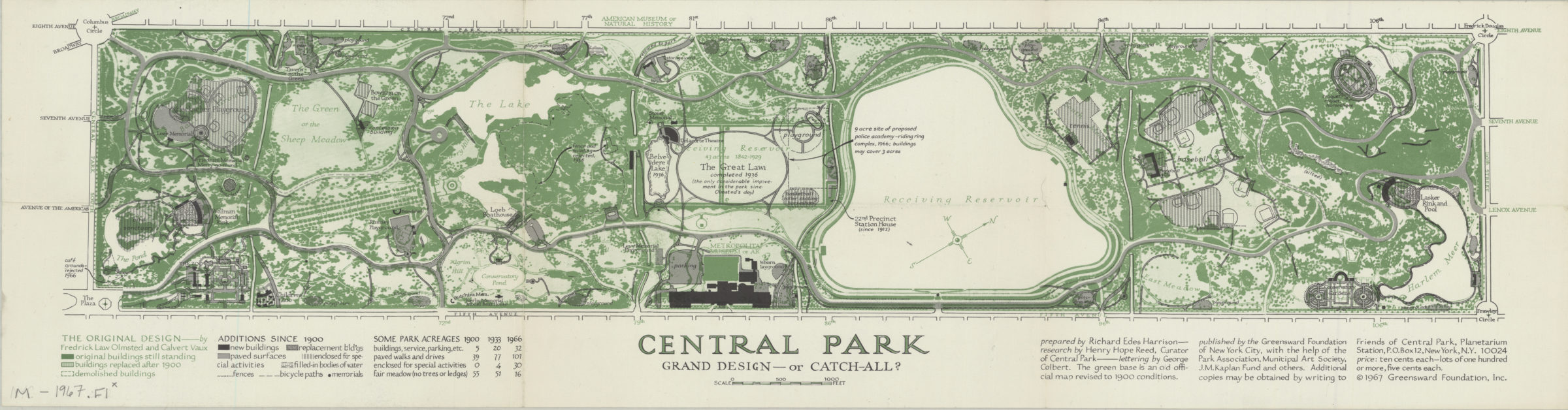
Central Park, grand design–or catch-all?: prepared by Richard Edes Harrison ; research by Henry Hope Reed, curator of Central Park ; lettering by George Colbert [ca. 1967]
Map No. M-1967.Fl;M-1967.Fl c.2
Shows original buildings still standing, replaced, and demolished and additions since 1900: new buildings, paved surfaces, areas enclosed for special activities, filled-in bodies of water, fences, bicycle paths, and memorials. Oriented with north toward the upper right. “The green base is an old official map revised to 1900 conditions.” “Published by the Greensward Foundation of New York City, with the help of the Park Association, Municipal Art Society, J.M. Kaplan Fund, and others.” Includes table of “Some park acreages”, key, and text.
Map area shown
Genre
Historical mapsRelation
Full catalog recordSize
21 × 69 cmDownload
Low Resolution Image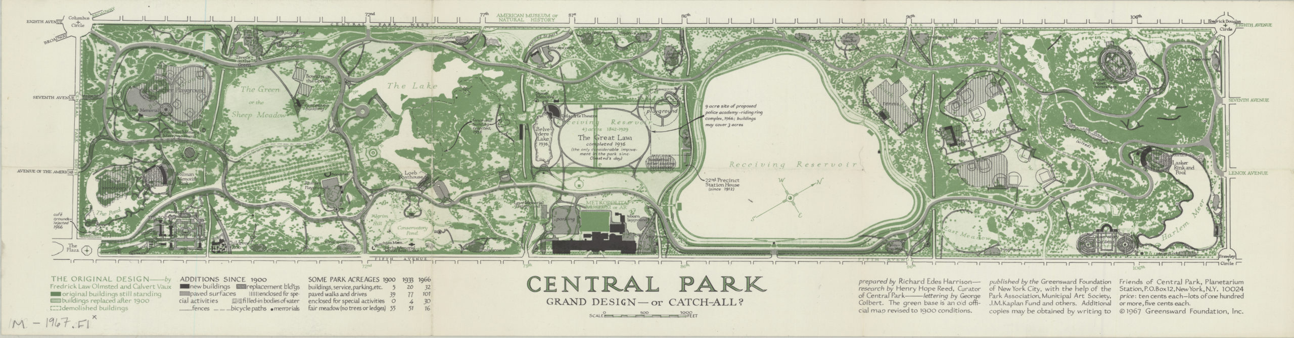
Creator
Harrison, Richard Edes,Publisher
Brooklyn Historical SocietyCitation
Central Park, grand design–or catch-all?: prepared by Richard Edes Harrison ; research by Henry Hope Reed, curator of Central Park ; lettering by George Colbert; [ca. 1967], Map Collection, M-1967.Fl;M-1967.Fl c.2; Brooklyn Historical Society.Scale
Scale [ca. 1:6,800]Loading zoom image...