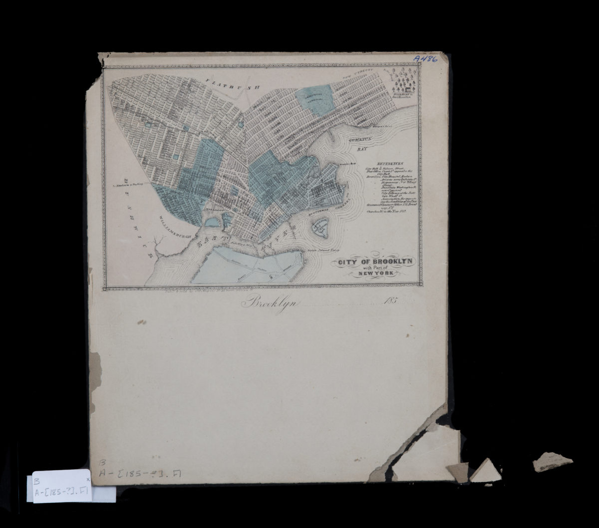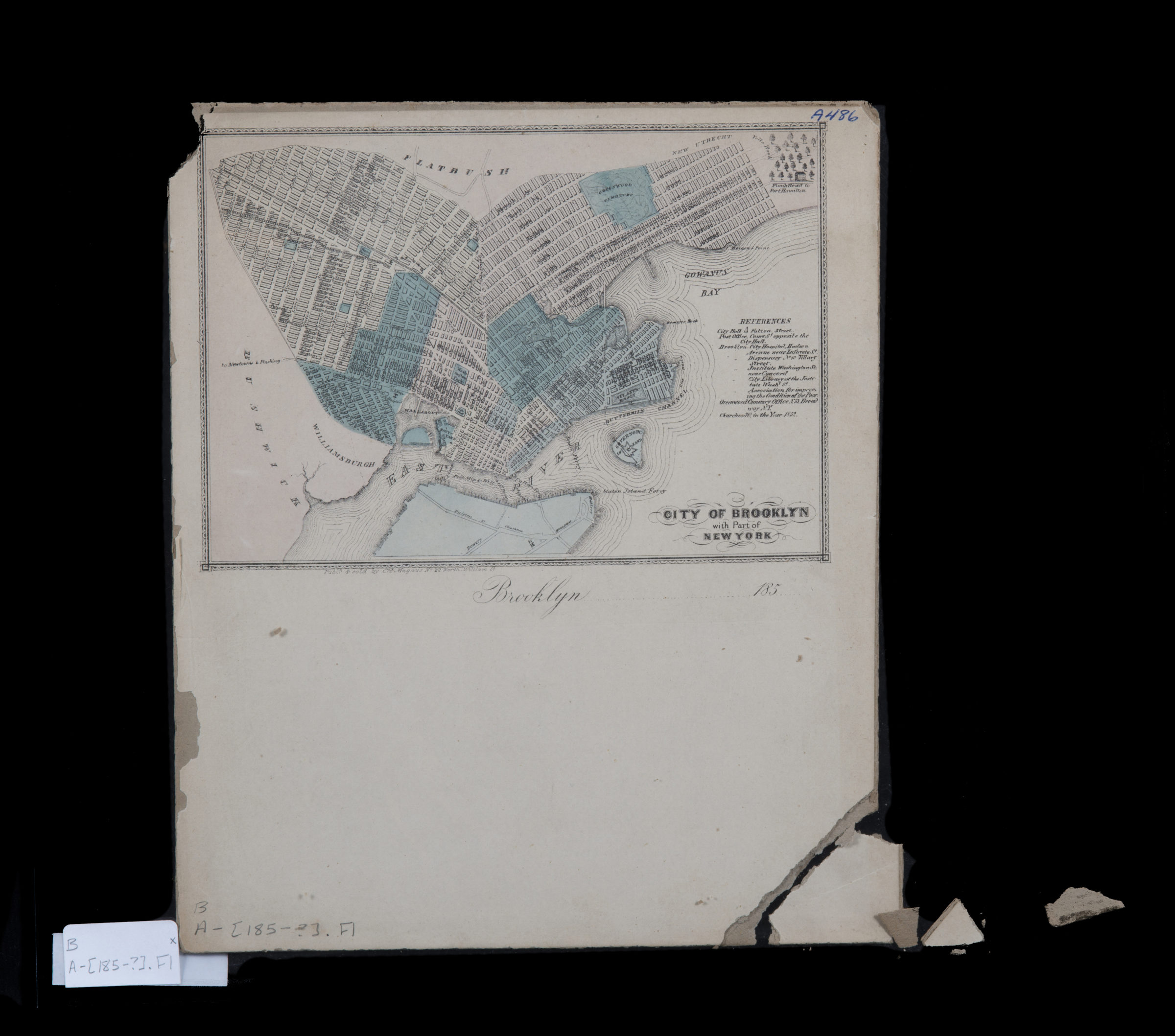
City of Brooklyn with part of New York [185?]
Map No. B A-[185-?].Fl
Covers Brooklyn north from 59th St. to the border with Williamsburg and east to Greenwood Cemetery. Shows public buildings, ferry lines, and churches. Oriented with north to the lower left. Date of publication conjectured from note in lower margin. “Brooklyn…185…”–Lower margin. Includes index and decorative border.
Map area shown
Genre
MapRelation
Full catalog recordSize
26 × 22 cmDownload
Low Resolution Image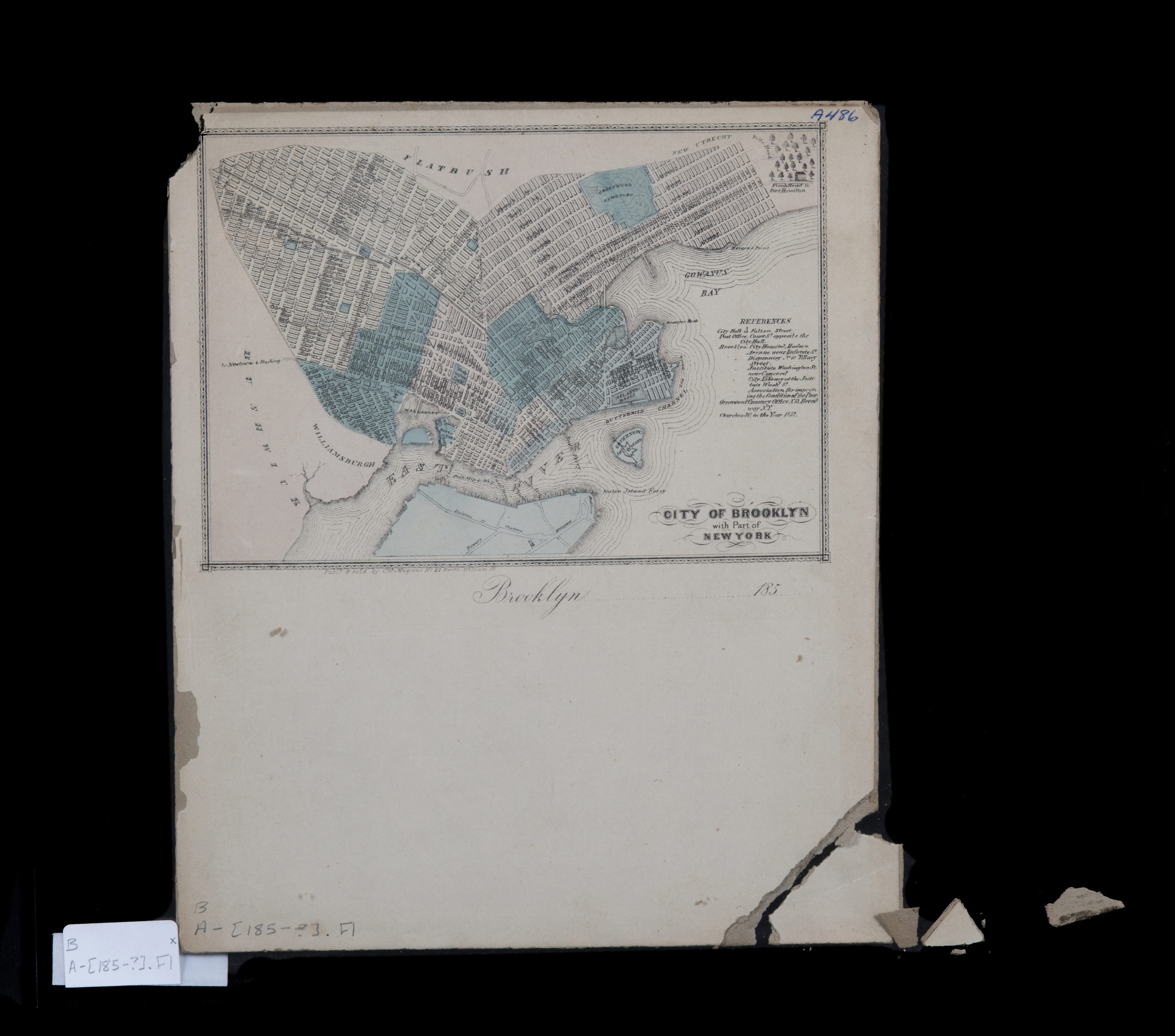
Creator
Magnus, Charles,Publisher
Brooklyn Historical SocietyCitation
City of Brooklyn with part of New York; [185?], Map Collection, B A-[185-?].Fl; Brooklyn Historical Society.Scale
Scale not givenLoading zoom image...