City of New-York [185?]
Map No. NYC-[185-?]a.Fl
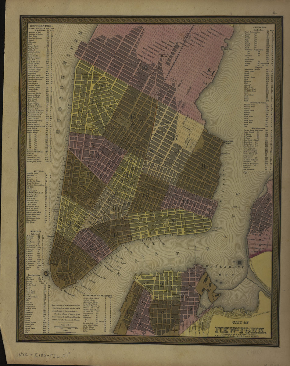
Covers Manhattan north to approximately 39th St. also covers Brooklyn Heights and a portion of Williamsburg. Shows wards, docks, and slips. Extracted from unknown atlas. Includes decorative border, note, and indexes to public buildings, squares, markets, hotels, and churches. “11.”–Upper right margin.
Map area shown
Genre
MapRelation
Full catalog recordSize
38 × 30 cmDownload
Low Resolution Image
Creator
Mitchell, S. Augustus,Publisher
Brooklyn Historical SocietyCitation
City of New-York; [185?], Map Collection, NYC-[185-?]a.Fl; Brooklyn Historical Society.Scale
Scale [ca. 1:57,929]Loading zoom image...