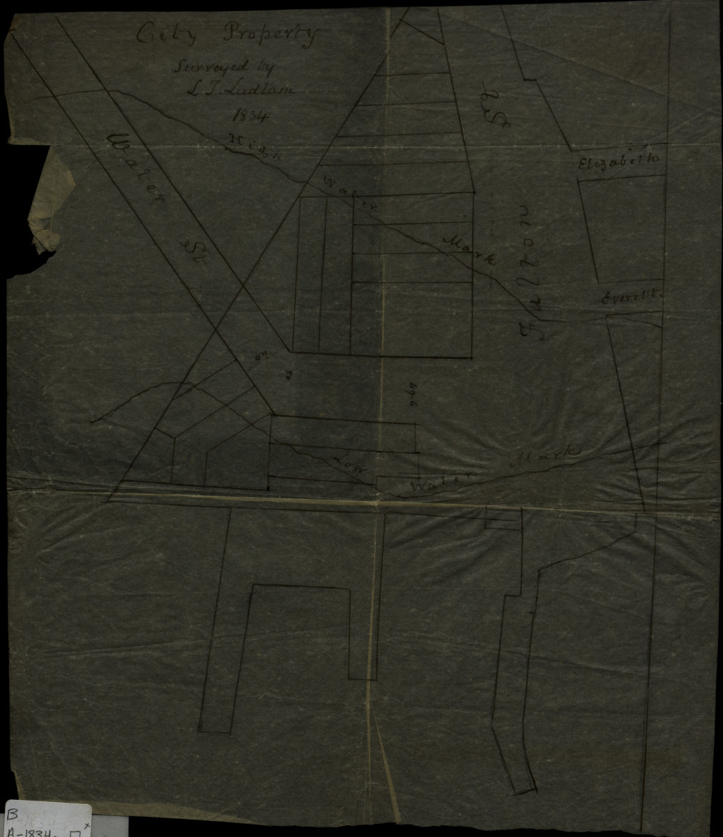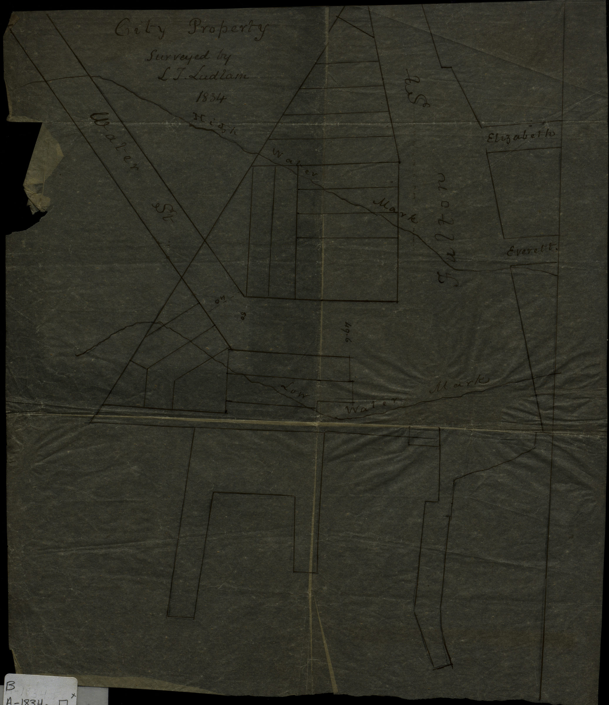
City property: surveyed by I.T. Ludlam 1834
Map No. B A-1834a.Fl
Covers the intersection of Fulton St. and Water St. (modern-day Fulton Ferry). Also shows piers and high/low water marks. Oriented with north to the left.
Map area shown
Genre
Manuscript mapsRelation
Full catalog recordSize
33 × 29 cmDownload
Low Resolution Image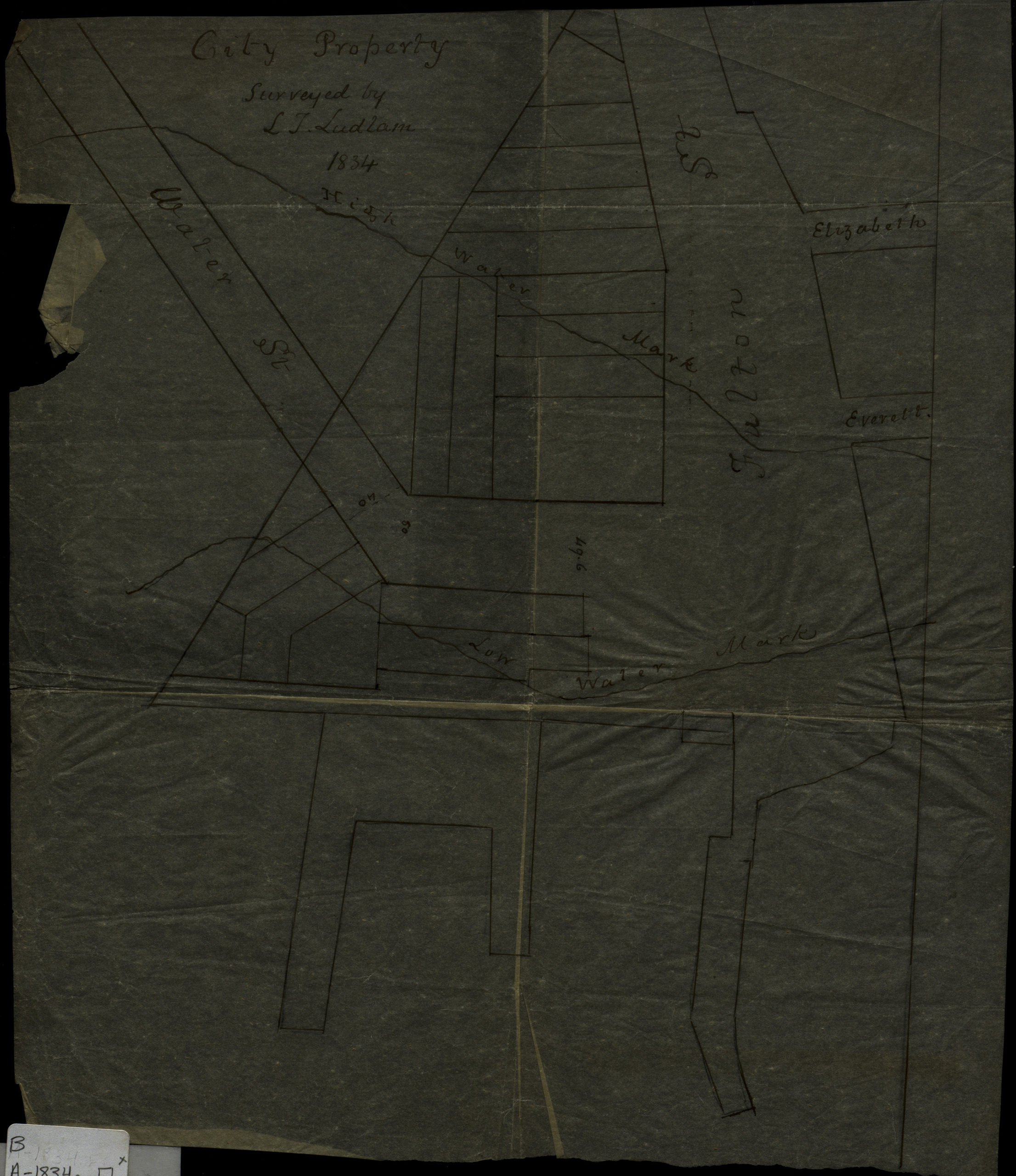
Creator
Ludlam, Isaac T.,Publisher
Brooklyn Historical SocietyCitation
City property: surveyed by I.T. Ludlam; 1834, Map Collection, B A-1834a.Fl; Brooklyn Historical Society.Scale
Scale not givenLoading zoom image...