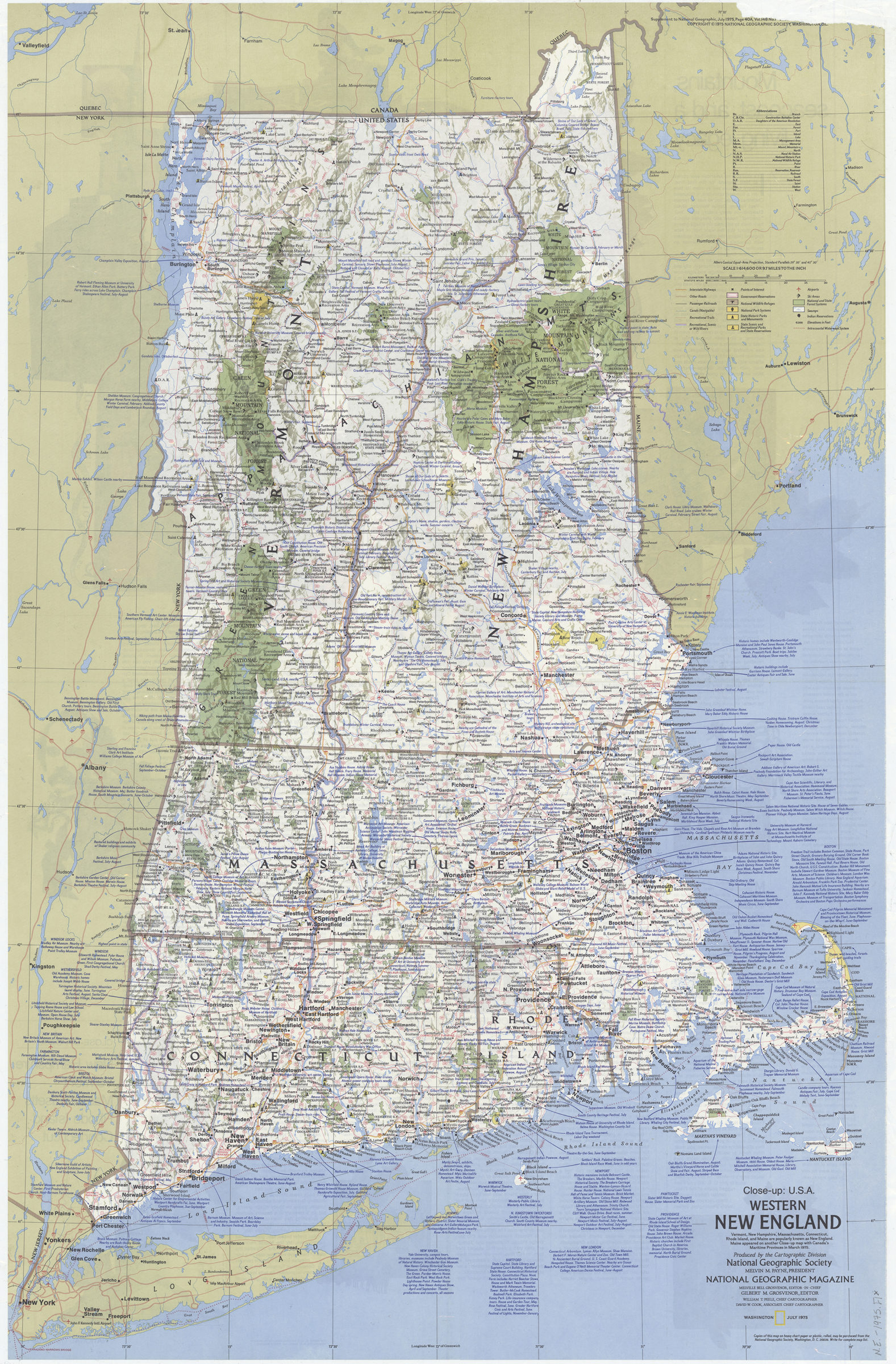
Close up: U.S.A., western New England: Produced by the Cartographic Division, National Geographic Society. William T. Peele, chief cartographer. David W. Cook, associate chief cartographer 1975
Map No. N.E.-1975.Fl
Shows highways and major roads, national and state parks and points of interest. Relief shown by shading and spot heights. “Supplement to National Geographic, July 1975, page 40A, vol. 148 no. 1 Close up: U.S.A., western New England.” Includes list of “Abbreviations” and historical and descriptive notes. Text and col. illus. on verso.
Places
Map area shown
Genre
MapRelation
Full catalog recordSize
90 × 58 cmDownload
Low Resolution Image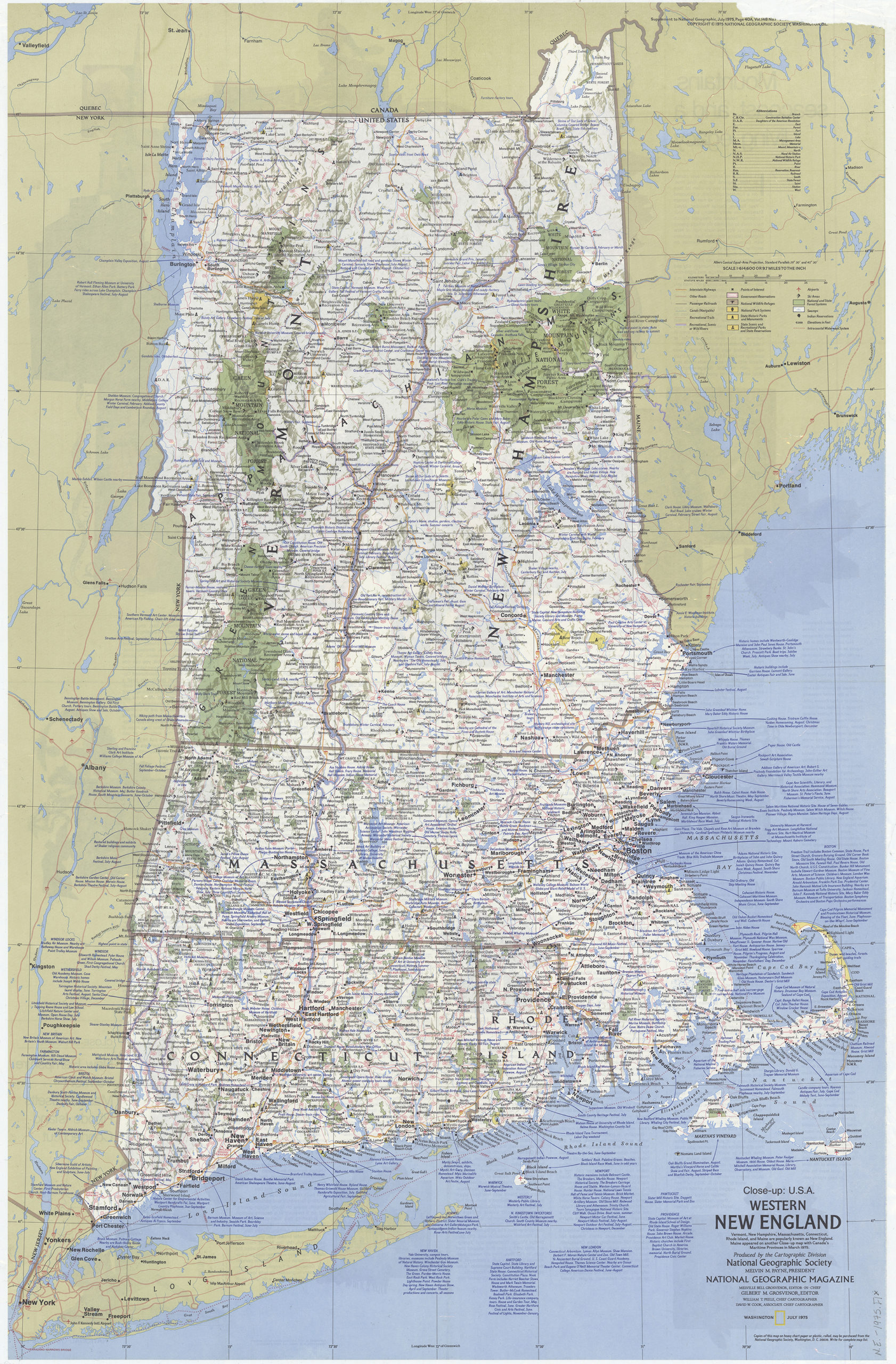
Creator
National Geographic Society (U.S.).; Cartographic Division,Publisher
Brooklyn Historical SocietyCitation
Close up: U.S.A., western New England: Produced by the Cartographic Division, National Geographic Society. William T. Peele, chief cartographer. David W. Cook, associate chief cartographer; 1975, Map Collection, N.E.-1975.Fl; Brooklyn Historical Society.Scale
Scale 1:614,600Loading zoom image... 