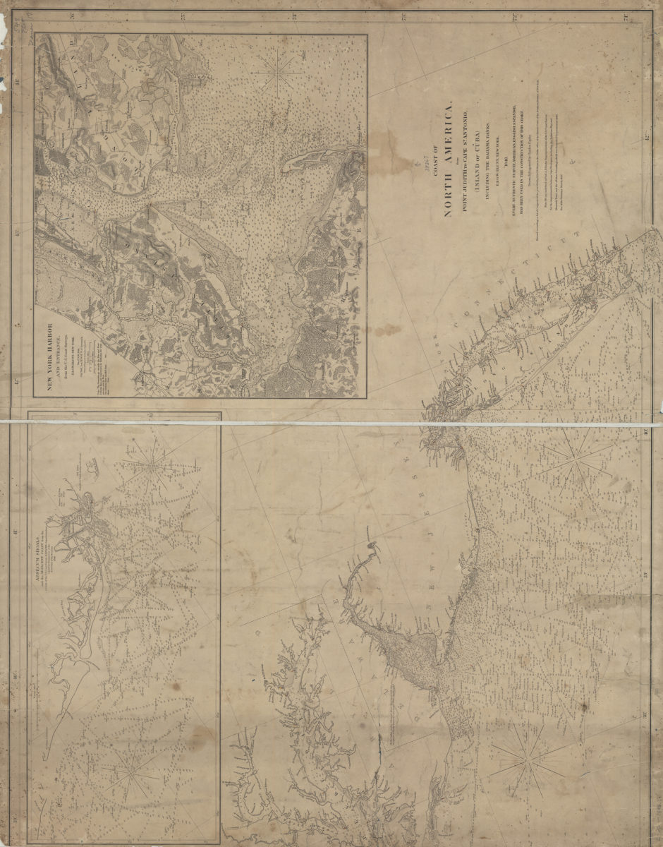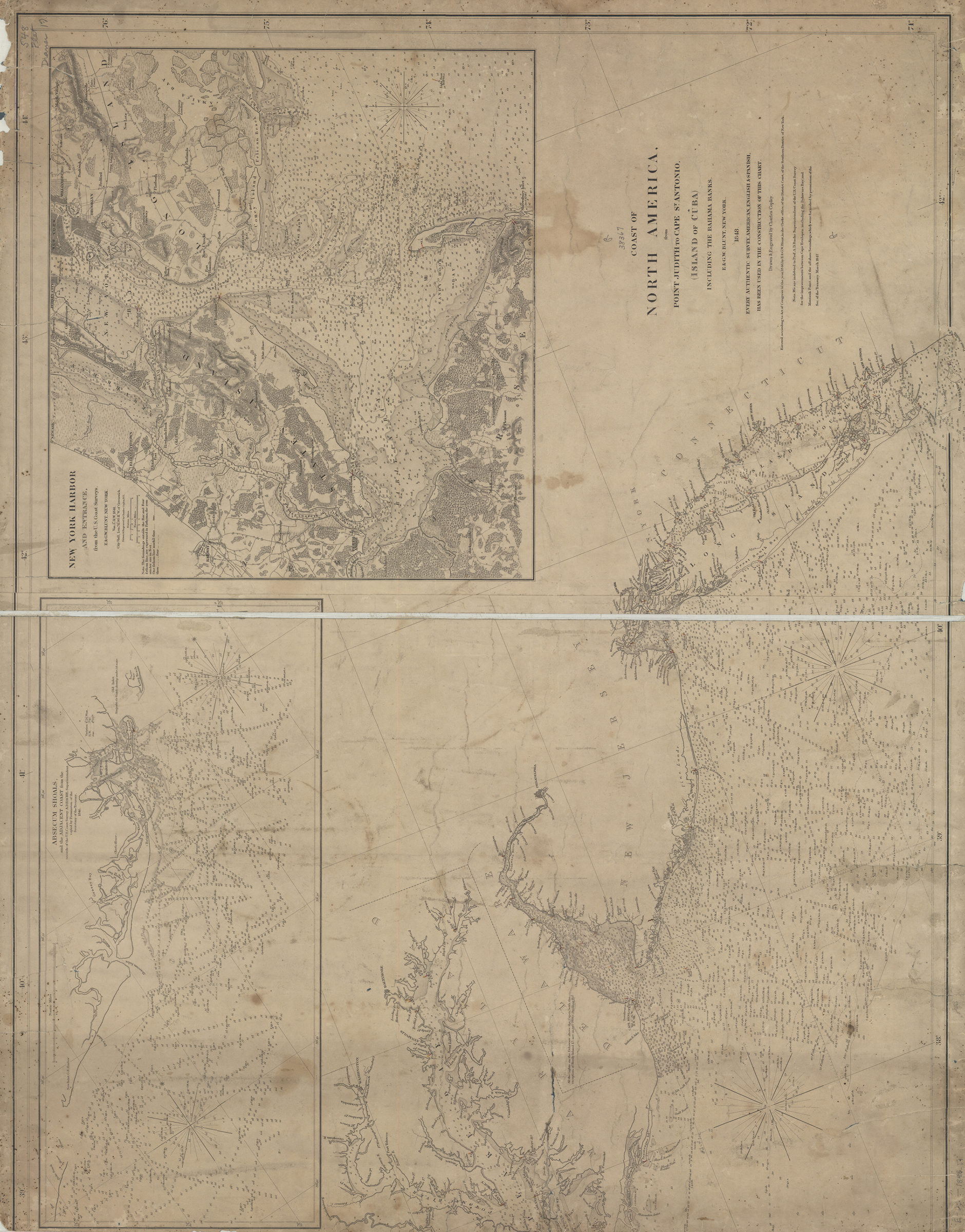
Coast of North America from Point Judith to St. Antonio (island of Cuba), including the Bahama Banks: drawn & engraved by Charles Copley 1848
Nautical chart. Relief shown by hachures. Depths shown by soundings, bathymetric tints, and isolines. Oriented with north to the left. “Entered according to Act of Congress in the year 1846, by E. & G.W. Blunt, in the Clerks office of the District Court, of the Southern District of New York.” “Every authentic survey, American, English, & Spanish, has been used in the construction of this chart.” “Note: We are indebted to Prof. A.D. Bache Superintendent of the U.S. Coast Survey for the improvements between Cape Henlopen (including the Delaware Bay) and Montauk Point, and the offshore Soundings, where were furnished by permission of the Sec. of the Treasury. March 1847.” Includes 2 insets. Insets: Absecum Shoals and the adjacent coast, from the records of the U.S. Coast Survey — New York Harbor and environs, from the U.S. Coast Surveys. BHS copy cut on left side before neat line ends at Potomac River, affecting description.
Map area shown
Genre
Nautical chartsRelation
Full catalog recordSize
75 × 95 cmDownload
Low Resolution Image
Creator
Copley, Charles,Publisher
Brooklyn Historical SocietyCitation
Coast of North America from Point Judith to St. Antonio (island of Cuba), including the Bahama Banks: drawn & engraved by Charles Copley; 1848, Map Collection, E-US-1848.Fl; Brooklyn Historical Society.Scale
Scale not given