
Colton’s new indexed map of the city of Brooklyn [19??]
Map No. B A-1890 (19--?).Fl
Covers the city of Brooklyn north from 60th St. to Greenpoint and east to Jamaica also covers a portion of Lower Manhattan. Shows wards, railroads, and ferry lines, and radial distances from New York City Hall. Oriented with north to the lower left. Includes indexes.
Map area shown
Genre
MapRelation
Full catalog recordSize
70 × 57 cmDownload
Low Resolution Image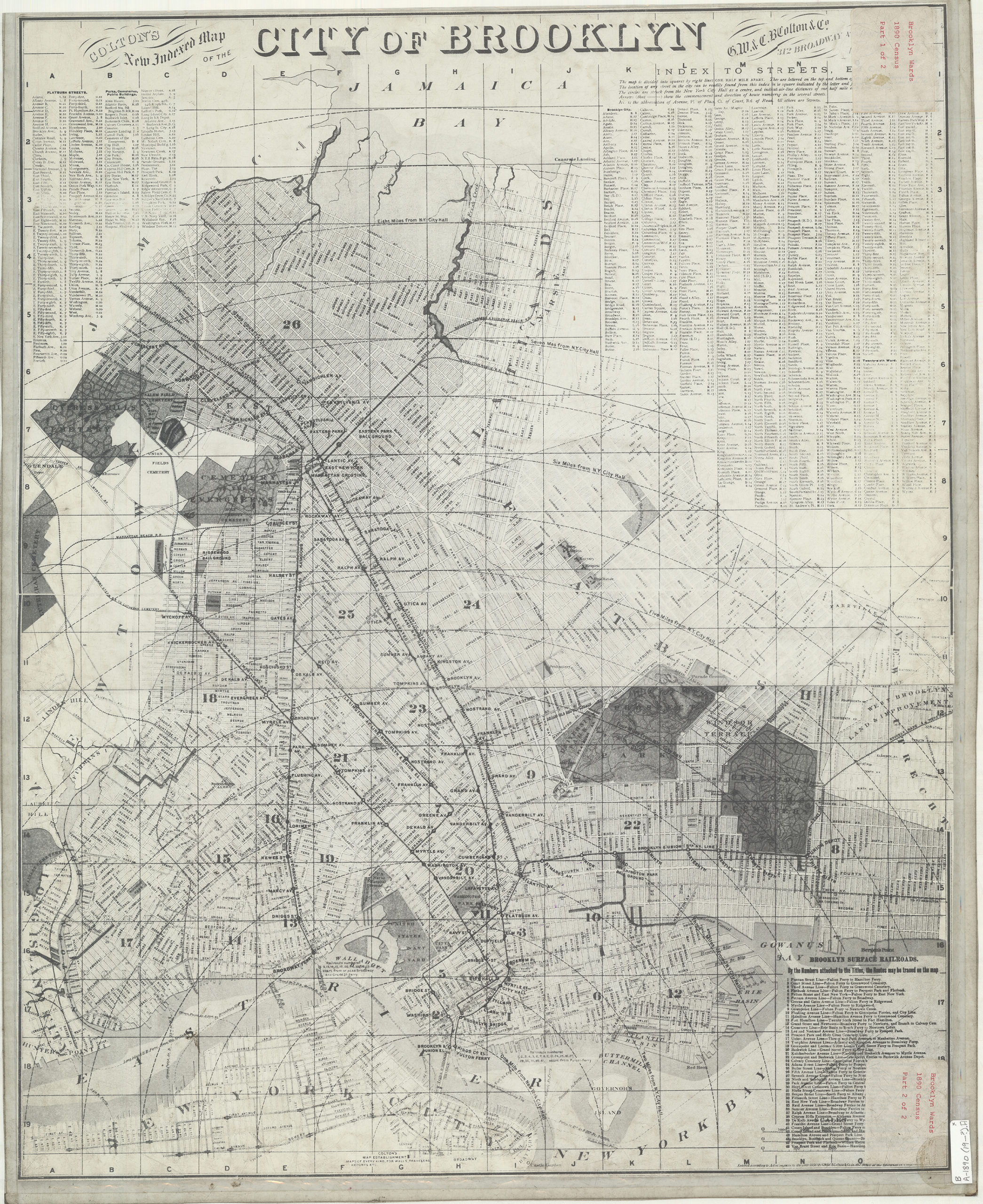
Creator
G.W. & C.B. Colton & Co.,Publisher
Brooklyn Historical SocietyCitation
Colton’s new indexed map of the city of Brooklyn; [19??], Map Collection, B A-1890 (19--?).Fl; Brooklyn Historical Society.Scale
Scale [1:23,330]Loading zoom image... 