
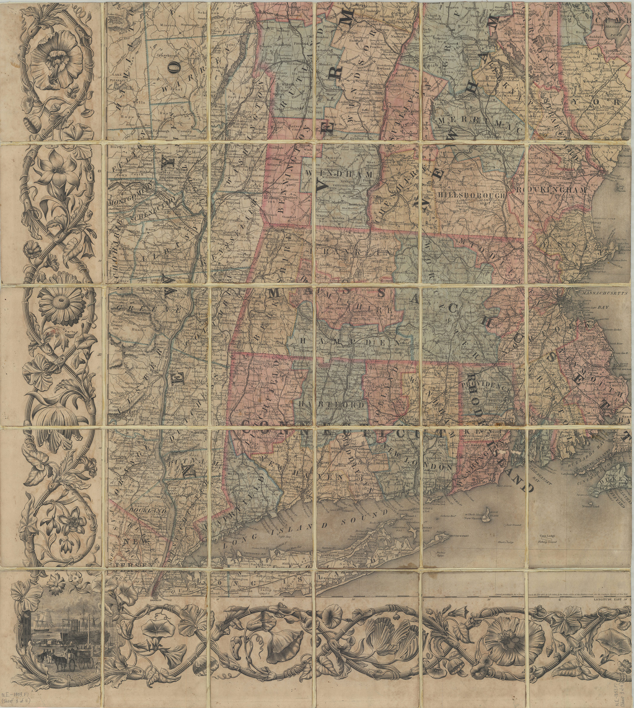
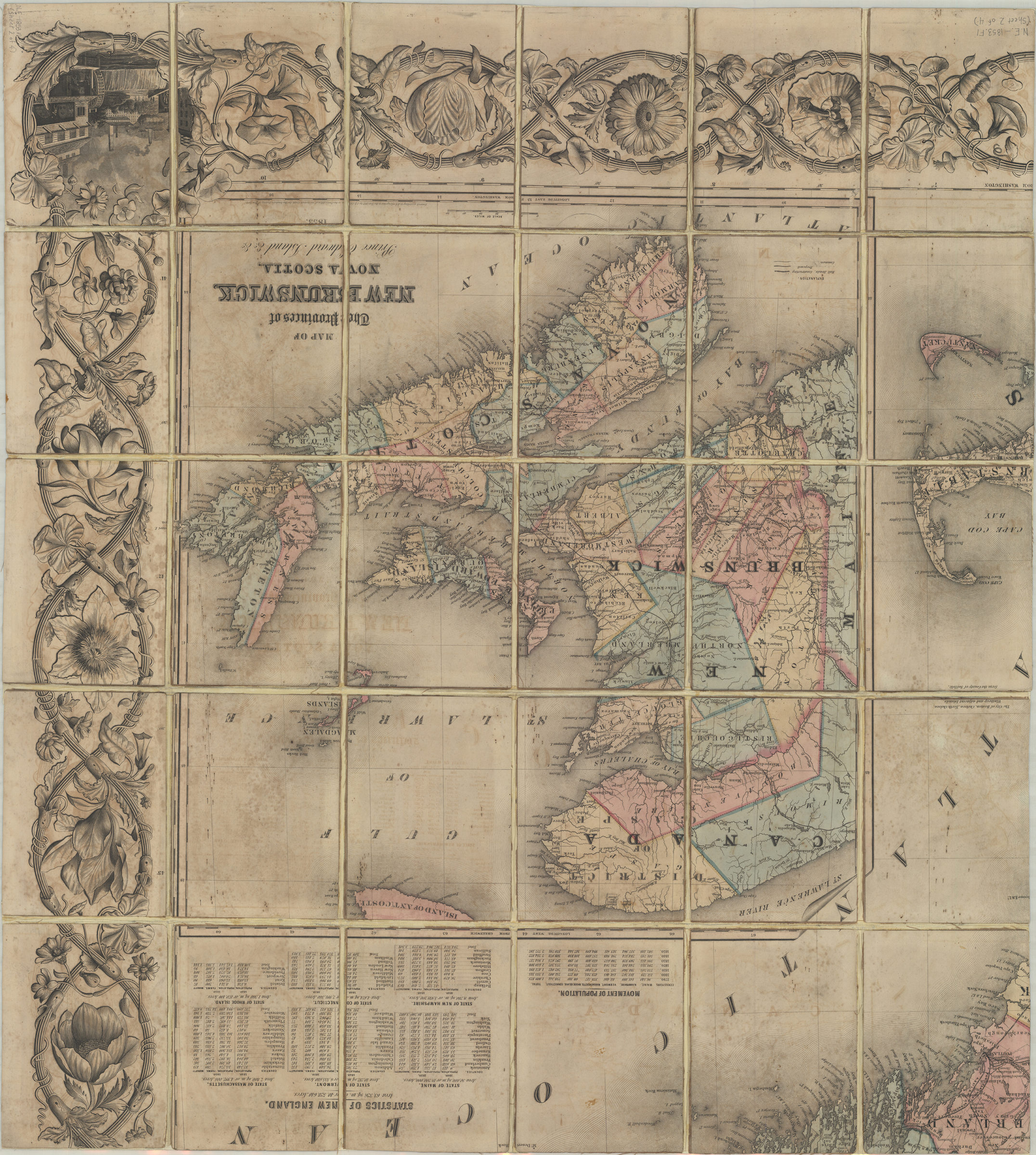


Colton’s railroad & township map of New England with portions of the state of New York, the British provinces, &c.: compiled & drawn by George W. Colton ; engraved at J.H. Colton’s map establishment by J.P. Cox … [et al.] ; border by W.S. Barnard 1853; [ca. 1852]
Map No. N.E.-1853.Fl
Shows proposed and finished railroads, common roads, political divisions, and depots. Relief shown by hachures. Prime meridian: Washington, D.C. “Entered according to Congress, in the Year 1852, by J.H. Colton, in the Clerks Office of the District Court for the Southern District of New York.” Some geology painted over no key. Includes ill., decorative border, tables, and inset. Tables: Statistics of New England and Movement of population. Inset: Map of the provinces of New Brunswick, Nova Scotia, Prince Edward Island &c. &c. (Scale [ca. 1:1,457,280]). “Steel plates.” BHS copy on 4 sheets, dissected and mounted on linen. Has key.
Map area shown
Genre
MapRelation
Full catalog recordSize
132 × 115 cmDownload
Low Resolution Image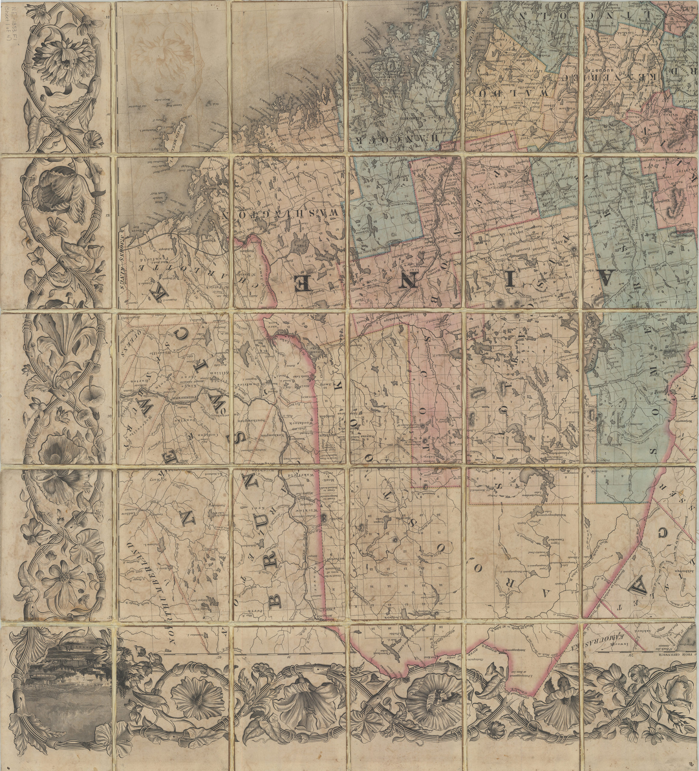
Creator
Colton, G. Woolworth, Colton, G. Woolworth,Publisher
Brooklyn Historical Society, Brooklyn Historical SocietyCitation
Colton’s railroad & township map of New England with portions of the state of New York, the British provinces, &c.: compiled & drawn by George W. Colton ; engraved at J.H. Colton’s map establishment by J.P. Cox … [et al.] ; border by W.S. Barnard; 1853; [ca. 1852], Map Collection, N.E.-1853.Fl; Brooklyn Historical Society.Scale
Scale [ca. 1:570,240]Loading zoom image... 