Columbia Street & shore: by Ludlam 1825
Map No. B P-1825.Fl.Folio
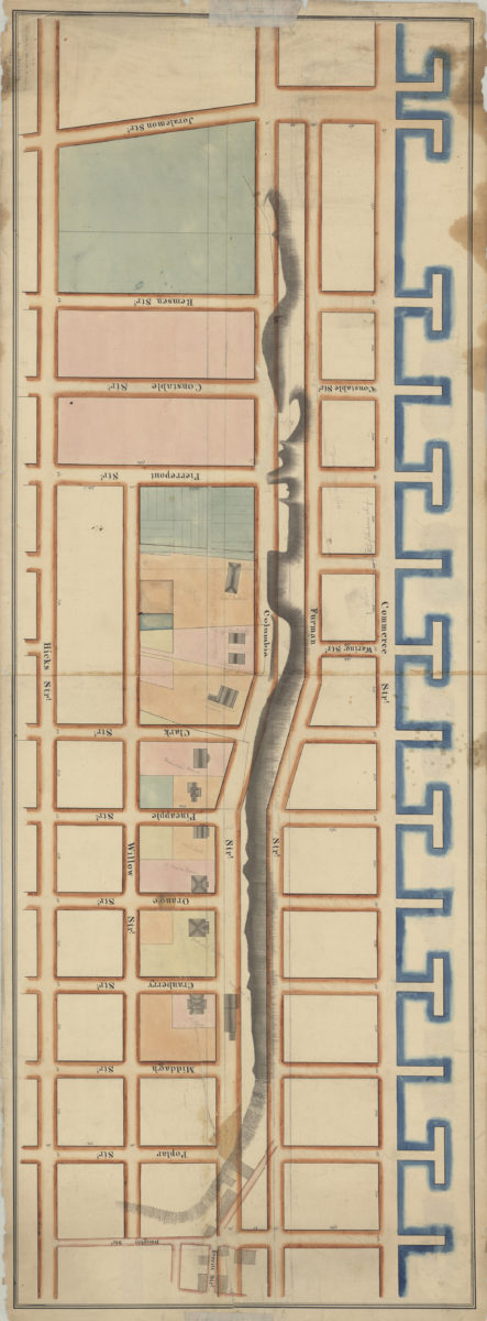
Cadastral map covering area north from Joralemon St. to Doughty St. and east from the East River to Hicks St. (modern-day Brooklyn Heights). Shows property (including lots, dimensions, and buildings), and piers. Relief shown by hachures. Verso title. “Ludlam” likely refers to Silas Ludlam or Isaac T. Ludlam cataloger unable to determine which is responsible for map. Oriented with north to the upper right. “Pd. for by Hez. B. Pierrepont”–Verso.
Map area shown
Relation
Full catalog recordSize
43 × 121 cmDownload
Low Resolution Image
Creator
Ludlam, Silas; Ludlam, Isaac T.,Publisher
Brooklyn Historical SocietyCitation
Columbia Street & shore: by Ludlam; 1825, Map Collection, B P-1825.Fl.Folio; Brooklyn Historical Society.Scale
Scale not givenLoading zoom image...